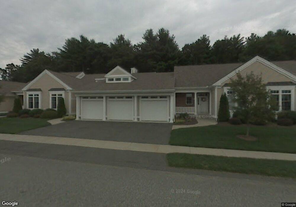
11 High Pine Cir Wilbraham, MA 01095
Estimated Value: $487,000 - $520,177
3
Beds
3
Baths
1,880
Sq Ft
$268/Sq Ft
Est. Value
About This Home
This home is located at 11 High Pine Cir, Wilbraham, MA 01095 and is currently estimated at $504,544, approximately $268 per square foot. 11 High Pine Cir is a home located in Hampden County with nearby schools including Minnechaug Regional High School and Wilbraham & Monson Academy.
Ownership History
Date
Name
Owned For
Owner Type
Purchase Details
Closed on
Aug 8, 2025
Sold by
Meyer Christine M
Bought by
Healy Kathleen
Current Estimated Value
Purchase Details
Closed on
Mar 18, 2011
Sold by
Doyle Debra A
Bought by
Meyer Gordon R and Meyer Christine M
Home Financials for this Owner
Home Financials are based on the most recent Mortgage that was taken out on this home.
Original Mortgage
$125,000
Interest Rate
4.84%
Mortgage Type
Purchase Money Mortgage
Purchase Details
Closed on
Jun 1, 2009
Sold by
Debra A Doyle Ret and Doyle
Bought by
Doyle Debra A
Purchase Details
Closed on
Apr 27, 2009
Sold by
Doyle Debra A
Bought by
Debra A Doyle Ret and Doyle
Purchase Details
Closed on
May 3, 2005
Sold by
Moriarty Henry M and Moriarty Mary C
Bought by
Doyle Debra A
Purchase Details
Closed on
Jun 28, 2001
Sold by
Woods At Wilbraham Llc and Landry
Bought by
Moriarty Henry M and Moriarty Mary C
Create a Home Valuation Report for This Property
The Home Valuation Report is an in-depth analysis detailing your home's value as well as a comparison with similar homes in the area
Home Values in the Area
Average Home Value in this Area
Purchase History
| Date | Buyer | Sale Price | Title Company |
|---|---|---|---|
| Healy Kathleen | $485,000 | -- | |
| Healy Kathleen | $485,000 | -- | |
| Meyer Gordon R | $285,900 | -- | |
| Meyer Gordon R | $285,900 | -- | |
| Meyer Gordon R | $285,900 | -- | |
| Doyle Debra A | -- | -- | |
| Doyle Debra A | -- | -- | |
| Doyle Debra A | -- | -- | |
| Debra A Doyle Ret | -- | -- | |
| Debra A Doyle Ret | -- | -- | |
| Debra A Doyle Ret | -- | -- | |
| Doyle Debra A | $339,000 | -- | |
| Doyle Debra A | $339,000 | -- | |
| Doyle Debra A | $339,000 | -- | |
| Moriarty Henry M | $229,900 | -- | |
| Moriarty Henry M | $229,900 | -- |
Source: Public Records
Mortgage History
| Date | Status | Borrower | Loan Amount |
|---|---|---|---|
| Previous Owner | Meyer Gordon R | $125,000 |
Source: Public Records
Tax History Compared to Growth
Tax History
| Year | Tax Paid | Tax Assessment Tax Assessment Total Assessment is a certain percentage of the fair market value that is determined by local assessors to be the total taxable value of land and additions on the property. | Land | Improvement |
|---|---|---|---|---|
| 2025 | $7,869 | $440,100 | $0 | $440,100 |
| 2024 | $6,719 | $363,200 | $0 | $363,200 |
| 2023 | $6,833 | $356,100 | $0 | $356,100 |
| 2022 | $6,833 | $333,500 | $0 | $333,500 |
| 2021 | $6,243 | $271,900 | $0 | $271,900 |
| 2020 | $6,085 | $271,900 | $0 | $271,900 |
| 2019 | $5,927 | $271,900 | $0 | $271,900 |
| 2018 | $6,081 | $268,600 | $0 | $268,600 |
| 2017 | $5,909 | $268,600 | $0 | $268,600 |
| 2016 | $5,724 | $265,000 | $0 | $265,000 |
| 2015 | $5,533 | $265,000 | $0 | $265,000 |
Source: Public Records
Map
Nearby Homes
- 79 High Pine Cir
- 69 High Pine Cir
- 54 High Pine Cir
- 35 Lake Dr
- 2 Vista Rd
- 4 Hillcrest Dr
- 28 Decorie Dr
- 46 Washington Rd
- 20 Old Orchard Rd
- 2 Bayberry Dr Unit 51
- 8 Patriot Ridge Ln
- 474-480 Mountain Rd
- 474 Mountain Rd
- 182 Mountain Rd
- 6 Teak Terrace Unit 24
- 19 Linwood Dr
- 99 Sandalwood Dr Unit site 00
- 103 Sandalwood Dr Unit site 00
- 57 Sandalwood Dr Unit site 61
- 111 Sandalwood Dr Unit site 00
- 9 High Pine Cir
- 15 High Pine Cir
- 11 High Pine Cir Unit 11 2
- 10 High Pine Cir
- 14 High Pine Cir
- 12 High Pine Cir
- 8 High Pine Cir
- 6 High Pine Cir
- 4 High Pine Cir
- 2 High Pine Cir
- 17 High Pine Cir
- 3 High Pine Cir
- 1 High Pine Cir
- 7 High Pine Cir
- 5 High Pine Cir
- 3 Peach St
- 1 Peach St
- 20 High Pine Cir
- 18 High Pine Cir
- 16 High Pine Cir