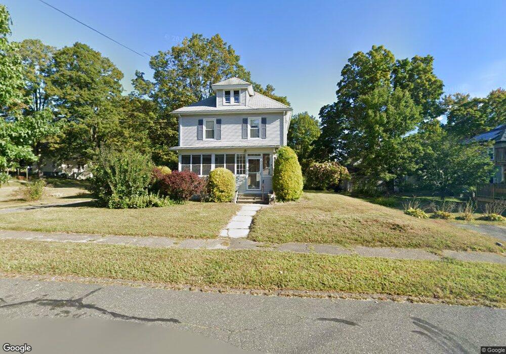
11 High St Florence, MA 01062
Florence NeighborhoodEstimated Value: $318,315 - $495,000
3
Beds
2
Baths
1,353
Sq Ft
$290/Sq Ft
Est. Value
About This Home
This home is located at 11 High St, Florence, MA 01062 and is currently estimated at $391,829, approximately $289 per square foot. 11 High St is a home located in Hampshire County with nearby schools including Northampton High School, The Montessori School of Northampton, and Lander Grinspoon Academy.
Create a Home Valuation Report for This Property
The Home Valuation Report is an in-depth analysis detailing your home's value as well as a comparison with similar homes in the area
Home Values in the Area
Average Home Value in this Area
Tax History
| Year | Tax Paid | Tax Assessment Tax Assessment Total Assessment is a certain percentage of the fair market value that is determined by local assessors to be the total taxable value of land and additions on the property. | Land | Improvement |
|---|---|---|---|---|
| 2025 | $5,173 | $272,700 | $78,100 | $194,600 |
| 2024 | $4,829 | $266,800 | $78,100 | $188,700 |
| 2023 | $4,996 | $254,400 | $78,100 | $176,300 |
| 2022 | $4,767 | $245,200 | $78,100 | $167,100 |
| 2021 | $4,813 | $229,500 | $78,100 | $151,400 |
| 2019 | $4,265 | $215,400 | $78,100 | $137,300 |
| 2018 | $4,010 | $215,400 | $78,100 | $137,300 |
| 2017 | $3,988 | $207,900 | $78,100 | $129,800 |
| 2016 | $3,898 | $207,900 | $78,100 | $129,800 |
| 2015 | $3,816 | $212,100 | $82,300 | $129,800 |
| 2014 | $3,684 | $212,100 | $82,300 | $129,800 |
Source: Public Records
Map
Nearby Homes
- 14 Garfield St Unit A1
- 14 Garfield St Unit A2
- 267 Locust St Unit 1A
- 106 Chestnut St
- 76 Maple St
- 41 N Main St
- 33 Landy Ave
- 197 Bridge Rd
- 9 Khloe Ln
- 99 Blackberry Ln
- 67 Milton St
- 61 Woodlawn Ave
- 42 Clark St
- 15 Massasoit St
- 296 Elm St
- 78 Forbes Ave
- 80 Damon Rd Unit 2303
- 155 Prospect St
- 26 Crescent St Unit G2
- 37 Finn St
Your Personal Tour Guide
Ask me questions while you tour the home.