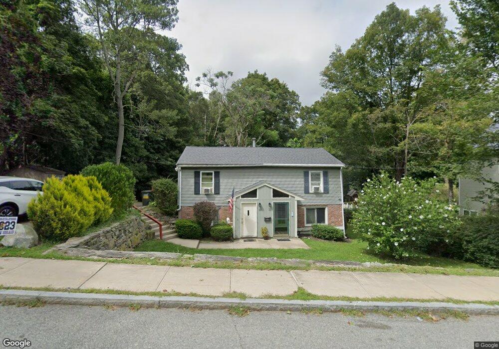
11 High St Uxbridge, MA 01569
Estimated Value: $224,000 - $323,000
2
Beds
1
Bath
791
Sq Ft
$326/Sq Ft
Est. Value
About This Home
This home is located at 11 High St, Uxbridge, MA 01569 and is currently estimated at $257,699, approximately $325 per square foot. 11 High St is a home located in Worcester County with nearby schools including Uxbridge High School, Our Lady of the Valley Regional School, and Whitinsville Christian School.
Ownership History
Date
Name
Owned For
Owner Type
Purchase Details
Closed on
Jan 22, 2019
Sold by
Connor Catherine
Bought by
Gates Francine M
Current Estimated Value
Home Financials for this Owner
Home Financials are based on the most recent Mortgage that was taken out on this home.
Original Mortgage
$145,500
Outstanding Balance
$128,183
Interest Rate
4.7%
Mortgage Type
New Conventional
Estimated Equity
$129,516
Purchase Details
Closed on
Sep 16, 2010
Sold by
Deutsche Bank Natl T C
Bought by
Connor Catherine
Purchase Details
Closed on
Apr 22, 2010
Sold by
Mottram Richard
Bought by
Deustche Bank Natl T C
Purchase Details
Closed on
Jul 30, 1999
Sold by
Sheridan Peter M and Sheridan Valerie L
Bought by
Mottram Richard and Mottram Madeline G
Home Financials for this Owner
Home Financials are based on the most recent Mortgage that was taken out on this home.
Original Mortgage
$75,900
Interest Rate
7.61%
Mortgage Type
Purchase Money Mortgage
Create a Home Valuation Report for This Property
The Home Valuation Report is an in-depth analysis detailing your home's value as well as a comparison with similar homes in the area
Home Values in the Area
Average Home Value in this Area
Purchase History
| Date | Buyer | Sale Price | Title Company |
|---|---|---|---|
| Gates Francine M | $150,000 | -- | |
| Connor Catherine | $76,500 | -- | |
| Deustche Bank Natl T C | $67,500 | -- | |
| Mottram Richard | $79,900 | -- |
Source: Public Records
Mortgage History
| Date | Status | Borrower | Loan Amount |
|---|---|---|---|
| Open | Gates Francine M | $145,500 | |
| Previous Owner | Mottram Richard | $96,000 | |
| Previous Owner | Mottram Richard | $75,900 |
Source: Public Records
Tax History
| Year | Tax Paid | Tax Assessment Tax Assessment Total Assessment is a certain percentage of the fair market value that is determined by local assessors to be the total taxable value of land and additions on the property. | Land | Improvement |
|---|---|---|---|---|
| 2025 | $23 | $173,800 | $0 | $173,800 |
| 2024 | $2,366 | $183,100 | $0 | $183,100 |
| 2023 | $2,380 | $170,600 | $0 | $170,600 |
| 2022 | $2,303 | $151,900 | $0 | $151,900 |
| 2021 | $2,226 | $140,700 | $0 | $140,700 |
| 2020 | $1,726 | $103,100 | $0 | $103,100 |
| 2019 | $1,789 | $103,100 | $0 | $103,100 |
| 2018 | $1,770 | $103,100 | $0 | $103,100 |
| 2017 | $2,134 | $125,800 | $0 | $125,800 |
| 2016 | $2,154 | $122,600 | $0 | $122,600 |
| 2015 | $2,091 | $120,200 | $0 | $120,200 |
Source: Public Records
Map
Nearby Homes
- 79 High St
- 24 Olde Canal Way Unit 24
- 37 Elizabeth St
- 20 Nature View Dr Unit 20
- 300 Crownshield Ave
- 197 Crownshield Ave Unit 16B
- 197 Crownshield Ave Unit 16A
- 197 Crownshield Ave Unit 16C
- 288 High St
- 73 Tea Party Dr Unit L-4
- 35 Pouts Ln
- 76 Pouts Ln
- 61 Spring Hill Dr Unit 61
- 395 High St
- 36 Elm St
- 307 N Main St
- 314 Richardson St
- 3 Strathmore Shire Unit A
- 71 Rivulet St Unit B
- 7 Jefferson Ct Unit 7