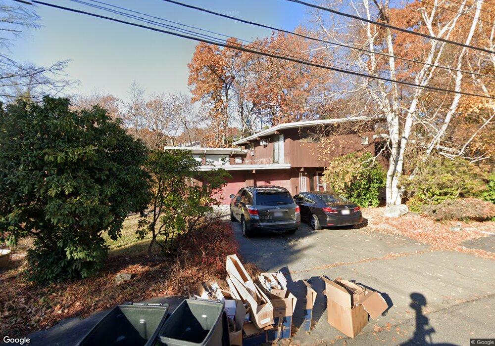
11 Independence Dr Woburn, MA 01801
Cummingsville NeighborhoodEstimated Value: $883,858 - $1,031,000
3
Beds
2
Baths
1,746
Sq Ft
$550/Sq Ft
Est. Value
About This Home
This home is located at 11 Independence Dr, Woburn, MA 01801 and is currently estimated at $959,465, approximately $549 per square foot. 11 Independence Dr is a home located in Middlesex County with nearby schools including Reeves Elementary School, Daniel L. Joyce Middle School, and Woburn High School.
Ownership History
Date
Name
Owned For
Owner Type
Purchase Details
Closed on
Jan 23, 2004
Sold by
Poulin Tr James E and Poulin Susan B
Bought by
Chang Johnny S and Chestnut-Chang Kimberlee
Current Estimated Value
Home Financials for this Owner
Home Financials are based on the most recent Mortgage that was taken out on this home.
Original Mortgage
$80,250
Interest Rate
5.89%
Mortgage Type
Purchase Money Mortgage
Create a Home Valuation Report for This Property
The Home Valuation Report is an in-depth analysis detailing your home's value as well as a comparison with similar homes in the area
Home Values in the Area
Average Home Value in this Area
Purchase History
| Date | Buyer | Sale Price | Title Company |
|---|---|---|---|
| Chang Johnny S | $460,000 | -- | |
| Chang Johnny S | $460,000 | -- |
Source: Public Records
Mortgage History
| Date | Status | Borrower | Loan Amount |
|---|---|---|---|
| Open | Chang Johnny S | $310,000 | |
| Closed | Chang Johnny S | $80,250 | |
| Previous Owner | Chang Johnny S | $100,000 |
Source: Public Records
Tax History
| Year | Tax Paid | Tax Assessment Tax Assessment Total Assessment is a certain percentage of the fair market value that is determined by local assessors to be the total taxable value of land and additions on the property. | Land | Improvement |
|---|---|---|---|---|
| 2025 | $6,718 | $786,700 | $387,100 | $399,600 |
| 2024 | $6,063 | $752,200 | $368,800 | $383,400 |
| 2023 | $5,842 | $671,500 | $335,300 | $336,200 |
| 2022 | $5,494 | $588,200 | $291,900 | $296,300 |
| 2021 | $5,190 | $556,300 | $278,100 | $278,200 |
| 2020 | $5,083 | $545,400 | $278,100 | $267,300 |
| 2019 | $4,959 | $522,000 | $265,000 | $257,000 |
| 2018 | $4,825 | $487,900 | $243,300 | $244,600 |
| 2017 | $4,603 | $463,100 | $231,800 | $231,300 |
| 2016 | $4,389 | $436,700 | $216,800 | $219,900 |
| 2015 | $4,221 | $415,000 | $202,700 | $212,300 |
| 2014 | $4,167 | $399,100 | $202,700 | $196,400 |
Source: Public Records
Map
Nearby Homes
- 15 Crescent Rd
- 16 Battlemarch Way
- 10 Gately Dr
- 1 Douglass Green
- 36 Cambridge Rd Unit 40
- 212 Cambridge Rd
- 74 Hammond Place Unit 74
- 14 Liana St
- 136 Bedford Rd
- 19 Indian Hill Rd
- 4 Gangi Terrace
- 255 East St
- 4 Northgate Cir
- 16 Manor Ave
- 23 Thoreau Rd
- 23 Burroughs Rd
- 20 Amberwood Dr
- 31 Arlington Rd Unit 1-6
- 12 Thornberry Rd
- 29 Arlington Rd Unit 3-2
- 13 Independence Dr
- 2 Patriot Cir
- 4 Patriot Rd
- 7 Independence Dr
- 4 Patriot Cir
- 10 Independence Dr
- 8 Independence Dr
- 15 Independence Dr
- 12 Independence Dr
- 6 Independence Dr
- 17 Independence Dr
- 14 Whispering Hill Rd
- 14 Independence Dr
- 2 Dawes Cir
- 41 Independence Dr
- 19 Independence Dr
- 1 Patriot Cir
- 3 Patriot Cir
- 4 Independence Dr
- 15 Whispering Hill Rd
Your Personal Tour Guide
Ask me questions while you tour the home.