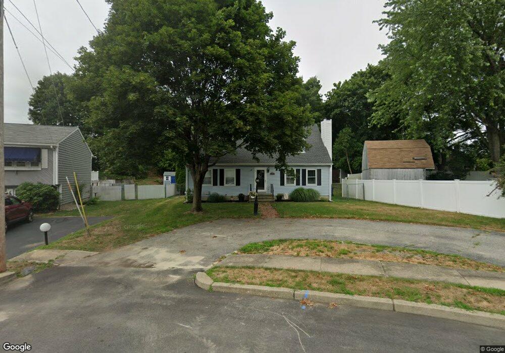
11 Jonathan Ct Warwick, RI 02888
Spring Green NeighborhoodEstimated Value: $434,000 - $478,000
3
Beds
2
Baths
1,612
Sq Ft
$286/Sq Ft
Est. Value
About This Home
This home is located at 11 Jonathan Ct, Warwick, RI 02888 and is currently estimated at $460,674, approximately $285 per square foot. 11 Jonathan Ct is a home located in Kent County with nearby schools including St. Peter School.
Ownership History
Date
Name
Owned For
Owner Type
Purchase Details
Closed on
Dec 8, 2006
Sold by
Morrison Frank W and Morrison Dawn M
Bought by
Leach Gregg J and Leach Sheri L
Current Estimated Value
Home Financials for this Owner
Home Financials are based on the most recent Mortgage that was taken out on this home.
Original Mortgage
$248,500
Outstanding Balance
$147,793
Interest Rate
6.4%
Mortgage Type
Purchase Money Mortgage
Estimated Equity
$312,881
Purchase Details
Closed on
Sep 28, 1992
Sold by
Votta Alan W and Votta Lisa
Bought by
Morrison Frank W and Morrison Dawn
Home Financials for this Owner
Home Financials are based on the most recent Mortgage that was taken out on this home.
Original Mortgage
$122,200
Interest Rate
7.9%
Mortgage Type
Purchase Money Mortgage
Create a Home Valuation Report for This Property
The Home Valuation Report is an in-depth analysis detailing your home's value as well as a comparison with similar homes in the area
Home Values in the Area
Average Home Value in this Area
Purchase History
| Date | Buyer | Sale Price | Title Company |
|---|---|---|---|
| Leach Gregg J | $248,500 | -- | |
| Morrison Frank W | $122,000 | -- | |
| Morrison Frank W | $122,000 | -- |
Source: Public Records
Mortgage History
| Date | Status | Borrower | Loan Amount |
|---|---|---|---|
| Open | Morrison Frank W | $248,500 | |
| Previous Owner | Morrison Frank W | $50,000 | |
| Previous Owner | Morrison Frank W | $102,808 | |
| Previous Owner | Morrison Frank W | $122,200 |
Source: Public Records
Tax History Compared to Growth
Tax History
| Year | Tax Paid | Tax Assessment Tax Assessment Total Assessment is a certain percentage of the fair market value that is determined by local assessors to be the total taxable value of land and additions on the property. | Land | Improvement |
|---|---|---|---|---|
| 2025 | $5,392 | $424,600 | $113,300 | $311,300 |
| 2024 | $5,088 | $351,600 | $98,500 | $253,100 |
| 2023 | $4,989 | $351,600 | $98,500 | $253,100 |
| 2022 | $4,720 | $252,000 | $61,600 | $190,400 |
| 2021 | $4,720 | $252,000 | $61,600 | $190,400 |
| 2020 | $4,720 | $252,000 | $61,600 | $190,400 |
| 2019 | $4,720 | $252,000 | $61,600 | $190,400 |
| 2018 | $4,247 | $204,200 | $54,800 | $149,400 |
| 2017 | $4,133 | $204,200 | $54,800 | $149,400 |
| 2016 | $4,133 | $204,200 | $54,800 | $149,400 |
| 2015 | $3,982 | $191,900 | $62,900 | $129,000 |
| 2014 | $3,850 | $191,900 | $62,900 | $129,000 |
| 2013 | $3,798 | $191,900 | $62,900 | $129,000 |
Source: Public Records
Map
Nearby Homes
- 39 Holiday Ave
- 15 Christopher Rhodes Way
- 6 Christopher Rhodes Way
- 111 Aster St
- 1153 Post Rd
- 126 Fairfax Dr
- 52 Recess Ln
- 1052 Post Rd
- 33 Recess Ln
- 49 Patience Ct
- 396 Elm St
- 5 Shippen Ave
- 101 Omaha Blvd
- 77 Kentucky Ave
- 7 Michigan Ave
- 72 W Shore Rd Unit 2
- 72 W Shore Rd Unit 3
- 72 W Shore Rd Unit 104
- 63 Benbridge Ave
- 27 Frederick St
- 17 Jonathan Ct
- 317 Sand Pond Rd
- 309 Sand Pond Rd
- 23 Jonathan Ct
- 10 Jonathan Ct
- 28 Jonathan Ct
- 31 Jonathan Ct
- 299 Sand Pond Rd
- 326 Easton Ave
- 319 Easton Ave
- 312 Sand Pond Rd
- 302 Sand Pond Rd
- 37 Jonathan Ct
- 320 Easton Ave
- 36 Jonathan Ct
- 296 Sand Pond Rd
- 40 Jonathan Ct
- 287 Sand Pond Rd
- 309 Easton Ave
- 56 Harvest Rd