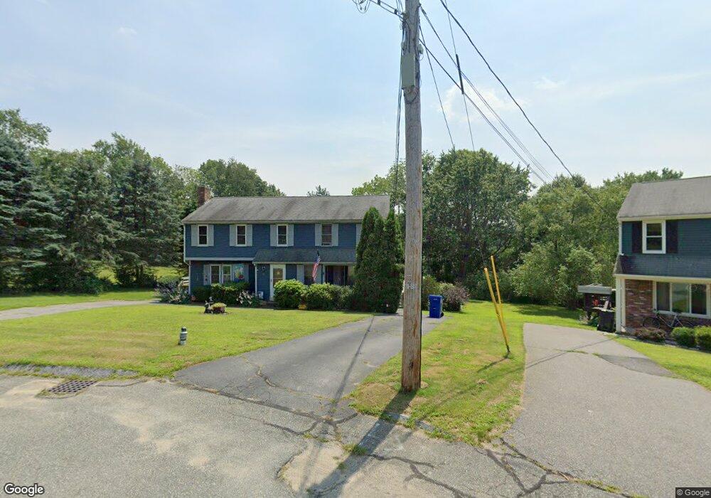
11 Karli Ln Bridgewater, MA 02324
Estimated Value: $466,000 - $474,000
3
Beds
2
Baths
1,278
Sq Ft
$368/Sq Ft
Est. Value
About This Home
This home is located at 11 Karli Ln, Bridgewater, MA 02324 and is currently estimated at $470,136, approximately $367 per square foot. 11 Karli Ln is a home located in Plymouth County with nearby schools including Mitchell Elementary School, Williams Intermediate School, and Bridgewater Middle School.
Ownership History
Date
Name
Owned For
Owner Type
Purchase Details
Closed on
Jul 31, 1998
Sold by
Ricard Arthur and Ricard Carrie L
Bought by
Hatch Lynda L
Current Estimated Value
Purchase Details
Closed on
Oct 6, 1994
Sold by
Fnma
Bought by
Ricard Arthur and Ricard Carrie L
Purchase Details
Closed on
Jun 14, 1994
Sold by
Nardone Louis J and Nardone Karen M
Bought by
Federal National Mortgage Association
Purchase Details
Closed on
Apr 21, 1989
Sold by
Hooley Daniel F
Bought by
Nardone Louis J
Create a Home Valuation Report for This Property
The Home Valuation Report is an in-depth analysis detailing your home's value as well as a comparison with similar homes in the area
Home Values in the Area
Average Home Value in this Area
Purchase History
| Date | Buyer | Sale Price | Title Company |
|---|---|---|---|
| Hatch Lynda L | $117,000 | -- | |
| Ricard Arthur | $95,000 | -- | |
| Federal National Mortgage Association | $76,500 | -- | |
| Nardone Louis J | $132,500 | -- |
Source: Public Records
Mortgage History
| Date | Status | Borrower | Loan Amount |
|---|---|---|---|
| Open | Nardone Louis J | $85,500 | |
| Closed | Nardone Louis J | $10,000 | |
| Closed | Nardone Louis J | $50,000 |
Source: Public Records
Tax History Compared to Growth
Tax History
| Year | Tax Paid | Tax Assessment Tax Assessment Total Assessment is a certain percentage of the fair market value that is determined by local assessors to be the total taxable value of land and additions on the property. | Land | Improvement |
|---|---|---|---|---|
| 2025 | $5,086 | $429,900 | $0 | $429,900 |
| 2024 | $4,665 | $384,300 | $0 | $384,300 |
| 2023 | $4,463 | $347,600 | $0 | $347,600 |
| 2022 | $4,336 | $302,800 | $0 | $302,800 |
| 2021 | $4,218 | $291,300 | $0 | $291,300 |
| 2020 | $4,176 | $283,500 | $0 | $283,500 |
| 2019 | $3,971 | $267,800 | $0 | $267,800 |
| 2018 | $3,708 | $244,100 | $0 | $244,100 |
| 2017 | $3,465 | $222,000 | $0 | $222,000 |
| 2016 | $3,388 | $218,000 | $0 | $218,000 |
| 2015 | $3,406 | $209,700 | $0 | $209,700 |
| 2014 | $3,374 | $207,600 | $0 | $207,600 |
Source: Public Records
Map
Nearby Homes
- 28 Yoke Rd
- 827 High St
- 81 Arrowhead Dr
- 225 Whitman St
- 12 Bridge St
- 398 Plymouth St
- 0 Three Rivers Dr
- 36 Michael Rd
- 201 Comfort St
- 52 Cottage St
- 54 Michael Rd Unit 33
- 45 Edge Hill Dr Unit 47
- 167 Spring St
- 121 South St
- 865 Plymouth St Unit 865
- 211 Oak St
- 49 Orange St
- 590 Bedford St
- 128 Broad St
- 12 Perkins St