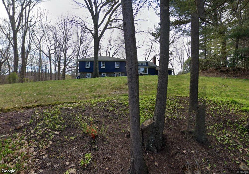
11 Kelsey Rd Wayland, MA 01778
Estimated Value: $1,193,000 - $1,323,275
4
Beds
3
Baths
2,474
Sq Ft
$516/Sq Ft
Est. Value
About This Home
This home is located at 11 Kelsey Rd, Wayland, MA 01778 and is currently estimated at $1,275,819, approximately $515 per square foot. 11 Kelsey Rd is a home located in Middlesex County with nearby schools including Wayland High School and Veritas Christian Academy.
Ownership History
Date
Name
Owned For
Owner Type
Purchase Details
Closed on
Jun 29, 2006
Sold by
Walker Edmund M and Walker Jillian D
Bought by
Harding Jennifer W
Current Estimated Value
Purchase Details
Closed on
Sep 26, 2003
Sold by
Curley Dwight G and Curley Gweneth A
Bought by
Walker Edmund M
Create a Home Valuation Report for This Property
The Home Valuation Report is an in-depth analysis detailing your home's value as well as a comparison with similar homes in the area
Home Values in the Area
Average Home Value in this Area
Purchase History
| Date | Buyer | Sale Price | Title Company |
|---|---|---|---|
| Harding Jennifer W | $664,500 | -- | |
| Walker Edmund M | $655,000 | -- | |
| Harding Jennifer W | $664,500 | -- | |
| Walker Edmund M | $655,000 | -- |
Source: Public Records
Mortgage History
| Date | Status | Borrower | Loan Amount |
|---|---|---|---|
| Open | Walker Edmund M | $95,500 | |
| Open | Walker Edmund M | $417,000 | |
| Closed | Walker Edmund M | $417,000 |
Source: Public Records
Tax History Compared to Growth
Tax History
| Year | Tax Paid | Tax Assessment Tax Assessment Total Assessment is a certain percentage of the fair market value that is determined by local assessors to be the total taxable value of land and additions on the property. | Land | Improvement |
|---|---|---|---|---|
| 2025 | $18,861 | $1,206,700 | $602,800 | $603,900 |
| 2024 | $17,877 | $1,151,900 | $574,300 | $577,600 |
| 2023 | $17,336 | $1,041,200 | $522,000 | $519,200 |
| 2022 | $16,706 | $910,400 | $432,100 | $478,300 |
| 2021 | $6,988 | $856,400 | $392,800 | $463,600 |
| 2020 | $15,719 | $885,100 | $392,800 | $492,300 |
| 2019 | $15,185 | $830,700 | $374,200 | $456,500 |
| 2018 | $6,004 | $761,200 | $374,200 | $387,000 |
| 2017 | $13,338 | $735,300 | $363,100 | $372,200 |
| 2016 | $12,332 | $711,200 | $356,100 | $355,100 |
| 2015 | $12,923 | $702,700 | $356,100 | $346,600 |
Source: Public Records
Map
Nearby Homes
- 47 Pequot Rd
- 37 Pequot Rd
- 353 Old Connecticut Path
- 22 Lakeshore Dr
- 208 Cochituate Rd
- 35 Wallace Rd
- 96 Lakeshore Dr
- 96 Lake Shore Dr
- 260 Cochituate Rd
- 108 Dudley Rd
- 7 Shaw Dr
- 123 Dudley Rd
- 26 Dudley Rd
- 15 Crest Rd
- 454 Old Connecticut Path
- 233 Lakeshore Dr
- 3 Keith Rd
- 28 Joyce Rd
- 15 Parkridge Rd
- 2 Forest Hill Rd
- 7 Kelsey Rd
- 15 Kelsey Rd
- 12 Kelsey Rd
- 14 Kelsey Rd
- 17 Clarence Rd
- 3 Kelsey Rd
- 4 Kelsey Rd
- 14 Clarence Rd
- 11 Clarence Rd
- 18 Cameron Rd
- 246 Old Connecticut Path
- 252 Old Connecticut Path
- 250 Old Connecticut Path
- 21 Cameron Rd
- 25 Cameron Rd
- 10 Clarence Rd
- 248 Old Connecticut Path
- 14 Cameron Rd
- 9 Clarence Rd
- 17 Cameron Rd