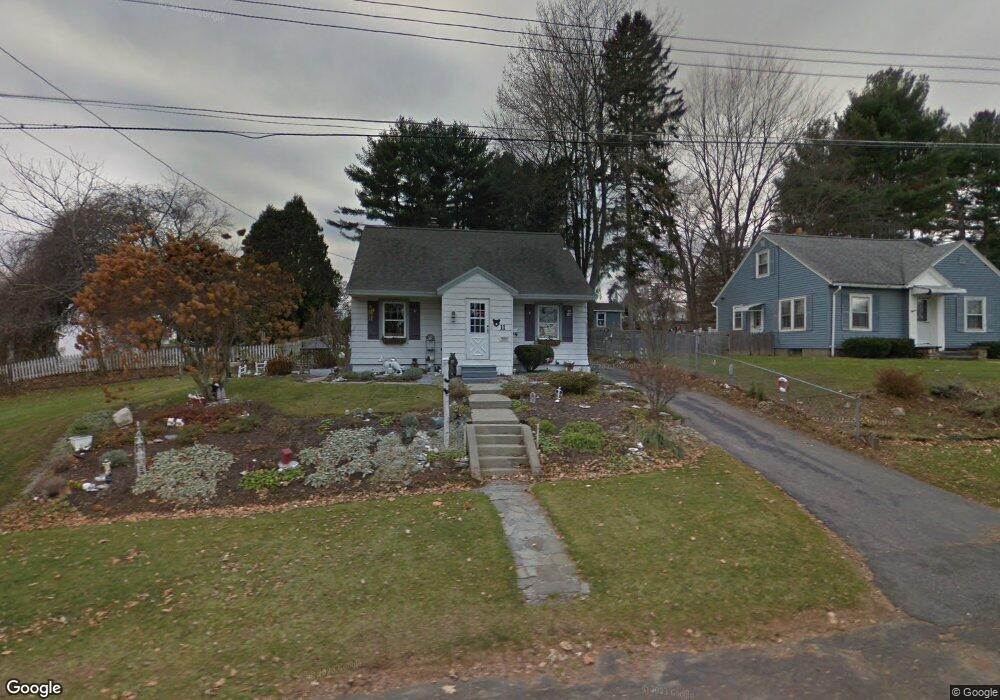
11 Kensington Ave Pittsfield, MA 01201
Estimated Value: $276,202 - $304,000
3
Beds
1
Bath
1,302
Sq Ft
$222/Sq Ft
Est. Value
About This Home
This home is located at 11 Kensington Ave, Pittsfield, MA 01201 and is currently estimated at $289,051, approximately $222 per square foot. 11 Kensington Ave is a home located in Berkshire County with nearby schools including Allendale Elementary School, Theodore Herberg Middle School, and Pittsfield High School.
Ownership History
Date
Name
Owned For
Owner Type
Purchase Details
Closed on
Sep 1, 1995
Sold by
Arms Mary
Bought by
Cannon Scott T and Cannon Pamela A
Current Estimated Value
Home Financials for this Owner
Home Financials are based on the most recent Mortgage that was taken out on this home.
Original Mortgage
$74,950
Interest Rate
7.61%
Mortgage Type
Purchase Money Mortgage
Create a Home Valuation Report for This Property
The Home Valuation Report is an in-depth analysis detailing your home's value as well as a comparison with similar homes in the area
Home Values in the Area
Average Home Value in this Area
Purchase History
| Date | Buyer | Sale Price | Title Company |
|---|---|---|---|
| Cannon Scott T | $77,300 | -- | |
| Cannon Scott T | $77,300 | -- |
Source: Public Records
Mortgage History
| Date | Status | Borrower | Loan Amount |
|---|---|---|---|
| Closed | Cannon Scott T | $74,950 |
Source: Public Records
Tax History Compared to Growth
Tax History
| Year | Tax Paid | Tax Assessment Tax Assessment Total Assessment is a certain percentage of the fair market value that is determined by local assessors to be the total taxable value of land and additions on the property. | Land | Improvement |
|---|---|---|---|---|
| 2025 | $4,519 | $251,900 | $70,300 | $181,600 |
| 2024 | $4,194 | $227,300 | $70,300 | $157,000 |
| 2023 | $3,911 | $213,500 | $70,300 | $143,200 |
| 2022 | $3,519 | $189,600 | $65,300 | $124,300 |
| 2021 | $3,157 | $164,000 | $65,300 | $98,700 |
| 2020 | $2,911 | $147,700 | $52,300 | $95,400 |
| 2019 | $2,445 | $125,900 | $48,300 | $77,600 |
| 2018 | $2,487 | $124,300 | $48,300 | $76,000 |
| 2017 | $2,424 | $123,500 | $50,300 | $73,200 |
| 2016 | $2,300 | $122,600 | $50,300 | $72,300 |
| 2015 | $2,214 | $122,600 | $50,300 | $72,300 |
Source: Public Records
Map
Nearby Homes
- 25 Kensington Ave
- 38 Allengate Ave
- 326 Dalton Ave
- 165 Connecticut Ave
- 122 Allengate Ave
- 81 Dartmouth St Unit 102
- 11 Stanley Ave
- 40 Roland St
- 46 Bossidy Dr
- 45 Patricia Ave
- 41 Perrine Ave
- 52 Bossidy Dr
- 919 Tyler St
- 98 Oak Hill Rd
- 156 Draper Ave
- 14 Allessio St
- 50 Grand Ave
- 127 Oak Hill Rd
- LOT 20 Plunkett St
- 134 Oak Hill Rd
- 15 Kensington Ave
- 395 Dalton Ave
- 401 Dalton Ave
- 391 Dalton Ave
- 21 Kensington Ave
- 387 Dalton Ave
- 12 Allengate Ave
- 409 Dalton Ave
- 16 Allengate Ave
- 381 Dalton Ave
- 12 Kensington Ave
- 16 Kensington Ave
- 8 Allengate Ave
- 415 Dalton Ave
- 22 Kensington Ave
- 375 Dalton Ave
- 26 Allengate Ave
- 26 Kensington Ave
- 419 Dalton Ave
- 392 Dalton Ave