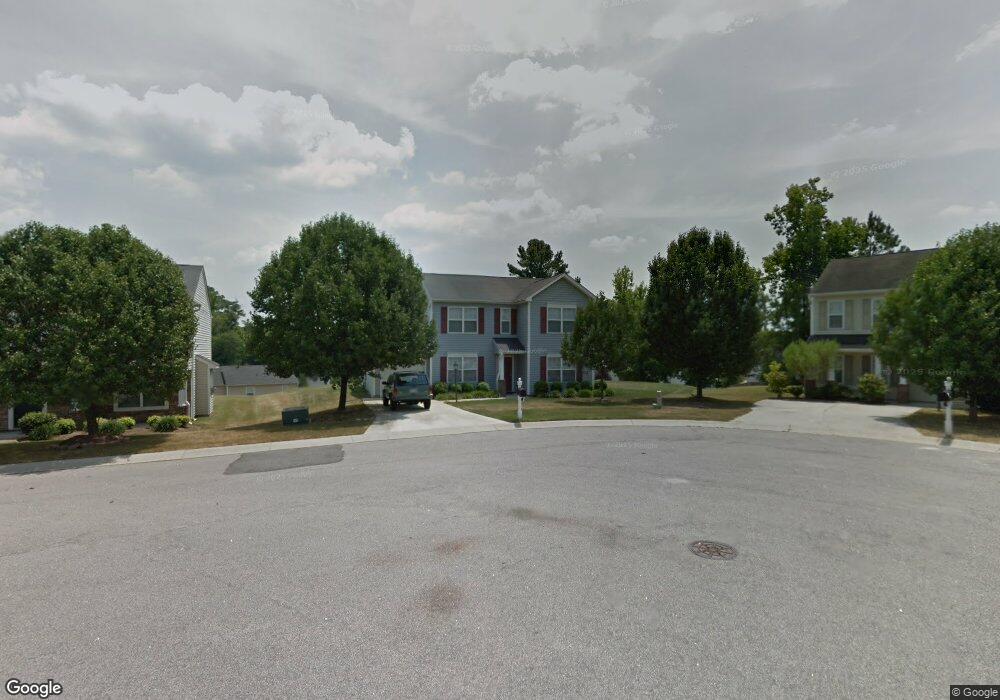
11 Kimbrough Ct Durham, NC 27703
Eastern Durham NeighborhoodEstimated Value: $360,000 - $379,000
3
Beds
3
Baths
1,740
Sq Ft
$214/Sq Ft
Est. Value
About This Home
This home is located at 11 Kimbrough Ct, Durham, NC 27703 and is currently estimated at $372,401, approximately $214 per square foot. 11 Kimbrough Ct is a home located in Durham County with nearby schools including Oak Grove Elementary, John W Neal Middle School, and Southern School of Energy & Sustainability.
Ownership History
Date
Name
Owned For
Owner Type
Purchase Details
Closed on
Jan 28, 2002
Sold by
Inc-Torrey D R Horton
Bought by
Thune Daniel B
Current Estimated Value
Home Financials for this Owner
Home Financials are based on the most recent Mortgage that was taken out on this home.
Original Mortgage
$116,500
Outstanding Balance
$48,240
Interest Rate
7.08%
Estimated Equity
$324,161
Create a Home Valuation Report for This Property
The Home Valuation Report is an in-depth analysis detailing your home's value as well as a comparison with similar homes in the area
Home Values in the Area
Average Home Value in this Area
Purchase History
| Date | Buyer | Sale Price | Title Company |
|---|---|---|---|
| Thune Daniel B | $146,500 | -- |
Source: Public Records
Mortgage History
| Date | Status | Borrower | Loan Amount |
|---|---|---|---|
| Open | Thune Daniel B | $116,500 |
Source: Public Records
Tax History
| Year | Tax Paid | Tax Assessment Tax Assessment Total Assessment is a certain percentage of the fair market value that is determined by local assessors to be the total taxable value of land and additions on the property. | Land | Improvement |
|---|---|---|---|---|
| 2025 | $3,586 | $361,749 | $95,250 | $266,499 |
| 2024 | $2,804 | $200,994 | $47,625 | $153,369 |
| 2023 | $2,633 | $200,994 | $47,625 | $153,369 |
| 2022 | $2,573 | $200,994 | $47,625 | $153,369 |
| 2021 | $2,560 | $200,994 | $47,625 | $153,369 |
| 2020 | $2,500 | $200,994 | $47,625 | $153,369 |
| 2019 | $2,500 | $200,994 | $47,625 | $153,369 |
| 2018 | $2,177 | $160,474 | $34,925 | $125,549 |
| 2017 | $2,161 | $160,474 | $34,925 | $125,549 |
| 2016 | $2,088 | $160,474 | $34,925 | $125,549 |
| 2015 | $2,425 | $175,159 | $34,066 | $141,093 |
| 2014 | -- | $175,159 | $34,066 | $141,093 |
Source: Public Records
Map
Nearby Homes
- 107 Crosswood Dr
- 110 Kindlewood Dr
- 217 Morning View Ct
- 4 Jarvis Ct
- 4505 Tyne Dr
- 5409 Hadrian Dr
- 2800-2809 Napoli Dr
- 304 Stallings Rd
- 5706 Wrenwood Ct Unit Lt 116
- 210 Stallings Rd
- 5002 Wake Forest Hwy
- 442 Gus Rd
- 4317 Marbrey Dr
- 601 Crossing Dr
- 502 Quartz Dr
- 501 Bellmeade Bay Dr
- 411 Bellmeade Bay Dr
- 615 Southshore Pkwy
- 604 Bellmeade Bay Dr
- 521 Quartz Dr
- 13 Kimbrough Ct
- 13 KIMBROU To Be Added
- 13 KIMBROUGH CT To Be Added
- 9 Kimbrough Ct
- 101 Bermuda Green Dr
- 7 Kimbrough Ct
- 105 BERMUDA To Be Added
- 105 Bermuda Green Dr
- 12 Kimbrough Ct
- 5 Gateview Ct
- 3 Gateview Ct
- 3 GATEVIEW To Be Added
- 3 GATEVIEW CT To Be Added
- 10 Kimbrough Ct
- 8 Kimbrough Ct
- 103 Crosswood Dr
- 6 Kimbrough Ct
- BQ217 Kimbrough
- BQ211 Kimbrough Ct
- BQ218 Kimbrough Ct
Your Personal Tour Guide
Ask me questions while you tour the home.