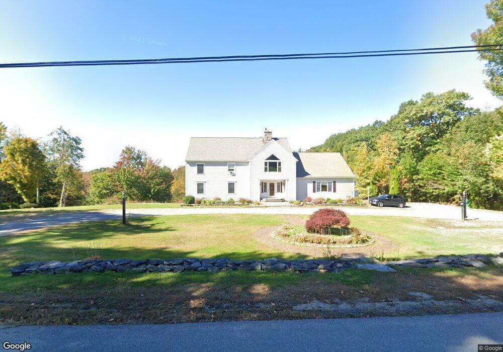
11 Lanes Rd Westminster, MA 01473
Estimated Value: $860,071 - $1,009,000
4
Beds
4
Baths
4,394
Sq Ft
$218/Sq Ft
Est. Value
About This Home
This home is located at 11 Lanes Rd, Westminster, MA 01473 and is currently estimated at $958,018, approximately $218 per square foot. 11 Lanes Rd is a home located in Worcester County with nearby schools including Oakmont Regional High School.
Ownership History
Date
Name
Owned For
Owner Type
Purchase Details
Closed on
Jul 14, 2014
Sold by
Blanchard Howard T and Blanchard Mary A
Bought by
Morse Wayne H and Morse Julia
Current Estimated Value
Purchase Details
Closed on
Aug 1, 1991
Sold by
Mcmahon Isabelle and Greene Leona I
Bought by
Morse Wayne H and Morse Beverly
Create a Home Valuation Report for This Property
The Home Valuation Report is an in-depth analysis detailing your home's value as well as a comparison with similar homes in the area
Home Values in the Area
Average Home Value in this Area
Purchase History
| Date | Buyer | Sale Price | Title Company |
|---|---|---|---|
| Morse Wayne H | -- | -- | |
| Blanchard Howard T | -- | -- | |
| Morse Wayne H | $62,695 | -- |
Source: Public Records
Mortgage History
| Date | Status | Borrower | Loan Amount |
|---|---|---|---|
| Previous Owner | Morse Wayne H | $50,000 | |
| Previous Owner | Morse Wayne H | $140,000 | |
| Previous Owner | Morse Wayne H | $110,000 |
Source: Public Records
Tax History
| Year | Tax Paid | Tax Assessment Tax Assessment Total Assessment is a certain percentage of the fair market value that is determined by local assessors to be the total taxable value of land and additions on the property. | Land | Improvement |
|---|---|---|---|---|
| 2025 | $9,337 | $759,100 | $135,400 | $623,700 |
| 2024 | $8,853 | $722,100 | $135,400 | $586,700 |
| 2023 | $8,856 | $678,100 | $126,700 | $551,400 |
| 2022 | $9,000 | $569,600 | $110,400 | $459,200 |
| 2021 | $9,107 | $543,400 | $96,600 | $446,800 |
| 2020 | $9,072 | $516,900 | $88,000 | $428,900 |
| 2019 | $9,167 | $502,300 | $73,400 | $428,900 |
| 2018 | $8,943 | $482,100 | $73,400 | $408,700 |
| 2017 | $8,598 | $472,700 | $73,400 | $399,300 |
| 2016 | $8,382 | $446,300 | $61,300 | $385,000 |
| 2015 | $8,262 | $436,000 | $61,000 | $375,000 |
| 2014 | $8,275 | $436,000 | $61,000 | $375,000 |
Source: Public Records
Map
Nearby Homes
- 49 Greene Rd
- 224 Worcester Rd Unit B
- 224 Worcester Rd
- 0 Minott Rd
- 21 Davis Rd
- 97 Worcester Rd
- 84 Minott Rd
- 3 Woods Rd
- 38 Knower Rd
- 3 Linda Dr
- 0 Worcester Rd Unit 73326124
- 17 Leominster St
- Lot 0 Narrows Rd
- 9 Knower Rd
- 134 Mountain Rd
- 2 Seaver St
- 20 Battles Rd
- 169 Narrows Rd
- 45 Old Colony Rd
- 56 Hubbardston Rd
- 259 W Princeton Rd
- Lot 1 (35) Lanes Rd
- 258 W Princeton Rd
- 251 W Princeton Rd
- 261 W Princeton Rd
- 249 W Princeton Rd
- 247 W Princeton Rd
- 265 W Princeton Rd
- 262 W Princeton Rd
- 22 Lanes Rd
- 267 W Princeton Rd Unit Lot 4
- 267 W Princeton Rd Unit Lot 6-4
- 267 W Princeton Rd
- 39 Lanes Rd
- 32 Lanes Rd
- 243 W Princeton Rd
- 269 W Princeton Rd Unit Lot 3
- 269 W Princeton Rd Unit Lot 4
- 269 W Princeton Rd Unit Lot 6-4
- 269 W Princeton Rd
Your Personal Tour Guide
Ask me questions while you tour the home.