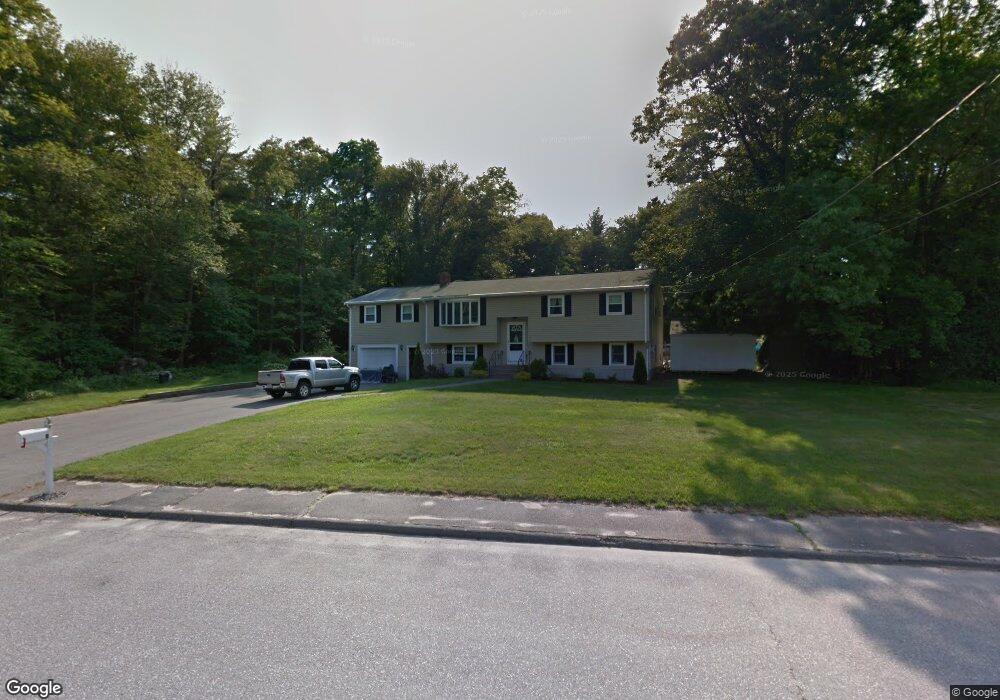
11 Lantern Rd Holbrook, MA 02343
Estimated Value: $720,000 - $755,000
4
Beds
3
Baths
2,695
Sq Ft
$273/Sq Ft
Est. Value
About This Home
This home is located at 11 Lantern Rd, Holbrook, MA 02343 and is currently estimated at $735,494, approximately $272 per square foot. 11 Lantern Rd is a home located in Norfolk County with nearby schools including John F. Kennedy Elementary School, Holbrook Middle High School, and Boston Higashi School.
Ownership History
Date
Name
Owned For
Owner Type
Purchase Details
Closed on
Aug 31, 2023
Sold by
Lewis Joan E and Lewis Thomas A
Bought by
Thomas & Joan Lewis Lt and Lewis
Current Estimated Value
Purchase Details
Closed on
Apr 19, 1978
Bought by
Lewis Thomas A and Lewis Joan E
Create a Home Valuation Report for This Property
The Home Valuation Report is an in-depth analysis detailing your home's value as well as a comparison with similar homes in the area
Home Values in the Area
Average Home Value in this Area
Purchase History
| Date | Buyer | Sale Price | Title Company |
|---|---|---|---|
| Thomas & Joan Lewis Lt | -- | None Available | |
| Thomas & Joan Lewis Lt | -- | None Available | |
| Lewis Thomas A | $42,900 | -- |
Source: Public Records
Mortgage History
| Date | Status | Borrower | Loan Amount |
|---|---|---|---|
| Previous Owner | Lewis Thomas A | $80,000 |
Source: Public Records
Tax History
| Year | Tax Paid | Tax Assessment Tax Assessment Total Assessment is a certain percentage of the fair market value that is determined by local assessors to be the total taxable value of land and additions on the property. | Land | Improvement |
|---|---|---|---|---|
| 2025 | $87 | $658,800 | $310,100 | $348,700 |
| 2024 | $8,008 | $595,800 | $267,900 | $327,900 |
| 2023 | $8,700 | $565,700 | $256,500 | $309,200 |
| 2022 | $8,163 | $495,000 | $219,100 | $275,900 |
| 2021 | $8,028 | $466,200 | $204,900 | $261,300 |
| 2020 | $8,162 | $444,300 | $189,200 | $255,100 |
| 2019 | $8,181 | $420,400 | $180,300 | $240,100 |
| 2018 | $7,848 | $379,700 | $147,900 | $231,800 |
| 2017 | $7,442 | $356,100 | $134,700 | $221,400 |
| 2016 | $6,864 | $349,500 | $132,300 | $217,200 |
| 2015 | $6,327 | $331,600 | $122,700 | $208,900 |
| 2014 | $6,068 | $323,300 | $122,700 | $200,600 |
Source: Public Records
Map
Nearby Homes
- 45 Ernest St
- 360 Plymouth St
- 88 Roseen Rd
- 95 Rindone St
- 24 Reeds Ln
- 375 S Franklin St Unit 1
- 52 Quincy St
- 181 S Franklin St Unit 102
- 181 S Franklin St Unit 206
- 14 Jamieson St
- 152 S Franklin St
- 220 Weymouth St
- 22 Kingswood Dr Unit 6F
- 660 S Franklin St
- 44 Old Forge Rd
- 719 S Franklin St Unit C Block 1
- 66 Coleman St
- 58 Chandler St
- 123-125 N Franklin St
- 720 Hancock St
- 7 Lantern Rd
- 8 Lantern Rd
- 15 Lantern Rd
- 3 Lantern Rd
- 4 Lantern Rd
- 12 Lantern Rd
- 655 Plymouth St Unit 657
- 677 Plymouth St
- 2 Lantern Rd
- 16 Lantern Rd
- 649 Plymouth St
- 19 Lantern Rd
- 19 Lantern Rd Unit 1
- 19 Lantern Rd Unit b
- 1 Lantern Rd
- 20 Lantern Rd
- 685 Plymouth St
- 712 Plymouth St
- 700 Plymouth St
- 680 Plymouth St
Your Personal Tour Guide
Ask me questions while you tour the home.