Estimated Value: $571,000 - $700,000
3
Beds
2
Baths
1,020
Sq Ft
$624/Sq Ft
Est. Value
About This Home
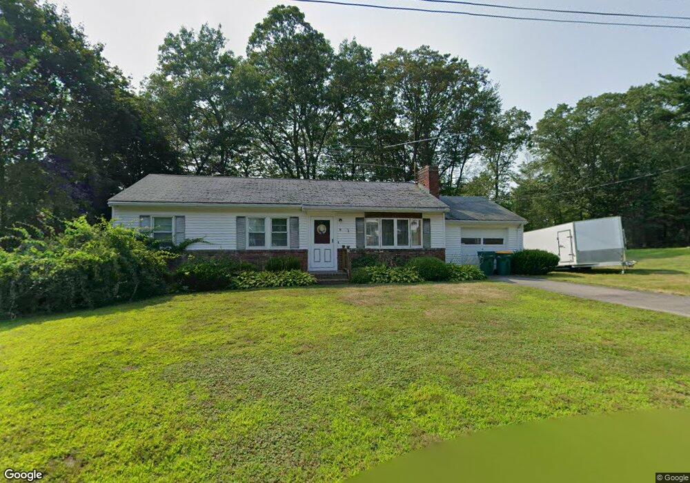
This home is located at 11 Lillian Rd, Acton, MA 01720 and is currently estimated at $636,488, approximately $624 per square foot. 11 Lillian Rd is a home located in Middlesex County with nearby schools including Acton-Boxborough Regional High School and Oak Meadow Montessori School.
Ownership History
Date
Name
Owned For
Owner Type
Purchase Details
Closed on
Sep 27, 2022
Sold by
Wojtkiewicz Peter J
Bought by
11 Lillian Road Rt
Current Estimated Value
Purchase Details
Closed on
Mar 24, 1962
Bought by
Wojtkiewicz Peter J
Create a Home Valuation Report for This Property
The Home Valuation Report is an in-depth analysis detailing your home's value as well as a comparison with similar homes in the area
Home Values in the Area
Average Home Value in this Area
Purchase History
| Date | Buyer | Sale Price | Title Company |
|---|---|---|---|
| 11 Lillian Road Rt | -- | None Available | |
| Wojtkiewicz Peter J | -- | -- |
Source: Public Records
Mortgage History
| Date | Status | Borrower | Loan Amount |
|---|---|---|---|
| Previous Owner | Wojtkiewicz Peter J | $50,000 |
Source: Public Records
Tax History Compared to Growth
Tax History
| Year | Tax Paid | Tax Assessment Tax Assessment Total Assessment is a certain percentage of the fair market value that is determined by local assessors to be the total taxable value of land and additions on the property. | Land | Improvement |
|---|---|---|---|---|
| 2025 | $9,525 | $555,400 | $317,400 | $238,000 |
| 2024 | $9,075 | $544,400 | $317,400 | $227,000 |
| 2023 | $8,669 | $493,700 | $288,700 | $205,000 |
| 2022 | $8,708 | $447,700 | $251,000 | $196,700 |
| 2021 | $8,321 | $411,300 | $232,300 | $179,000 |
| 2020 | $7,815 | $406,200 | $232,300 | $173,900 |
| 2019 | $7,372 | $380,600 | $232,300 | $148,300 |
| 2018 | $6,957 | $359,000 | $232,300 | $126,700 |
| 2017 | $6,843 | $359,000 | $232,300 | $126,700 |
| 2016 | $6,602 | $343,300 | $232,300 | $111,000 |
| 2015 | $6,563 | $344,500 | $232,300 | $112,200 |
| 2014 | $6,605 | $339,600 | $232,300 | $107,300 |
Source: Public Records
Map
Nearby Homes
- 4 Huron Rd
- 4 Omega Way
- 31 Mohawk Dr
- 9 Elm St Unit 1
- 5 Elm St Unit 1
- 305 Harwood Ave
- 285 Central St Unit 285
- 134 Russet Ln
- 68 Macintosh Ln
- 62 Waite Rd
- 777 Depot Rd
- 35 Queen Rd
- Lot 2 Strawberry Farm
- 23 John Swift Rd
- 89 Windsor Ave
- 159 Skyline Dr Unit 159
- 18 Long Lake Rd
- 524 Main St
- 9 Breezy Point Rd
- 491 Main St
- 13 Lillian Rd
- 12 Lillian Rd
- Lot 3 Lillian Rd Unit EUA-3
- 10 Lillian Rd
- 7 Lillian Rd
- 8 Lillian Rd
- 15 Bulette Rd
- 11 Bulette Rd
- 19 Bulette Rd
- 19 Bulette Rd Unit 19
- 19 Bulette Rd Unit EUA 1
- 37 Fort Pond Hill Rd
- 5 Lillian Rd
- 3 Lillian Rd
- 3 Bulette Rd
- 16 Bulette Rd
- 27 Fort Pond Hill Rd
- 27 Fort Pond Hill Rd
- 250 Newtown Rd
- 55 Fort Pond Hill Rd