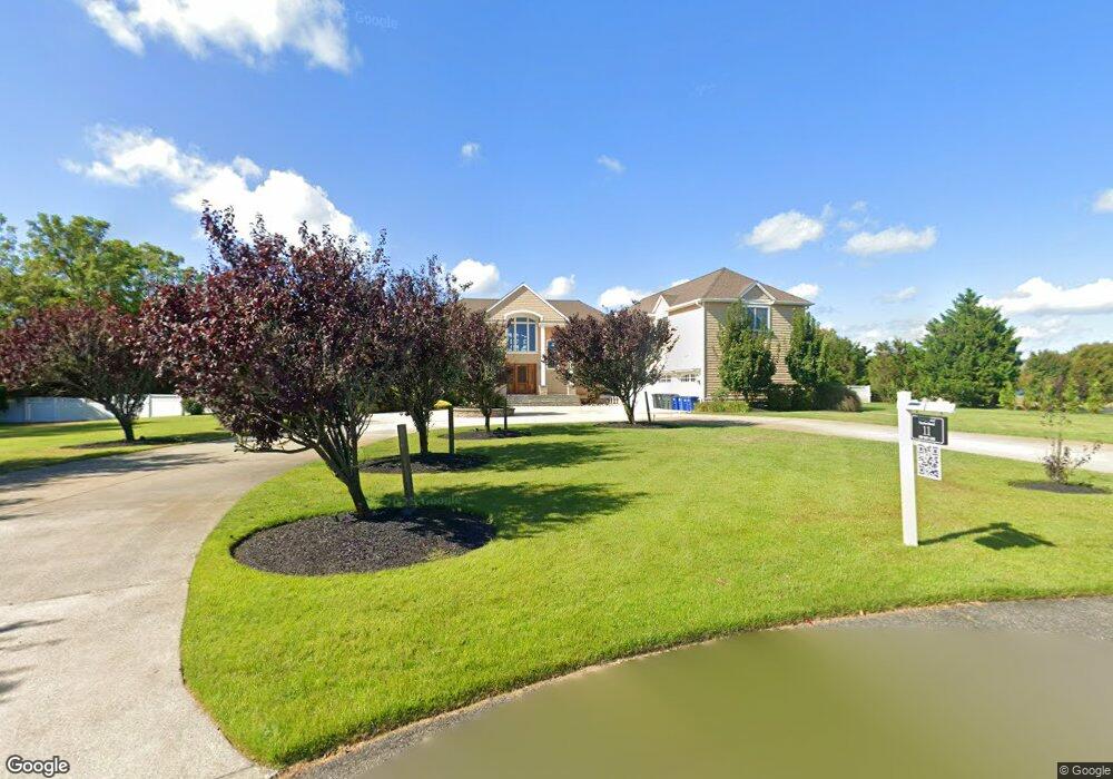
11 Linda Sue Ln Cape May, NJ 08204
Estimated Value: $1,057,000 - $3,578,000
--
Bed
--
Bath
6,434
Sq Ft
$345/Sq Ft
Est. Value
About This Home
This home is located at 11 Linda Sue Ln, Cape May, NJ 08204 and is currently estimated at $2,222,824, approximately $345 per square foot. 11 Linda Sue Ln is a home located in Cape May County with nearby schools including Carl T. Mitnick School, David C. Douglass Veterans Memorial School, and Maud Abrams School.
Ownership History
Date
Name
Owned For
Owner Type
Purchase Details
Closed on
Sep 29, 2020
Sold by
Pawlus Fabio and Whittington Deborah L
Bought by
Whittington Deborah L
Current Estimated Value
Home Financials for this Owner
Home Financials are based on the most recent Mortgage that was taken out on this home.
Original Mortgage
$760,000
Outstanding Balance
$675,979
Interest Rate
2.9%
Mortgage Type
Stand Alone Refi Refinance Of Original Loan
Estimated Equity
$1,546,845
Purchase Details
Closed on
Nov 4, 2004
Sold by
Lawrence A Pray Builders Inc
Bought by
Pawlus Fabio and Pawlus Deborah
Create a Home Valuation Report for This Property
The Home Valuation Report is an in-depth analysis detailing your home's value as well as a comparison with similar homes in the area
Home Values in the Area
Average Home Value in this Area
Purchase History
| Date | Buyer | Sale Price | Title Company |
|---|---|---|---|
| Whittington Deborah L | -- | Misc Company | |
| Pawlus Fabio | $350,000 | -- |
Source: Public Records
Mortgage History
| Date | Status | Borrower | Loan Amount |
|---|---|---|---|
| Open | Whittington Deborah L | $760,000 |
Source: Public Records
Tax History Compared to Growth
Tax History
| Year | Tax Paid | Tax Assessment Tax Assessment Total Assessment is a certain percentage of the fair market value that is determined by local assessors to be the total taxable value of land and additions on the property. | Land | Improvement |
|---|---|---|---|---|
| 2025 | $24,034 | $1,185,100 | $253,700 | $931,400 |
| 2024 | $24,034 | $1,185,100 | $253,700 | $931,400 |
| 2023 | $23,690 | $1,185,100 | $253,700 | $931,400 |
| 2022 | $22,967 | $1,185,100 | $253,700 | $931,400 |
| 2021 | $22,280 | $1,185,100 | $253,700 | $931,400 |
| 2020 | $21,924 | $1,185,100 | $253,700 | $931,400 |
| 2019 | $21,379 | $1,185,100 | $253,700 | $931,400 |
| 2018 | $20,870 | $1,185,100 | $253,700 | $931,400 |
| 2017 | $20,893 | $1,185,100 | $253,700 | $931,400 |
| 2016 | $20,573 | $1,185,100 | $253,700 | $931,400 |
| 2015 | $19,910 | $1,185,100 | $253,700 | $931,400 |
| 2014 | $19,258 | $1,185,100 | $253,700 | $931,400 |
Source: Public Records
Map
Nearby Homes
- 3941 Bayshore Rd
- 3 Hannah Dr
- 1023 Shunpike Rd
- 3911 Bayshore Rd
- 59 Westwood Dr
- 712 Gorham Ave
- 1036 Seashore Rd
- 1031 Seashore Rd
- 1062 Seashore Rd
- 602 Gorham Ave
- 123 Stimpson Ln
- 1083 Seashore Rd
- 712 Indian Ave
- 306 Sixth Ave
- 402 Whildam Ave
- 305 Whildam Ave
- 1400 Franklin Ave
- 717 Third Ave
- 711 Beach Dr
- 818 Shunpike Rd
- 9 Linda Sue Ln
- 586 New England Rd
- 588 New England Rd
- 12 Linda Sue Ln
- 7 Linda Sue Ln
- 580 New England Rd
- 590 New England Rd
- 10 Linda Sue Ln
- 8 Linda Sue Ln
- 5 Linda Sue Ln
- 5 Linda Sue Ln Unit CAPE MAY ESTATES
- 594 New England Rd
- 585 New England Rd
- 574 New England Rd
- 6 Linda Sue Ln
- 3 Linda Sue Ln
- 596 New England Rd
- 591 New England Rd
- 4 Linda Sue Ln
- 598 New England Rd