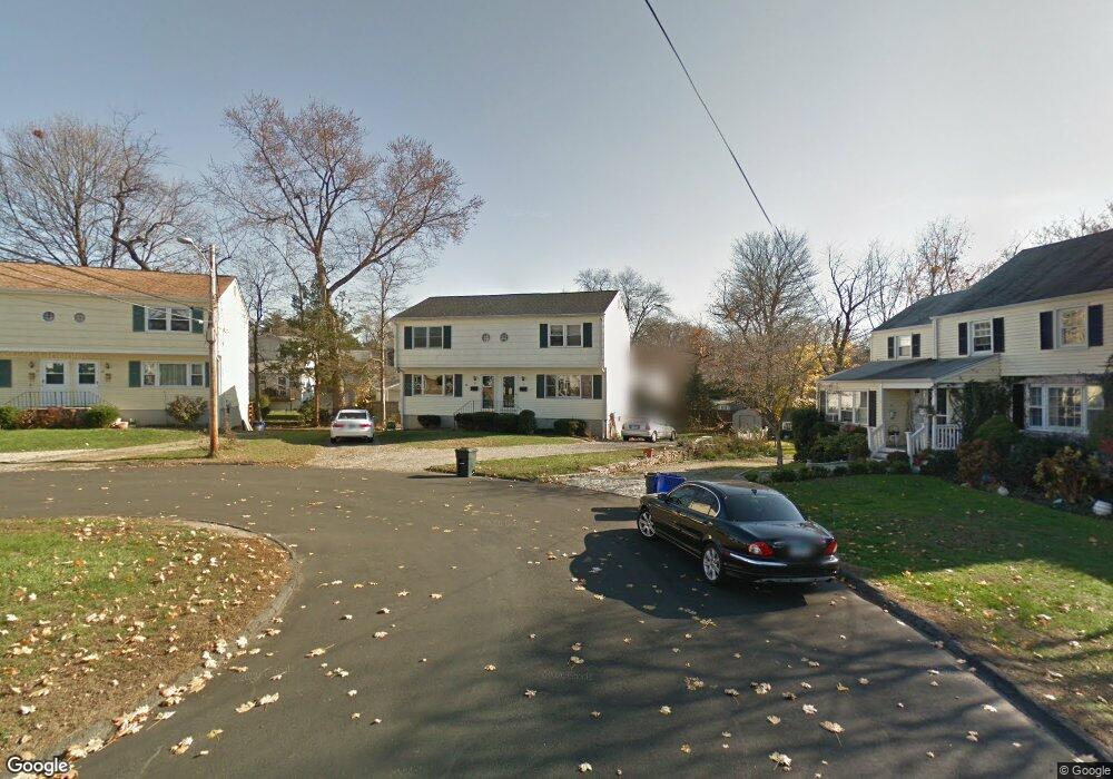
11 Locust St Unit A Norwalk, CT 06855
East Norwalk NeighborhoodEstimated Value: $328,000 - $508,000
2
Beds
2
Baths
1,080
Sq Ft
$420/Sq Ft
Est. Value
About This Home
This home is located at 11 Locust St Unit A, Norwalk, CT 06855 and is currently estimated at $453,600, approximately $420 per square foot. 11 Locust St Unit A is a home located in Fairfield County with nearby schools including Marvin Elementary School, Nathan Hale Middle School, and Norwalk High School.
Ownership History
Date
Name
Owned For
Owner Type
Purchase Details
Closed on
Aug 13, 1998
Sold by
Wilson Anne S
Bought by
Callahan Denise
Current Estimated Value
Purchase Details
Closed on
Jul 18, 1988
Sold by
Fitzsimmons Wm
Bought by
Wilson Ann
Create a Home Valuation Report for This Property
The Home Valuation Report is an in-depth analysis detailing your home's value as well as a comparison with similar homes in the area
Home Values in the Area
Average Home Value in this Area
Purchase History
| Date | Buyer | Sale Price | Title Company |
|---|---|---|---|
| Callahan Denise | $148,000 | -- | |
| Callahan Denise | $148,000 | -- | |
| Wilson Ann | $180,000 | -- |
Source: Public Records
Mortgage History
| Date | Status | Borrower | Loan Amount |
|---|---|---|---|
| Open | Wilson Ann | $193,500 | |
| Closed | Wilson Ann | $100,026 | |
| Closed | Wilson Ann | $40,465 |
Source: Public Records
Tax History
| Year | Tax Paid | Tax Assessment Tax Assessment Total Assessment is a certain percentage of the fair market value that is determined by local assessors to be the total taxable value of land and additions on the property. | Land | Improvement |
|---|---|---|---|---|
| 2025 | $6,474 | $270,860 | $0 | $270,860 |
| 2024 | $6,377 | $270,860 | $0 | $270,860 |
| 2023 | $2,712 | $108,120 | $0 | $108,120 |
| 2022 | $2,654 | $108,120 | $0 | $108,120 |
| 2021 | $2,591 | $108,120 | $0 | $108,120 |
| 2020 | $2,590 | $108,120 | $0 | $108,120 |
| 2019 | $2,521 | $108,120 | $0 | $108,120 |
| 2018 | $2,749 | $103,330 | $0 | $103,330 |
| 2017 | $2,654 | $103,330 | $0 | $103,330 |
| 2016 | $2,629 | $103,330 | $0 | $103,330 |
| 2015 | $2,621 | $103,330 | $0 | $103,330 |
| 2014 | $2,587 | $103,330 | $0 | $103,330 |
Source: Public Records
Map
Nearby Homes
- 18 Cloverly Cir
- 1 Howard Ave Unit C4
- 189 East Ave
- 281 East Ave
- 40 1st St
- 23 Macintosh Rd
- 100 Seaview Ave Unit 3I
- 100 Seaview Ave Unit 2J
- 26 Cove Ave Unit 3B
- 17 Pleasant St
- 11 Roland Ave
- 4 van Zant St Unit A2
- 144 East Ave Unit B404
- 136 East Ave Unit 4C
- 16 Sunset Hill Ave
- 34 Shorehaven Rd
- 30 Merwin St Unit 6
- 30 Merwin St Unit 1
- 30 Merwin St Unit 5
- 33 N Water St Unit 505
- 11 Locust St Unit B
- 9 Locust St
- 15 Locust St
- 17 Locust St
- 17 Locust St Unit A-1
- 14 Winfield Ct
- 12 Winfield Ct
- 12 Winfield Ct Unit 2
- 1 Poplar St
- 16 Winfield Ct
- 3 Poplar St
- 10 Winfield Ct
- 2 Carlson Ct
- 5 Poplar St
- 42 Melrose Ave Unit B
- 42 Melrose Ave Unit A
- 21 Locust St
- 21 Locust St Unit 1
- 40 Melrose Ave
- 3 Carlson Ct
Your Personal Tour Guide
Ask me questions while you tour the home.