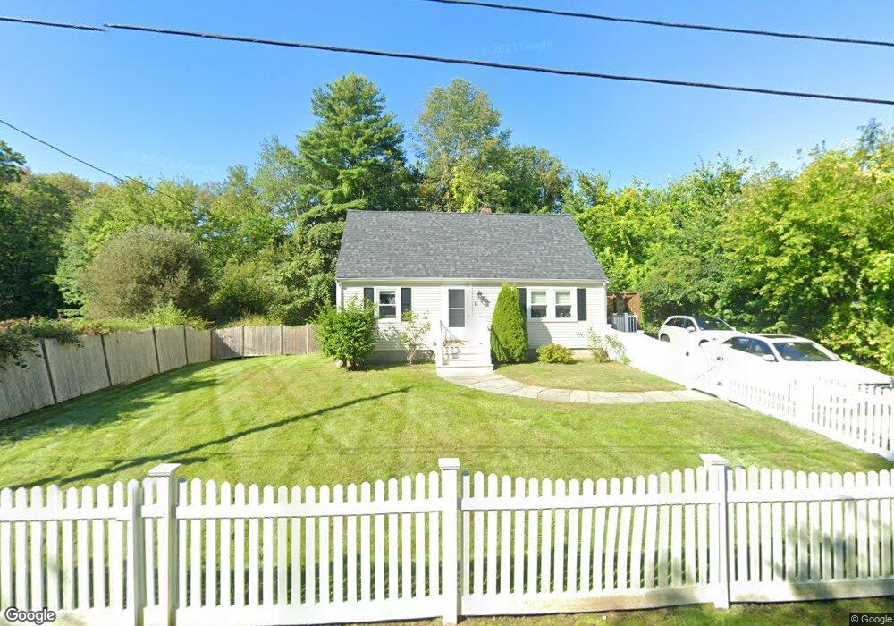
11 Maple Dell Ln Holliston, MA 01746
Estimated Value: $515,000 - $580,000
3
Beds
1
Bath
1,152
Sq Ft
$477/Sq Ft
Est. Value
About This Home
This home is located at 11 Maple Dell Ln, Holliston, MA 01746 and is currently estimated at $548,972, approximately $476 per square foot. 11 Maple Dell Ln is a home located in Middlesex County with nearby schools including Miller Elementary School, Robert H. Adams Middle School, and Holliston High School.
Ownership History
Date
Name
Owned For
Owner Type
Purchase Details
Closed on
Apr 6, 2012
Sold by
Oller Roy M
Bought by
Oller Roy M and Oller Brittany A
Current Estimated Value
Purchase Details
Closed on
Mar 6, 2009
Sold by
Morgan Stanley Abs Inc
Bought by
Oller Roy M
Home Financials for this Owner
Home Financials are based on the most recent Mortgage that was taken out on this home.
Original Mortgage
$183,350
Interest Rate
5.14%
Mortgage Type
Purchase Money Mortgage
Purchase Details
Closed on
May 23, 2008
Sold by
Menezes Marcelo N
Bought by
Deutsche Bank Natl T C
Purchase Details
Closed on
Jun 9, 2006
Sold by
Graham Elisabeth R
Bought by
Menezes Marcelo N
Home Financials for this Owner
Home Financials are based on the most recent Mortgage that was taken out on this home.
Original Mortgage
$256,000
Interest Rate
6.62%
Mortgage Type
Purchase Money Mortgage
Purchase Details
Closed on
Jun 23, 2003
Sold by
Todd Lisa B and Todd Charles S
Bought by
Graham Elizabeth R and Graham Steven P
Home Financials for this Owner
Home Financials are based on the most recent Mortgage that was taken out on this home.
Original Mortgage
$246,000
Interest Rate
5.71%
Mortgage Type
Purchase Money Mortgage
Purchase Details
Closed on
May 2, 1994
Sold by
Burroughs Janis L and Largesse Gerald L
Bought by
Lightbody Timothy R and Lightbody Donna M
Purchase Details
Closed on
Nov 2, 1989
Sold by
Holmes Barbara R
Bought by
Burroughs Janis
Create a Home Valuation Report for This Property
The Home Valuation Report is an in-depth analysis detailing your home's value as well as a comparison with similar homes in the area
Home Values in the Area
Average Home Value in this Area
Purchase History
| Date | Buyer | Sale Price | Title Company |
|---|---|---|---|
| Oller Roy M | -- | -- | |
| Oller Roy M | $193,000 | -- | |
| Deutsche Bank Natl T C | $290,050 | -- | |
| Menezes Marcelo N | $320,000 | -- | |
| Graham Elizabeth R | $286,000 | -- | |
| Lightbody Timothy R | $123,000 | -- | |
| Burroughs Janis | $140,000 | -- |
Source: Public Records
Mortgage History
| Date | Status | Borrower | Loan Amount |
|---|---|---|---|
| Previous Owner | Burroughs Janis | $185,000 | |
| Previous Owner | Burroughs Janis | $191,200 | |
| Previous Owner | Oller Roy M | $183,350 | |
| Previous Owner | Menezes Marcelo N | $256,000 | |
| Previous Owner | Graham Elizabeth R | $246,000 |
Source: Public Records
Tax History Compared to Growth
Tax History
| Year | Tax Paid | Tax Assessment Tax Assessment Total Assessment is a certain percentage of the fair market value that is determined by local assessors to be the total taxable value of land and additions on the property. | Land | Improvement |
|---|---|---|---|---|
| 2025 | $6,349 | $433,400 | $235,600 | $197,800 |
| 2024 | $5,894 | $391,400 | $235,600 | $155,800 |
| 2023 | $5,926 | $384,800 | $235,600 | $149,200 |
| 2022 | $6,231 | $358,500 | $235,600 | $122,900 |
| 2021 | $6,205 | $347,600 | $224,700 | $122,900 |
| 2020 | $5,825 | $309,000 | $203,700 | $105,300 |
| 2019 | $5,657 | $300,400 | $197,700 | $102,700 |
| 2018 | $5,608 | $300,400 | $197,700 | $102,700 |
| 2017 | $5,725 | $309,100 | $201,800 | $107,300 |
| 2016 | $5,272 | $280,600 | $173,300 | $107,300 |
| 2015 | $4,611 | $237,900 | $140,100 | $97,800 |
Source: Public Records
Map
Nearby Homes
- 156 Mitchell Rd
- 1366 Washington St
- 154 Union St
- 11 Francine Dr
- 266 Willowgate Rise
- 1037 Washington St
- 160 Winter St
- 43 Bittersweet Cir Unit 43
- 30 Powderhorn Ln
- 121 Bullard St
- 27 Richardson Dr Unit 27
- 625 Norfolk St
- 1014 Highland St
- 195 High St
- 140 Goulding St
- 54 Westfield Dr
- 1 Jameson Dr Unit 1
- 3 Jameson Dr Unit 3
- 56 Roy Ave
- 0 Hill St
- 11 Maple Del Ln
- 21 Maple Dell Ln
- 291 Central St
- 287 Central St
- 43 Maple Del Ln
- 29 Maple Dell Ln
- 319 Central St
- 37 Maple Dell Ln
- 288 Central St
- 278 Central St
- 40 Maple Dell Ln
- 43 Maple Dell Ln
- 318 Central St
- 253 Central St
- 255 Central St
- 50 Maple Dell Ln
- 256 Central St
- 51 Maple Dell Ln
- 332 Central St
- 249 Central St