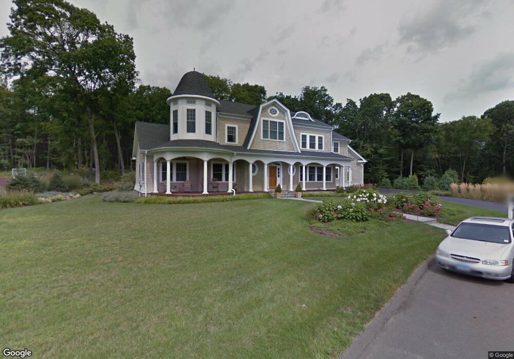
11 Matthew Ct Madison, CT 06443
Estimated Value: $1,550,778 - $1,743,000
5
Beds
4
Baths
5,171
Sq Ft
$317/Sq Ft
Est. Value
About This Home
This home is located at 11 Matthew Ct, Madison, CT 06443 and is currently estimated at $1,637,926, approximately $316 per square foot. 11 Matthew Ct is a home with nearby schools including Walter C. Polson Upper Middle School, Daniel Hand High School, and The Country School.
Ownership History
Date
Name
Owned For
Owner Type
Purchase Details
Closed on
Jan 11, 2010
Sold by
Ferrncci Ft and Ferrncci Joseph P
Bought by
11 Matthew Court Llc
Current Estimated Value
Create a Home Valuation Report for This Property
The Home Valuation Report is an in-depth analysis detailing your home's value as well as a comparison with similar homes in the area
Home Values in the Area
Average Home Value in this Area
Purchase History
| Date | Buyer | Sale Price | Title Company |
|---|---|---|---|
| 11 Matthew Court Llc | -- | -- | |
| 11 Matthew Court Llc | -- | -- |
Source: Public Records
Mortgage History
| Date | Status | Borrower | Loan Amount |
|---|---|---|---|
| Open | 11 Matthew Court Llc | $800,000 | |
| Closed | 11 Matthew Court Llc | $300,000 | |
| Closed | 11 Matthew Court Llc | $700,000 |
Source: Public Records
Tax History
| Year | Tax Paid | Tax Assessment Tax Assessment Total Assessment is a certain percentage of the fair market value that is determined by local assessors to be the total taxable value of land and additions on the property. | Land | Improvement |
|---|---|---|---|---|
| 2025 | $22,679 | $1,011,100 | $184,000 | $827,100 |
| 2024 | $22,244 | $1,011,100 | $184,000 | $827,100 |
| 2023 | $20,134 | $671,800 | $154,800 | $517,000 |
| 2022 | $19,758 | $671,800 | $154,800 | $517,000 |
| 2021 | $19,381 | $671,800 | $154,800 | $517,000 |
| 2020 | $19,046 | $671,800 | $154,800 | $517,000 |
| 2019 | $19,046 | $671,800 | $154,800 | $517,000 |
| 2018 | $7,755 | $635,400 | $123,700 | $511,700 |
| 2017 | $17,346 | $635,400 | $123,700 | $511,700 |
| 2016 | $16,832 | $635,400 | $123,700 | $511,700 |
| 2015 | $16,368 | $635,400 | $123,700 | $511,700 |
| 2014 | $18,392 | $730,700 | $185,900 | $544,800 |
Source: Public Records
Map
Nearby Homes
- 70 Wildwood Ave
- 178 Mungertown Rd
- 173 Wildwood Ave
- 23 Sheep Pasture Rd
- 67 Boston Post Rd Unit 8
- 22 Nathans Ln
- 2 Esterly Farms Rd
- 4 Boston Post Rd
- 26 Opening Hill Rd
- 38 Opening Hill Rd
- 31 Stony Lane Lot 3 Rd
- 42 Neck Rd
- 31 Stony Lane Lot 2 Rd
- 31 Stony Lane Lot 1 Rd
- 75 Fairview Dr
- 41 Harbor Ave
- 395 Boston Post Rd
- 46A Beach Ave
- 37 Lantern Hill Rd
- 461 Green Hill Rd
Your Personal Tour Guide
Ask me questions while you tour the home.