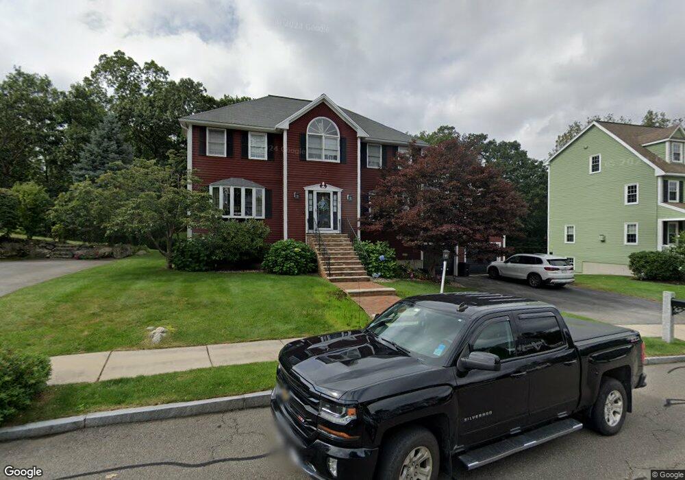
11 Mauriello Dr Stoneham, MA 02180
Nobility Hill NeighborhoodEstimated Value: $1,198,000 - $1,457,000
4
Beds
3
Baths
2,430
Sq Ft
$533/Sq Ft
Est. Value
About This Home
This home is located at 11 Mauriello Dr, Stoneham, MA 02180 and is currently estimated at $1,294,286, approximately $532 per square foot. 11 Mauriello Dr is a home located in Middlesex County with nearby schools including Stoneham High School, Greater Boston Academy, and St. Patrick Elementary School.
Ownership History
Date
Name
Owned For
Owner Type
Purchase Details
Closed on
Dec 29, 2016
Sold by
Lafauci Charles and Lafauci Claire
Bought by
Claire E Lafauci Ret
Current Estimated Value
Purchase Details
Closed on
Dec 24, 1997
Sold by
Summit Woods Llc
Bought by
Lafauci Charles and Lafauci Claire
Create a Home Valuation Report for This Property
The Home Valuation Report is an in-depth analysis detailing your home's value as well as a comparison with similar homes in the area
Home Values in the Area
Average Home Value in this Area
Purchase History
| Date | Buyer | Sale Price | Title Company |
|---|---|---|---|
| Claire E Lafauci Ret | -- | -- | |
| Lafauci Charles | $360,000 | -- | |
| Lafauci Charles | $360,000 | -- |
Source: Public Records
Mortgage History
| Date | Status | Borrower | Loan Amount |
|---|---|---|---|
| Previous Owner | Lafauci Charles | $321,750 | |
| Previous Owner | Lafauci Charles | $100,000 | |
| Previous Owner | Lafauci Charles | $339,000 |
Source: Public Records
Tax History Compared to Growth
Tax History
| Year | Tax Paid | Tax Assessment Tax Assessment Total Assessment is a certain percentage of the fair market value that is determined by local assessors to be the total taxable value of land and additions on the property. | Land | Improvement |
|---|---|---|---|---|
| 2025 | $11,109 | $1,085,900 | $419,700 | $666,200 |
| 2024 | $10,550 | $996,200 | $381,700 | $614,500 |
| 2023 | $10,184 | $917,500 | $343,700 | $573,800 |
| 2022 | $9,089 | $873,100 | $334,200 | $538,900 |
| 2021 | $8,931 | $825,400 | $296,200 | $529,200 |
| 2020 | $8,832 | $818,500 | $296,200 | $522,300 |
| 2019 | $8,713 | $776,600 | $258,200 | $518,400 |
| 2018 | $8,712 | $744,000 | $248,700 | $495,300 |
| 2017 | $8,666 | $699,400 | $220,200 | $479,200 |
| 2016 | $8,362 | $658,400 | $220,200 | $438,200 |
| 2015 | $8,341 | $643,600 | $220,200 | $423,400 |
| 2014 | $8,487 | $629,100 | $210,700 | $418,400 |
Source: Public Records
Map
Nearby Homes
- 5 Rockville Park
- 5-9 Rockville Park
- 588 Main St Unit 3C
- 222 Park St
- 25 Murdoch Rd
- 11 Congress St
- 34 Warren St Unit 3
- 8 Walnut St
- 2 Stratton Dr Unit 1109
- 2 Archer Dr Unit 1
- 27 Emerson St Unit 27
- 17A 17 B Emerson
- 17 Emerson St Unit A
- 10 Mason Way Unit 61
- 2 Mason Way Unit 6524
- 6 Mason Way Unit 6324
- 137 Franklin St Unit 102
- 137 Franklin St Unit 404
- 19 Mason Way Unit 75
- 14 Grant Rd
- 9 Mauriello Dr
- 5 Mauriello Dr
- 12 Mauriello Dr
- 7 Mauriello Dr
- 14 Mauriello Dr
- 17 Mauriello Dr
- 10 Kenwood Ave
- 15 Kenwood Ave
- 16 Mauriello Dr
- 6 Mauriello Dr
- 19 Mauriello Dr
- 6 Buttonwood Rd
- 0 Rockville Park
- 4 Mauriello Dr
- 3 David Cir
- 11 Kenwood Ave
- 9 Rockville Park
- 8 Kenwood Ave
- 8 Buttonwood Rd
- 2 Mauriello Dr