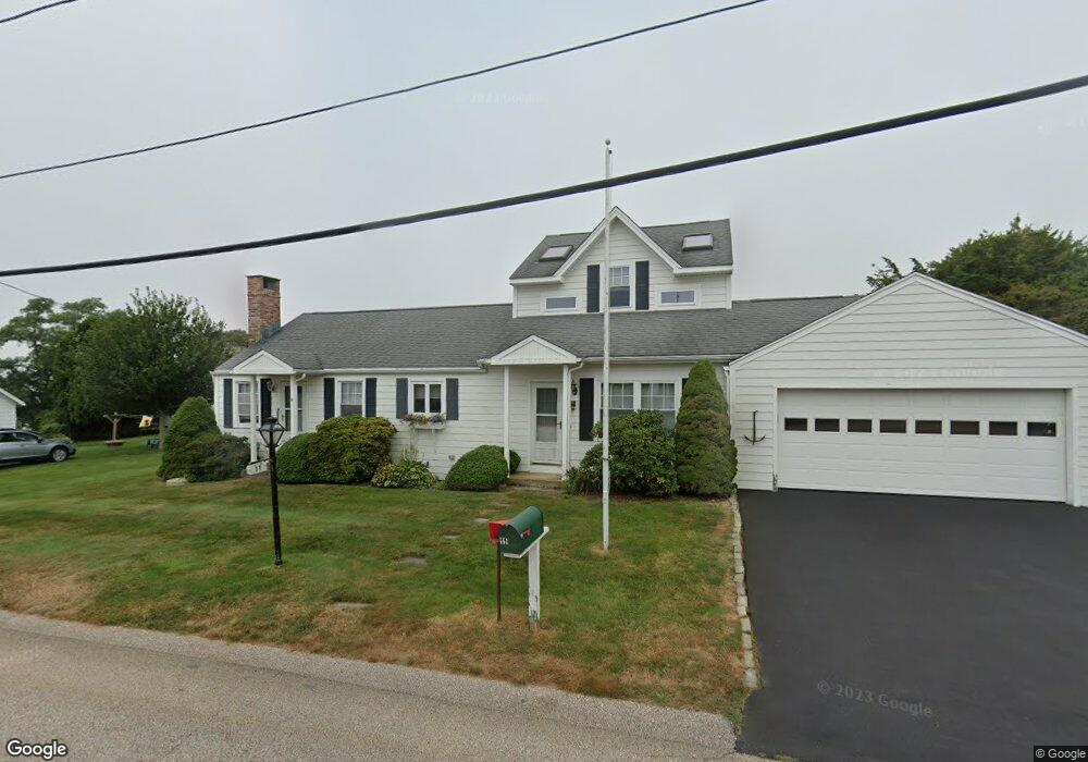
11 Meadow Rd Narragansett, RI 02882
Estimated Value: $907,000 - $1,137,000
2
Beds
3
Baths
1,699
Sq Ft
$577/Sq Ft
Est. Value
About This Home
This home is located at 11 Meadow Rd, Narragansett, RI 02882 and is currently estimated at $980,245, approximately $576 per square foot. 11 Meadow Rd is a home located in Washington County with nearby schools including Narragansett Elementary School, Narragansett Pier Middle School, and Narragansett High School.
Ownership History
Date
Name
Owned For
Owner Type
Purchase Details
Closed on
Nov 27, 2019
Sold by
Brearley Rt
Bought by
Brearley Rt
Current Estimated Value
Purchase Details
Closed on
Dec 1, 2011
Sold by
Brearley Patricia A and Brearley Richard D
Bought by
Brearley Ret
Home Financials for this Owner
Home Financials are based on the most recent Mortgage that was taken out on this home.
Original Mortgage
$200,000
Interest Rate
3.98%
Create a Home Valuation Report for This Property
The Home Valuation Report is an in-depth analysis detailing your home's value as well as a comparison with similar homes in the area
Home Values in the Area
Average Home Value in this Area
Purchase History
| Date | Buyer | Sale Price | Title Company |
|---|---|---|---|
| Brearley Rt | -- | -- | |
| Brearley Ret | -- | -- |
Source: Public Records
Mortgage History
| Date | Status | Borrower | Loan Amount |
|---|---|---|---|
| Previous Owner | Brearley Ret | $200,000 |
Source: Public Records
Tax History Compared to Growth
Tax History
| Year | Tax Paid | Tax Assessment Tax Assessment Total Assessment is a certain percentage of the fair market value that is determined by local assessors to be the total taxable value of land and additions on the property. | Land | Improvement |
|---|---|---|---|---|
| 2025 | $5,810 | $855,600 | $428,200 | $427,400 |
| 2024 | $5,604 | $855,600 | $428,200 | $427,400 |
| 2023 | $5,240 | $562,800 | $267,600 | $295,200 |
| 2022 | $5,065 | $562,800 | $267,600 | $295,200 |
| 2021 | $4,986 | $562,800 | $267,600 | $295,200 |
| 2020 | $5,074 | $484,200 | $212,800 | $271,400 |
| 2019 | $4,953 | $484,200 | $212,800 | $271,400 |
| 2018 | $4,818 | $484,200 | $212,800 | $271,400 |
| 2017 | $4,154 | $393,400 | $207,000 | $186,400 |
| 2016 | $3,965 | $393,400 | $207,000 | $186,400 |
| 2015 | $3,910 | $393,400 | $207,000 | $186,400 |
| 2014 | $4,026 | $401,000 | $224,200 | $176,800 |
Source: Public Records
Map
Nearby Homes
- 45 Durkin Dr
- 17 Goose Island Rd
- 18 Greenbrier Rd
- 25 Scallop Shell Rd
- 2 Bristol Rd
- 0 Point Judith Rd
- 0 Houston Ave
- 124 Houston Ave
- 580 Point Judith Rd
- 62 Daytona Ave
- 60 Daytona Ave
- 8 Pocono Rd
- 576 Point Judith Rd
- 815 Ocean Rd
- 813 Ocean Rd
- 811 Ocean Rd
- 0 Hemlock Ave
- 1125 Point Judith Rd Unit D4
- 89 Sand Hill Cove Rd
- 271 Great Island Rd