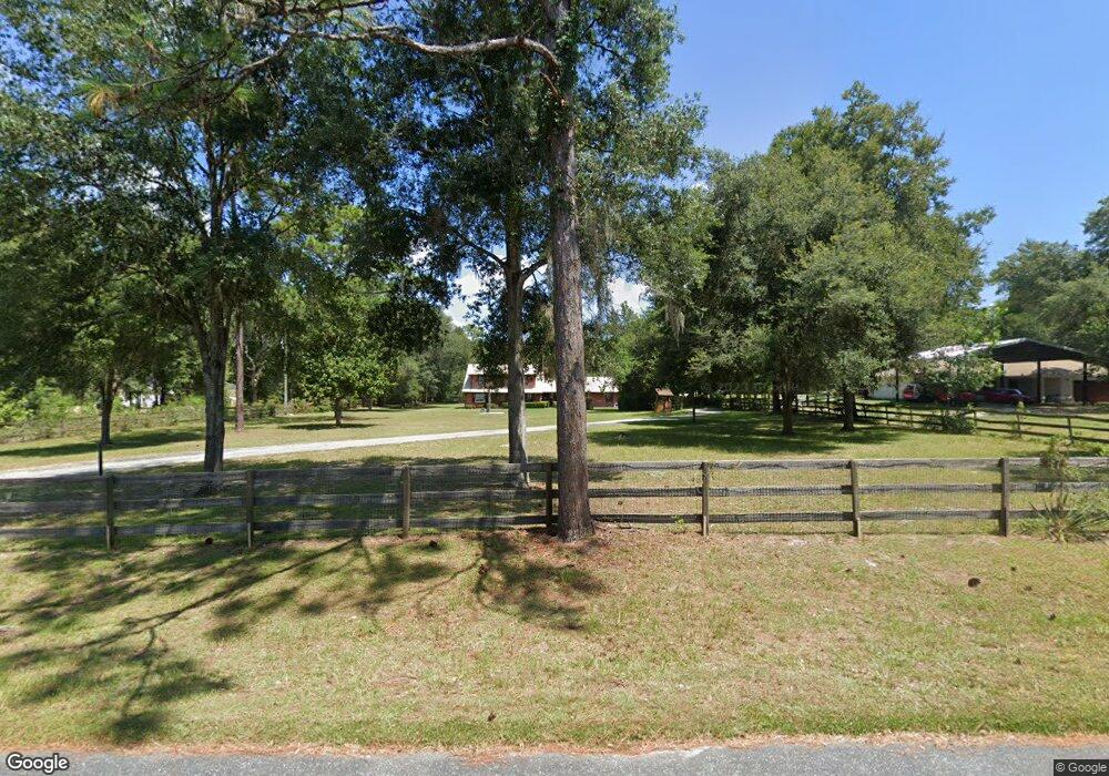
11 Middleground Rd Ocala, FL 34482
Fellowship NeighborhoodEstimated Value: $393,000 - $624,000
4
Beds
2
Baths
1,324
Sq Ft
$381/Sq Ft
Est. Value
About This Home
This home is located at 11 Middleground Rd, Ocala, FL 34482 and is currently estimated at $504,916, approximately $381 per square foot. 11 Middleground Rd is a home located in Marion County with nearby schools including Romeo Elementary School, Dunnellon Middle School, and West Port High School.
Ownership History
Date
Name
Owned For
Owner Type
Purchase Details
Closed on
Mar 6, 2024
Sold by
Lindsey Richard P and Lindsey Beate B
Bought by
Lindsey Richard P and Lindsey Richard P
Current Estimated Value
Purchase Details
Closed on
Aug 13, 2002
Sold by
Wright Joseph A and Wright Karen B
Bought by
Lindsey Richard P and Lindsey Beate B
Home Financials for this Owner
Home Financials are based on the most recent Mortgage that was taken out on this home.
Original Mortgage
$231,750
Interest Rate
6.52%
Mortgage Type
VA
Create a Home Valuation Report for This Property
The Home Valuation Report is an in-depth analysis detailing your home's value as well as a comparison with similar homes in the area
Home Values in the Area
Average Home Value in this Area
Purchase History
| Date | Buyer | Sale Price | Title Company |
|---|---|---|---|
| Lindsey Richard P | $100 | None Listed On Document | |
| Lindsey Richard P | $100 | None Listed On Document | |
| Lindsey Richard P | $225,000 | Ocala Land Title Ins Agency |
Source: Public Records
Mortgage History
| Date | Status | Borrower | Loan Amount |
|---|---|---|---|
| Previous Owner | Lindsey Richard P | $231,750 |
Source: Public Records
Tax History
| Year | Tax Paid | Tax Assessment Tax Assessment Total Assessment is a certain percentage of the fair market value that is determined by local assessors to be the total taxable value of land and additions on the property. | Land | Improvement |
|---|---|---|---|---|
| 2025 | $2,534 | $170,589 | -- | -- |
| 2024 | $2,288 | $165,781 | -- | -- |
| 2023 | $2,512 | $160,952 | $0 | $0 |
| 2022 | $2,752 | $156,264 | $0 | $0 |
| 2021 | $2,746 | $151,713 | $0 | $0 |
| 2020 | $2,727 | $149,618 | $0 | $0 |
| 2019 | $2,693 | $146,254 | $0 | $0 |
| 2018 | $2,578 | $143,527 | $0 | $0 |
| 2017 | $2,541 | $140,575 | $0 | $0 |
| 2016 | $2,500 | $137,684 | $0 | $0 |
| 2015 | $2,512 | $136,727 | $0 | $0 |
| 2014 | $2,399 | $135,642 | $0 | $0 |
Source: Public Records
Map
Nearby Homes
- 15 Middleground Rd
- 9 Middleground Rd
- 35 Lake Wood Cir
- 3 Carry Back Rd
- 7 Needles Dr
- TBD NW 127 Ct
- 33 Lake Wood Cir
- TBD NW
- 25 Lake Wood Cir
- 16 Meadow Wood Dr
- 1370 NW 120th Ave
- 12740 NW 35th St
- 0 NW 15th St Unit MFROM710218
- 1391 NW 120th Ave
- Lot 19 NW 119th Ct
- TBD NW 120th Ave
- 12051 NW 7th Place
- Lot 11 NW 16th Place
- 11860 NW 21 St
- 0 NW 3rd St Unit MFRTB8475408
- 13 Middleground Rd
- 10 Middleground Rd
- 12 Middleground Rd
- 8 Middleground Rd
- 0 Middleground Rd
- 17 Middleground Rd
- 1 Never Bend Dr
- 14 Middleground Rd
- 5 Never Bend Dr
- 9 Never Bend Dr
- 6 Never Bend Dr
- 0 Never Bend Dr Unit OM526699
- 0 Never Bend Dr Unit OM392773
- 0 Never Bend Dr Unit OM325264
- 0 Never Bend Dr Unit OM306525
- 0 Never Bend Dr
- 1380 NW 127th Ct
- 13 Never Bend Dr
- 17 Never Bend Dr
- 6 Middleground Rd
