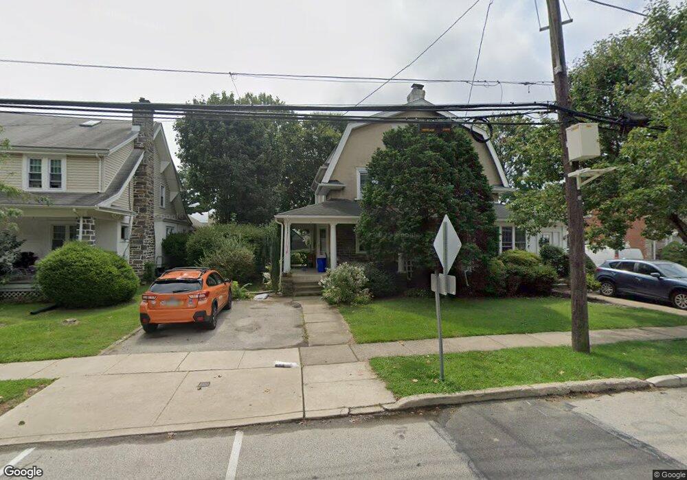
11 Mill Rd Havertown, PA 19083
Estimated Value: $426,000 - $501,000
4
Beds
2
Baths
1,319
Sq Ft
$348/Sq Ft
Est. Value
About This Home
This home is located at 11 Mill Rd, Havertown, PA 19083 and is currently estimated at $459,483, approximately $348 per square foot. 11 Mill Rd is a home located in Delaware County with nearby schools including Chatham Park Elementary School, Haverford Middle School, and Haverford Senior High School.
Ownership History
Date
Name
Owned For
Owner Type
Purchase Details
Closed on
Nov 27, 2002
Sold by
Mchugh Brendan and Ali Mchugh Karen
Bought by
Kaufhold Matthew and Bartels Stacy
Current Estimated Value
Home Financials for this Owner
Home Financials are based on the most recent Mortgage that was taken out on this home.
Original Mortgage
$162,450
Outstanding Balance
$70,281
Interest Rate
6.34%
Mortgage Type
Purchase Money Mortgage
Estimated Equity
$389,202
Purchase Details
Closed on
Aug 7, 2000
Sold by
Crosby John C and Crosby Courtney Preston
Bought by
Mchugh Brendan and Ali Mchugh Karen
Home Financials for this Owner
Home Financials are based on the most recent Mortgage that was taken out on this home.
Original Mortgage
$141,550
Interest Rate
8.21%
Create a Home Valuation Report for This Property
The Home Valuation Report is an in-depth analysis detailing your home's value as well as a comparison with similar homes in the area
Home Values in the Area
Average Home Value in this Area
Purchase History
| Date | Buyer | Sale Price | Title Company |
|---|---|---|---|
| Kaufhold Matthew | $171,000 | Commonwealth Land Title Ins | |
| Mchugh Brendan | $149,000 | -- |
Source: Public Records
Mortgage History
| Date | Status | Borrower | Loan Amount |
|---|---|---|---|
| Open | Kaufhold Matthew | $162,450 | |
| Previous Owner | Mchugh Brendan | $141,550 |
Source: Public Records
Tax History Compared to Growth
Tax History
| Year | Tax Paid | Tax Assessment Tax Assessment Total Assessment is a certain percentage of the fair market value that is determined by local assessors to be the total taxable value of land and additions on the property. | Land | Improvement |
|---|---|---|---|---|
| 2025 | $6,105 | $237,440 | $96,500 | $140,940 |
| 2024 | $6,105 | $237,440 | $96,500 | $140,940 |
| 2023 | $5,932 | $237,440 | $96,500 | $140,940 |
| 2022 | $5,793 | $237,440 | $96,500 | $140,940 |
| 2021 | $9,438 | $237,440 | $96,500 | $140,940 |
| 2020 | $5,572 | $119,890 | $48,860 | $71,030 |
| 2019 | $5,470 | $119,890 | $48,860 | $71,030 |
| 2018 | $5,376 | $119,890 | $0 | $0 |
| 2017 | $5,262 | $119,890 | $0 | $0 |
| 2016 | $658 | $119,890 | $0 | $0 |
| 2015 | $658 | $119,890 | $0 | $0 |
| 2014 | $658 | $119,890 | $0 | $0 |
Source: Public Records
Map
Nearby Homes
- 16 Chelten Rd
- 100 Brookline Blvd
- 1216 Darby Rd
- 100 Yale Rd
- 5 W Turnbull Ave
- 2 D E Manoa St
- 26 E Turnbull Ave
- 204 E Manoa Rd
- 15 Rodman Ave
- 210 Farnham Rd
- 504 N Manoa Rd
- 168 Upland Rd
- 139 Campbell Ave
- 231 Hastings Ave
- 128 Campbell Ave
- 52 Woodbine Rd
- 1901 Pennview Ave
- 11 Woodbine Rd
- 103 Shelbourne Rd
- 524 Sagamore Rd