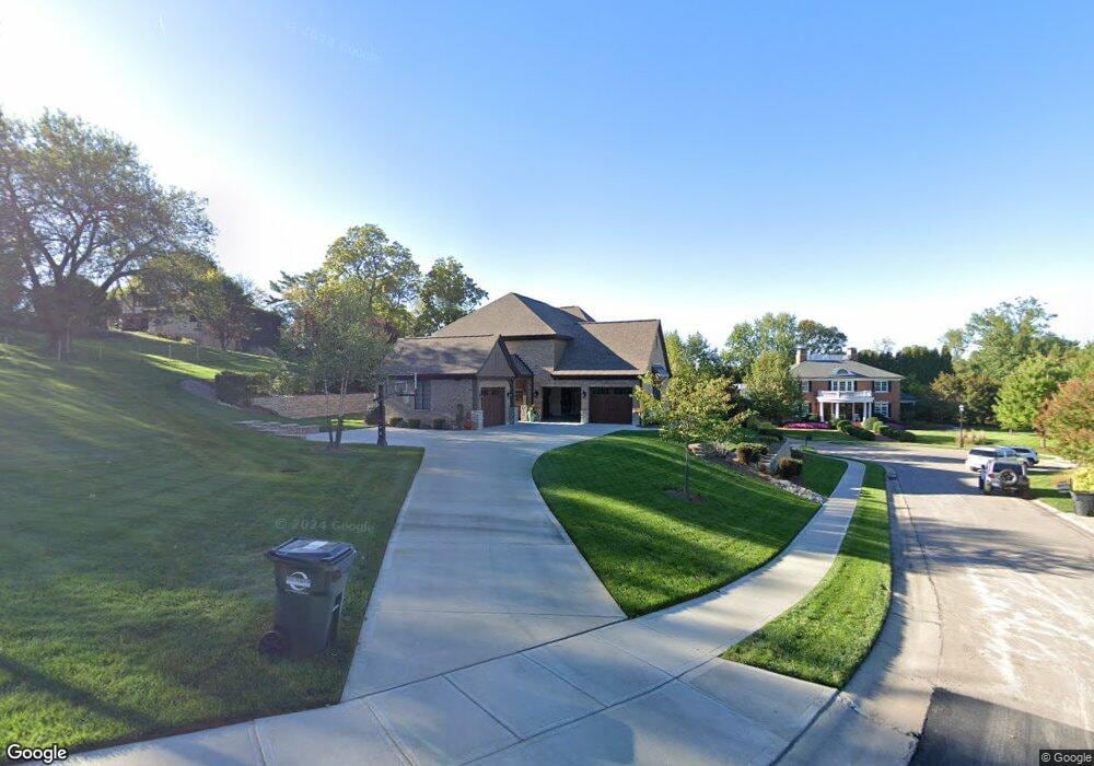
11 Mitchell Hill Fort Thomas, KY 41075
Estimated Value: $432,000 - $1,342,709
Studio
--
Bath
3,600
Sq Ft
$272/Sq Ft
Est. Value
About This Home
This home is located at 11 Mitchell Hill, Fort Thomas, KY 41075 and is currently estimated at $979,570, approximately $272 per square foot. 11 Mitchell Hill is a home located in Campbell County with nearby schools including Highlands Middle School, Highlands High School, and St. Catherine of Siena School.
Ownership History
Date
Name
Owned For
Owner Type
Purchase Details
Closed on
May 28, 2021
Sold by
Wirtz Michael R and Wirtz Christina M
Bought by
Wirtz Christina M and The Christina M Wirtz Trust
Current Estimated Value
Purchase Details
Closed on
Jul 3, 2018
Sold by
Wirtz Michael Richard and Wirtz Christina M
Bought by
Wirtz Michael R and Wirtz Christina M
Purchase Details
Closed on
Sep 11, 2015
Sold by
Schofield Nancy and The Nancy Schofield Revocable
Bought by
Wirtz Michael Richard
Purchase Details
Closed on
Jan 15, 2010
Sold by
Fort Thomas Partners Iii Llc
Bought by
Schofield Nancy and The Nancy Schofield Revocable
Purchase Details
Closed on
Jul 23, 2008
Sold by
Tracy Andrew V and Tracy Kristin D
Bought by
Fort Thomas Partners Iii Llc
Purchase Details
Closed on
Jul 31, 2007
Sold by
Hall Michele L and Riggs George
Bought by
Fort Thomas Partners Iii Llc
Create a Home Valuation Report for This Property
The Home Valuation Report is an in-depth analysis detailing your home's value as well as a comparison with similar homes in the area
Home Values in the Area
Average Home Value in this Area
Purchase History
| Date | Buyer | Sale Price | Title Company |
|---|---|---|---|
| Wirtz Christina M | -- | None Available | |
| Wirtz Michael R | -- | None Available | |
| Wirtz Michael Richard | $200,000 | None Available | |
| Schofield Nancy | $200,000 | None Available | |
| Fort Thomas Partners Iii Llc | $250,000 | None Available | |
| Fort Thomas Partners Iii Llc | $580,000 | Homestead Title Agency Ltd |
Source: Public Records
Tax History
| Year | Tax Paid | Tax Assessment Tax Assessment Total Assessment is a certain percentage of the fair market value that is determined by local assessors to be the total taxable value of land and additions on the property. | Land | Improvement |
|---|---|---|---|---|
| 2025 | $3,542 | $920,000 | $184,000 | $736,000 |
| 2024 | $3,542 | $920,000 | $184,000 | $736,000 |
| 2023 | $3,634 | $920,000 | $184,000 | $736,000 |
| 2022 | $3,721 | $920,000 | $184,000 | $736,000 |
| 2021 | $3,441 | $825,000 | $200,000 | $625,000 |
| 2020 | $3,510 | $825,000 | $200,000 | $625,000 |
| 2019 | $3,541 | $825,000 | $200,000 | $625,000 |
| 2018 | $3,488 | $825,000 | $200,000 | $625,000 |
| 2017 | $2,895 | $678,700 | $200,000 | $478,700 |
| 2016 | $823 | $200,000 | $0 | $0 |
| 2015 | $838 | $200,000 | $0 | $0 |
| 2014 | $820 | $200,000 | $0 | $0 |
Source: Public Records
Map
Nearby Homes
- 42 E Kimberly Dr
- 57 E Kimberly Dr
- 319 Rossford Ave
- 315 Rossford Ave
- 811 Rossford Run
- 814 Rossford Run
- 17 Harrison Ave
- 718 Belle Ridge Loop Unit 14
- 714 Belle Ridge Loop Unit 13
- 38 Walker Rd
- 706 Belle Ridge Loop Unit 11
- 23 Beechwood Place
- 31 Broadview Place
- 861 Belle Ridge Loop
- 868 Belle Ridge Loop
- 872 Belle Ridge Loop
- 880 Belle Ridge Loop
- 1859 Riverpointe Ct Unit 5
- 625 S O Fallon Ave
- 1428 Waterworks Rd
- 10 Mitchell Hill
- 88 Gunpowder Ridge
- 445 Rossford Ave
- 15 Mitchell Hill
- 14 Mitchell Hill
- 38 E Kimberly Dr
- 34 E Kimberly Dr
- 18 Mitchell Hill
- 28 E Kimberly Dr
- 90 Gunpowder Ridge
- 46 E Kimberly Dr
- 22 E Kimberly Dr
- 82 Gunpowder Ridge
- 76 Gunpowder Ridge
- 50 E Kimberly Dr
- 16 E Kimberly Dr
- 54 E Kimberly Dr
- 70 Gunpowder Ridge
- 12 E Kimberly Dr
- 87 Gunpowder Ridge
Your Personal Tour Guide
Ask me questions while you tour the home.