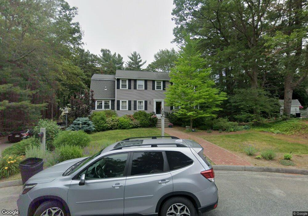
11 Mohawk Cir East Walpole, MA 02032
Estimated Value: $836,755 - $975,000
4
Beds
3
Baths
2,215
Sq Ft
$410/Sq Ft
Est. Value
About This Home
This home is located at 11 Mohawk Cir, East Walpole, MA 02032 and is currently estimated at $907,939, approximately $409 per square foot. 11 Mohawk Cir is a home located in Norfolk County with nearby schools including Old Post Road School, Walpole Middle School, and Walpole High School.
Create a Home Valuation Report for This Property
The Home Valuation Report is an in-depth analysis detailing your home's value as well as a comparison with similar homes in the area
Home Values in the Area
Average Home Value in this Area
Tax History Compared to Growth
Tax History
| Year | Tax Paid | Tax Assessment Tax Assessment Total Assessment is a certain percentage of the fair market value that is determined by local assessors to be the total taxable value of land and additions on the property. | Land | Improvement |
|---|---|---|---|---|
| 2025 | $8,872 | $691,500 | $354,900 | $336,600 |
| 2024 | $8,613 | $651,500 | $341,200 | $310,300 |
| 2023 | $8,202 | $590,500 | $296,700 | $293,800 |
| 2022 | $7,716 | $533,600 | $274,800 | $258,800 |
| 2021 | $7,567 | $509,900 | $259,200 | $250,700 |
| 2020 | $7,342 | $489,800 | $244,500 | $245,300 |
| 2019 | $7,076 | $468,600 | $235,100 | $233,500 |
| 2018 | $6,827 | $447,100 | $226,800 | $220,300 |
| 2017 | $6,629 | $432,400 | $218,100 | $214,300 |
| 2016 | $6,454 | $414,800 | $210,200 | $204,600 |
| 2015 | $6,395 | $407,300 | $208,600 | $198,700 |
| 2014 | $6,145 | $389,900 | $208,600 | $181,300 |
Source: Public Records
Map
Nearby Homes
- 270 Moosehill Rd
- 1 Palace Ct
- 486 Washington St
- 2 Alexandra Way
- 363 - 367 Washington St
- 11 Park Ln
- 52 Baker St
- Unit 11 Powder House Ln Unit 11
- 8 Powder House Ln Unit 2
- Unit 12 Powder House Ln Unit 12
- Unit 3 Powder House Ln Unit 3
- 7 Washington Green
- 8 Rainbow Pond Dr Unit 8
- 256 Norwood St
- 4403 Pennington Dr Unit 4403
- 2213 Pennington Dr Unit 2213
- 93 Brewster Dr
- 0 Charlotte Rd
- 635 Old Post Rd Unit 303
- 635 Old Post Rd Unit 302