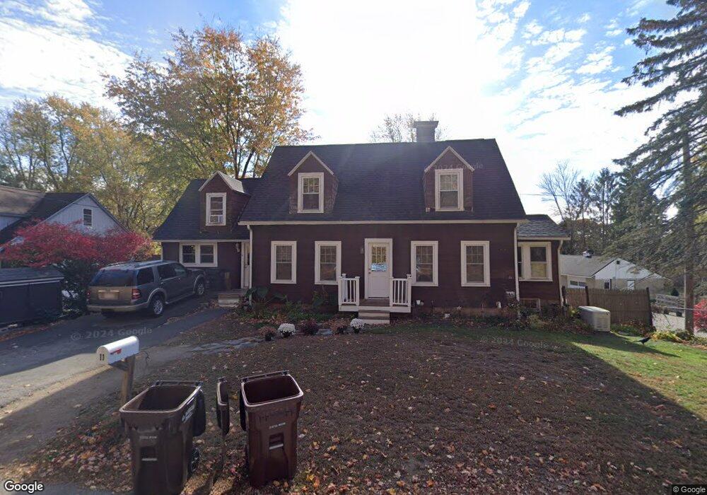
11 Monroe St Amesbury, MA 01913
Estimated Value: $588,000 - $656,000
3
Beds
2
Baths
1,660
Sq Ft
$373/Sq Ft
Est. Value
About This Home
This home is located at 11 Monroe St, Amesbury, MA 01913 and is currently estimated at $619,511, approximately $373 per square foot. 11 Monroe St is a home located in Essex County with nearby schools including Amesbury High School and Amesbury Seventh-Day Adventist School.
Ownership History
Date
Name
Owned For
Owner Type
Purchase Details
Closed on
Aug 31, 1988
Sold by
Graham Ward P
Bought by
Mccassie Paul G
Current Estimated Value
Create a Home Valuation Report for This Property
The Home Valuation Report is an in-depth analysis detailing your home's value as well as a comparison with similar homes in the area
Home Values in the Area
Average Home Value in this Area
Purchase History
| Date | Buyer | Sale Price | Title Company |
|---|---|---|---|
| Mccassie Paul G | $136,000 | -- |
Source: Public Records
Mortgage History
| Date | Status | Borrower | Loan Amount |
|---|---|---|---|
| Open | Mccassie Paul G | $158,000 | |
| Closed | Mccassie Paul G | $175,000 | |
| Closed | Mccassie Paul G | $175,000 | |
| Closed | Mccassie Paul G | $135,000 |
Source: Public Records
Tax History
| Year | Tax Paid | Tax Assessment Tax Assessment Total Assessment is a certain percentage of the fair market value that is determined by local assessors to be the total taxable value of land and additions on the property. | Land | Improvement |
|---|---|---|---|---|
| 2025 | $7,535 | $492,500 | $218,800 | $273,700 |
| 2024 | $7,509 | $480,100 | $206,400 | $273,700 |
| 2023 | $6,709 | $410,600 | $179,400 | $231,200 |
| 2022 | $6,154 | $347,900 | $156,000 | $191,900 |
| 2021 | $5,689 | $311,700 | $120,500 | $191,200 |
| 2020 | $5,168 | $300,800 | $115,900 | $184,900 |
| 2019 | $5,191 | $282,600 | $115,900 | $166,700 |
| 2018 | $5,215 | $274,600 | $110,400 | $164,200 |
| 2017 | $5,055 | $253,400 | $110,400 | $143,000 |
| 2016 | $4,926 | $242,900 | $110,400 | $132,500 |
| 2015 | $4,907 | $238,900 | $110,400 | $128,500 |
| 2014 | $4,565 | $217,700 | $110,400 | $107,300 |
Source: Public Records
Map
Nearby Homes
- 21 River St
- 97 Elm St
- 82 Monroe St
- 4 Clark St
- 25 Cedar St Unit 4
- 3 Birchwood Point Unit 202
- 382 Main St
- 4 Greenwood St
- 7 Birchwood Pointe Unit 101
- 253 Main St
- 101 Market St Unit B
- 105 Market St Unit B
- 37 Powow St
- 53 Rabbit Rd
- 149 Market St
- 3 Tremont Ave Unit A
- 1 Hillside Ave Unit 3
- 48 Orchard St
- 60 Merrimac St Unit 504
- 191 Elm St
Your Personal Tour Guide
Ask me questions while you tour the home.