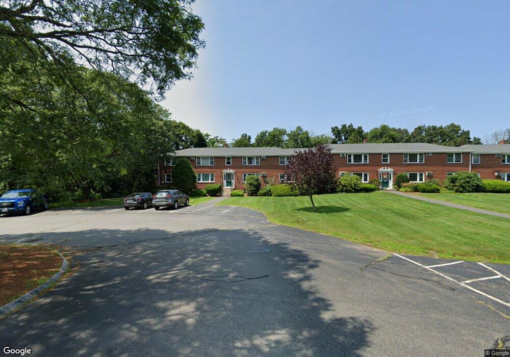
11 Myles Standish Dr Unit 12 11 Haverhill, MA 01835
Central Bradford NeighborhoodEstimated Value: $270,000 - $291,417
2
Beds
1
Bath
730
Sq Ft
$382/Sq Ft
Est. Value
About This Home
This home is located at 11 Myles Standish Dr Unit 12 11, Haverhill, MA 01835 and is currently estimated at $278,854, approximately $381 per square foot. 11 Myles Standish Dr Unit 12 11 is a home located in Essex County with nearby schools including Greenleaf Academy, Bradford Elementary School, and Haverhill High School.
Ownership History
Date
Name
Owned For
Owner Type
Purchase Details
Closed on
Dec 22, 2023
Sold by
Hosford-Walsh Lisabeth A and Walsh Martin
Bought by
Hosford-Walsh Lisabeth A and Walsh Martin
Current Estimated Value
Purchase Details
Closed on
Aug 10, 2018
Sold by
Parker Jill
Bought by
Life Rt and Parker
Purchase Details
Closed on
Sep 9, 2004
Sold by
Romei Rt and Buhler
Bought by
Bradford Andover Llc
Purchase Details
Closed on
Jun 2, 1992
Sold by
Sullivan Thomas H
Bought by
Michaud Margaret L
Create a Home Valuation Report for This Property
The Home Valuation Report is an in-depth analysis detailing your home's value as well as a comparison with similar homes in the area
Home Values in the Area
Average Home Value in this Area
Purchase History
| Date | Buyer | Sale Price | Title Company |
|---|---|---|---|
| Hosford-Walsh Lisabeth A | -- | None Available | |
| Life Rt | -- | -- | |
| Bradford Andover Llc | -- | -- | |
| Michaud Margaret L | $45,000 | -- |
Source: Public Records
Tax History Compared to Growth
Tax History
| Year | Tax Paid | Tax Assessment Tax Assessment Total Assessment is a certain percentage of the fair market value that is determined by local assessors to be the total taxable value of land and additions on the property. | Land | Improvement |
|---|---|---|---|---|
| 2025 | $2,663 | $248,600 | $0 | $248,600 |
| 2024 | $2,389 | $224,500 | $0 | $224,500 |
| 2023 | $2,305 | $206,700 | $0 | $206,700 |
| 2022 | $2,174 | $170,900 | $0 | $170,900 |
| 2021 | $2,013 | $149,800 | $0 | $149,800 |
| 2020 | $1,968 | $144,700 | $0 | $144,700 |
| 2019 | $1,942 | $139,200 | $0 | $139,200 |
| 2018 | $1,871 | $127,600 | $0 | $127,600 |
| 2017 | $1,854 | $123,700 | $0 | $123,700 |
| 2016 | $1,321 | $86,000 | $0 | $86,000 |
| 2015 | $1,254 | $81,700 | $0 | $81,700 |
Source: Public Records
Map
Nearby Homes
- 552 S Main St Unit 2
- 812 S Main St
- 496 S Main St
- 36 S Spring St
- 23 Lincolnshire Dr
- 402 River St Unit 3E
- 11 Villa St Unit 106
- 80/88 River St
- 219-221 Wilson St Unit 1
- 340 Kingsbury Ave
- 552 Washington St
- 45 Lincolnshire Dr
- 39 Ayer St
- 15 Hyatt Ave
- 15 Blossom St
- 585 Washington St
- 308 Willow Ave
- 40 Haseltine St
- 455 Washington St
- 2 Marion St
- 11 Myles Standish Dr Unit 9
- 11 Myles Standish Dr Unit 12A
- 11 Myles Standish Dr Unit 12
- 11 Myles Standish Dr
- 11 Myles Standish Dr Unit 11
- 9 Myles Standish Dr Unit 8
- 9 Myles Standish Dr Unit 7
- 9 Myles Standish Dr Unit 6
- 9 Myles Standish Dr Unit 7 9
- 7 Myles Standish Dr Unit 4
- 7 Myles Standish Dr Unit 3
- 7 Myles Standish Dr Unit 2
- 7 Myles Standish Dr Unit 1
- 7 Myles Standish Dr Unit 2 7
- 2 Myles Standish Dr Unit 4
- 2 Myles Standish Dr Unit 3
- 2 Myles Standish Dr
- 2 Myles Standish Dr Unit 1
- 2 Myles Standish Dr Unit 2
- 2 Myles Standish Dr Unit 4 2