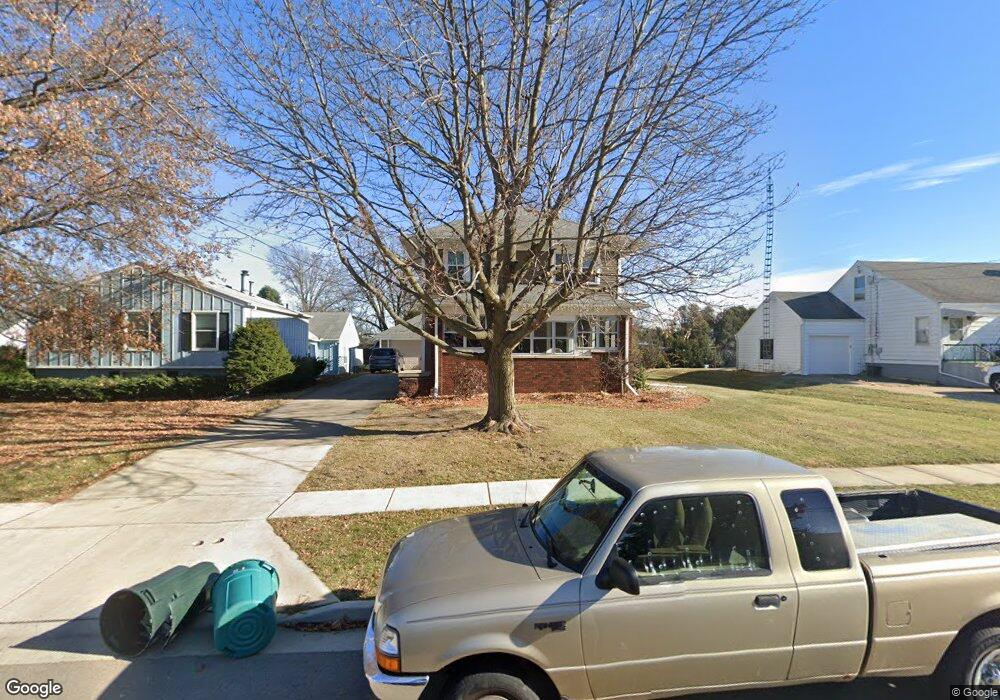
11 N Euclid Ave Princeton, IL 61356
Estimated Value: $161,870 - $283,000
3
Beds
2
Baths
1,802
Sq Ft
$110/Sq Ft
Est. Value
About This Home
This home is located at 11 N Euclid Ave, Princeton, IL 61356 and is currently estimated at $197,718, approximately $109 per square foot. 11 N Euclid Ave is a home located in Bureau County with nearby schools including Lincoln Elementary School, Jefferson Elementary School, and Logan Junior High School.
Ownership History
Date
Name
Owned For
Owner Type
Purchase Details
Closed on
Jun 14, 2013
Sold by
H & K Enterprises Ii Inc
Bought by
Odell Curtis A and Odell Jessica L
Current Estimated Value
Home Financials for this Owner
Home Financials are based on the most recent Mortgage that was taken out on this home.
Original Mortgage
$92,000
Outstanding Balance
$66,908
Interest Rate
4%
Mortgage Type
New Conventional
Estimated Equity
$130,810
Purchase Details
Closed on
Oct 2, 2009
Sold by
Piper Rex M and Piper Deborah K
Bought by
H & K Enterprises Ii Llc
Home Financials for this Owner
Home Financials are based on the most recent Mortgage that was taken out on this home.
Original Mortgage
$96,000
Interest Rate
5.15%
Mortgage Type
Future Advance Clause Open End Mortgage
Create a Home Valuation Report for This Property
The Home Valuation Report is an in-depth analysis detailing your home's value as well as a comparison with similar homes in the area
Home Values in the Area
Average Home Value in this Area
Purchase History
| Date | Buyer | Sale Price | Title Company |
|---|---|---|---|
| Odell Curtis A | $115,000 | None Available | |
| H & K Enterprises Ii Llc | $115,000 | None Available |
Source: Public Records
Mortgage History
| Date | Status | Borrower | Loan Amount |
|---|---|---|---|
| Open | Odell Curtis A | $92,000 | |
| Previous Owner | H & K Enterprises Ii Llc | $96,000 |
Source: Public Records
Tax History Compared to Growth
Tax History
| Year | Tax Paid | Tax Assessment Tax Assessment Total Assessment is a certain percentage of the fair market value that is determined by local assessors to be the total taxable value of land and additions on the property. | Land | Improvement |
|---|---|---|---|---|
| 2024 | $3,085 | $45,707 | $6,614 | $39,093 |
| 2023 | $3,085 | $42,095 | $6,091 | $36,004 |
| 2022 | $2,884 | $39,467 | $5,711 | $33,756 |
| 2021 | $2,791 | $37,360 | $5,406 | $31,954 |
| 2020 | $2,685 | $35,992 | $5,208 | $30,784 |
| 2019 | $2,688 | $35,562 | $5,146 | $30,416 |
| 2018 | $2,629 | $34,954 | $5,058 | $29,896 |
| 2017 | $2,677 | $35,080 | $5,076 | $30,004 |
| 2016 | $2,597 | $34,165 | $4,944 | $29,221 |
| 2015 | -- | $28,710 | $0 | $28,710 |
| 2014 | -- | $33,568 | $4,858 | $28,710 |
| 2013 | -- | $33,750 | $4,884 | $28,866 |
Source: Public Records
Map
Nearby Homes
- 210 N Church St
- 20 S Church St
- 319 N Chestnut St
- 305 S Chestnut St
- 405 N Church St
- 443 E Peru St
- 32 S Dallas St
- 525 E Marion St
- 9 S Randolph St
- 725 Independence Dr
- 221 W Peru St
- 919 N Euclid Ave
- 311 W Franklin St
- 411 W Peru St
- 625 S 5th Avenue Dr
- 465 Prouty Dr
- 103 S Plum St
- 0 W Longhaven St Unit MRD12383107
- 702 W Hudson St
- 815 W Hudson St
- 29 N Euclid Ave
- 9 N Euclid Ave
- 105 N Euclid Ave
- 24 N Euclid Ave
- 16 N Euclid Ave
- 100 N Euclid Ave
- 000 N Euclid Ave
- 119 N Euclid Ave
- 424 Pombrook Dr
- 116 N Euclid Ave
- 323 E Central Ave
- 423 Pombrook Dr
- 436 Pombrook Dr
- 437 E Central Ave
- 122 N Euclid Ave
- 435 E Central Ave
- 435 Pombrook Dr
- 125 N Euclid Ave
- 23 N Chestnut St
- 6 S Euclid Ave