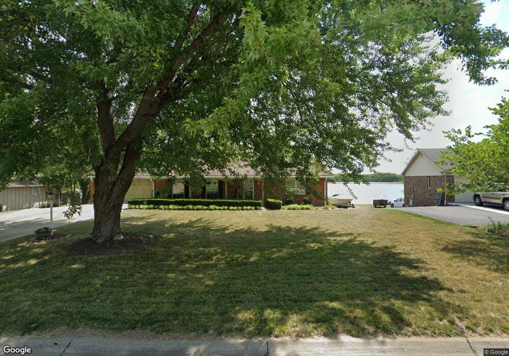
11 N Larand Dr Holts Summit, MO 65043
Estimated Value: $283,268 - $322,000
--
Bed
1
Bath
1,593
Sq Ft
$193/Sq Ft
Est. Value
About This Home
This home is located at 11 N Larand Dr, Holts Summit, MO 65043 and is currently estimated at $307,067, approximately $192 per square foot. 11 N Larand Dr is a home located in Callaway County with nearby schools including New Bloomfield Elementary School and New Bloomfield High School.
Ownership History
Date
Name
Owned For
Owner Type
Purchase Details
Closed on
May 1, 2023
Sold by
Dickrader Diana Y
Bought by
Tarrence Steven T and Tarrence Patricia S
Current Estimated Value
Home Financials for this Owner
Home Financials are based on the most recent Mortgage that was taken out on this home.
Original Mortgage
$190,000
Outstanding Balance
$184,916
Interest Rate
6.6%
Mortgage Type
Credit Line Revolving
Estimated Equity
$122,151
Purchase Details
Closed on
Sep 19, 2005
Sold by
Fuehlen Marjoria A
Bought by
Dickrader Diana Y and Dickrader Charles Richard
Create a Home Valuation Report for This Property
The Home Valuation Report is an in-depth analysis detailing your home's value as well as a comparison with similar homes in the area
Home Values in the Area
Average Home Value in this Area
Purchase History
| Date | Buyer | Sale Price | Title Company |
|---|---|---|---|
| Tarrence Steven T | -- | None Listed On Document | |
| Dickrader Diana Y | -- | -- |
Source: Public Records
Mortgage History
| Date | Status | Borrower | Loan Amount |
|---|---|---|---|
| Open | Tarrence Steven T | $190,000 |
Source: Public Records
Tax History Compared to Growth
Tax History
| Year | Tax Paid | Tax Assessment Tax Assessment Total Assessment is a certain percentage of the fair market value that is determined by local assessors to be the total taxable value of land and additions on the property. | Land | Improvement |
|---|---|---|---|---|
| 2024 | $1,813 | $30,683 | $0 | $0 |
| 2023 | $1,813 | $27,050 | $0 | $0 |
| 2022 | $1,595 | $27,050 | $3,420 | $23,630 |
| 2021 | $1,572 | $27,050 | $3,420 | $23,630 |
| 2020 | $1,574 | $27,050 | $3,420 | $23,630 |
| 2019 | $1,540 | $27,050 | $3,420 | $23,630 |
| 2018 | $1,545 | $27,050 | $3,420 | $23,630 |
| 2017 | $1,558 | $27,050 | $3,420 | $23,630 |
| 2016 | $1,320 | $21,010 | $0 | $0 |
| 2015 | $1,313 | $21,010 | $0 | $0 |
| 2014 | -- | $21,010 | $0 | $0 |
Source: Public Records
Map
Nearby Homes
- 133 Manview Ln
- 10431 County Road 497
- 10407 County Road 497
- 57 Kirk Dr
- 63 Kirk Dr
- 65 Kirk Dr
- 56 Kirk Dr
- 64 Kirk Dr
- 55 Kirk Dr
- 54 Kirk Dr
- 10879 Country Aire Meadows Ct
- 10884 Country Aire Meadows Ct
- 10890 Country Aire Meadows Ct
- 10896 Country Aire Meadows Ct
- 4 Eagle View Spur
- 2 Eagle View Spur
- LOT 7 Eagle View Spur
- LOT 8 Eagle Lake Ln
- LOT 6 Eagle View Spur
- LOT 4 Eagle View Spur