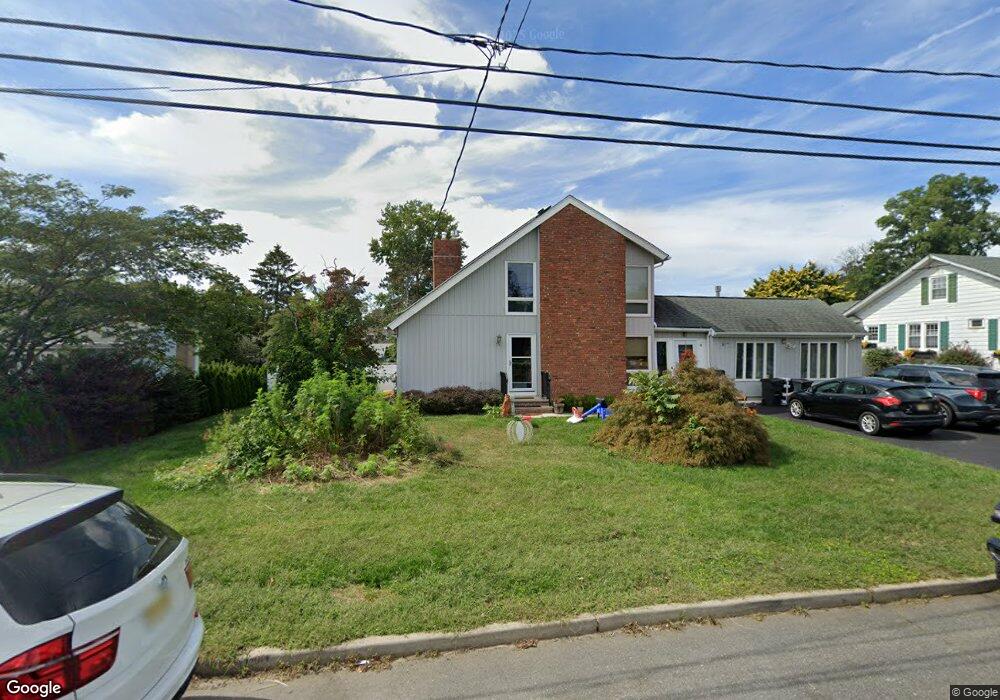
11 N Locust Ave West Long Branch, NJ 07764
Estimated Value: $925,000 - $1,024,000
5
Beds
3
Baths
2,894
Sq Ft
$337/Sq Ft
Est. Value
About This Home
This home is located at 11 N Locust Ave, West Long Branch, NJ 07764 and is currently estimated at $974,101, approximately $336 per square foot. 11 N Locust Ave is a home located in Monmouth County with nearby schools including Betty McElmon Elementary School, Frank Antonides School, and Shore Regional High School.
Ownership History
Date
Name
Owned For
Owner Type
Purchase Details
Closed on
Dec 12, 2014
Sold by
Kelly Edward P and Kelly Linda A
Bought by
Kelly Sean E and Kelly Brian T
Current Estimated Value
Create a Home Valuation Report for This Property
The Home Valuation Report is an in-depth analysis detailing your home's value as well as a comparison with similar homes in the area
Home Values in the Area
Average Home Value in this Area
Purchase History
| Date | Buyer | Sale Price | Title Company |
|---|---|---|---|
| Kelly Sean E | -- | Multiple |
Source: Public Records
Tax History Compared to Growth
Tax History
| Year | Tax Paid | Tax Assessment Tax Assessment Total Assessment is a certain percentage of the fair market value that is determined by local assessors to be the total taxable value of land and additions on the property. | Land | Improvement |
|---|---|---|---|---|
| 2025 | $10,973 | $949,200 | $491,900 | $457,300 |
| 2024 | $9,671 | $842,100 | $393,200 | $448,900 |
| 2023 | $9,671 | $692,300 | $278,200 | $414,100 |
| 2022 | $4,282 | $622,500 | $228,200 | $394,300 |
| 2021 | $4,282 | $498,200 | $183,800 | $314,400 |
| 2020 | $9,757 | $474,800 | $167,500 | $307,300 |
| 2019 | $9,315 | $455,700 | $150,200 | $305,500 |
| 2018 | $9,342 | $441,500 | $150,200 | $291,300 |
| 2017 | $9,425 | $425,300 | $142,800 | $282,500 |
| 2016 | $9,081 | $418,100 | $142,800 | $275,300 |
| 2015 | $9,857 | $453,200 | $167,200 | $286,000 |
| 2014 | $9,811 | $420,900 | $126,900 | $294,000 |
Source: Public Records
Map
Nearby Homes
- 15 N Locust Ave
- 7 N Locust Ave
- 1003 Broadway
- 17 N Locust Ave
- 19 N Locust Ave
- 12 N Locust Ave
- 10 Homestead Ave
- 16 N Locust Ave
- 997 Broadway
- 10 N Locust Ave
- 14 Homestead Ave
- 3 N Locust Ave
- 21 N Locust Ave
- 20 N Locust Ave
- 1007 Broadway
- 12 Homestead Ave
- 16 Homestead Ave
- 979 Broadway
- 26 Homestead Ave
- 23 N Locust Ave