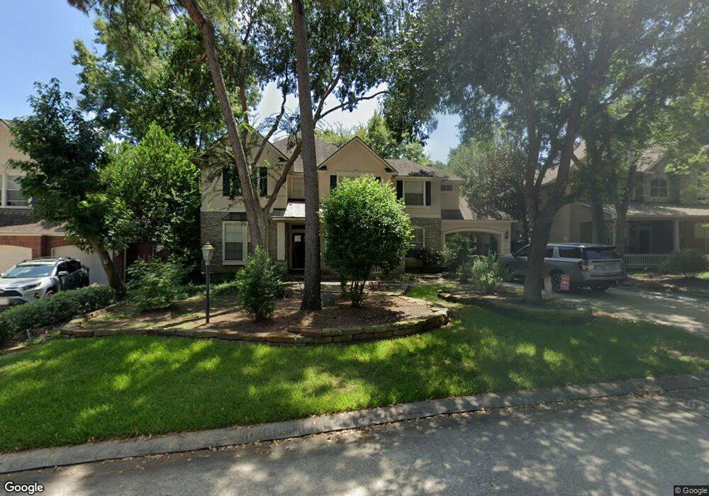
11 N Plum Crest Cir Spring, TX 77382
Alden Bridge NeighborhoodEstimated Value: $768,382 - $866,000
4
Beds
5
Baths
3,849
Sq Ft
$213/Sq Ft
Est. Value
About This Home
This home is located at 11 N Plum Crest Cir, Spring, TX 77382 and is currently estimated at $821,096, approximately $213 per square foot. 11 N Plum Crest Cir is a home located in Montgomery County with nearby schools including Buckalew Elementary School, Mitchell Intermediate School, and McCullough Junior High School.
Ownership History
Date
Name
Owned For
Owner Type
Purchase Details
Closed on
Aug 20, 2016
Sold by
Singh Mukesh and Singh Mildred
Bought by
Rodden Paul R and Rodden Mary C
Current Estimated Value
Home Financials for this Owner
Home Financials are based on the most recent Mortgage that was taken out on this home.
Original Mortgage
$335,825
Outstanding Balance
$266,994
Interest Rate
3.37%
Mortgage Type
FHA
Estimated Equity
$554,102
Purchase Details
Closed on
Jun 30, 1999
Sold by
Life Forms Inc
Bought by
Singh Mukesh and Singh Mildred
Home Financials for this Owner
Home Financials are based on the most recent Mortgage that was taken out on this home.
Original Mortgage
$193,418
Interest Rate
7.21%
Purchase Details
Closed on
Jan 28, 1999
Sold by
Woodlands Land Dev Lp
Bought by
Rodden Paul R and Rodden Mary C
Create a Home Valuation Report for This Property
The Home Valuation Report is an in-depth analysis detailing your home's value as well as a comparison with similar homes in the area
Home Values in the Area
Average Home Value in this Area
Purchase History
| Date | Buyer | Sale Price | Title Company |
|---|---|---|---|
| Rodden Paul R | -- | Great American Title | |
| Singh Mukesh | -- | American Title Company | |
| Rodden Paul R | -- | -- |
Source: Public Records
Mortgage History
| Date | Status | Borrower | Loan Amount |
|---|---|---|---|
| Open | Rodden Paul R | $335,825 | |
| Previous Owner | Singh Mukesh | $193,418 |
Source: Public Records
Tax History
| Year | Tax Paid | Tax Assessment Tax Assessment Total Assessment is a certain percentage of the fair market value that is determined by local assessors to be the total taxable value of land and additions on the property. | Land | Improvement |
|---|---|---|---|---|
| 2025 | $9,659 | $666,371 | $100,000 | $566,371 |
| 2024 | $8,756 | $627,451 | -- | -- |
| 2023 | $8,756 | $570,410 | $100,000 | $534,720 |
| 2022 | $10,510 | $518,550 | $100,000 | $456,410 |
| 2021 | $10,282 | $471,410 | $53,530 | $417,880 |
| 2020 | $10,839 | $468,560 | $53,530 | $415,030 |
| 2019 | $10,696 | $448,160 | $53,530 | $394,630 |
| 2018 | $8,921 | $414,180 | $53,530 | $360,650 |
| 2017 | $10,773 | $445,910 | $53,530 | $392,380 |
| 2016 | $10,028 | $415,080 | $53,530 | $361,550 |
| 2015 | $8,749 | $390,740 | $53,530 | $337,210 |
| 2014 | $8,749 | $367,820 | $53,530 | $314,290 |
Source: Public Records
Map
Nearby Homes
- 150 Goldenvine Ct
- 6 Glentrace Cir
- 195 W Sundance Cir
- 171 W Sundance Cir
- 23 Fortuneberry Place
- 6 Vinca Trail
- 82 N Apple Springs Cir
- 81 N Apple Springs Cir
- 62 N Goldenvine Cir
- 14 Mammoth Springs Ct
- 31 Bluff Creek Place
- 3 Belcarra Place
- 14 Broadweather Place
- 178 Brooksedge Ct
- 14 N Flickering Sun Cir
- 19 Clingstone Place
- 7 Moatwood Ct
- 130 S Millport Cir
- 35 Dewdrift Place
- 163 N Millport Cir
- 7 N Plum Crest Cir
- 15 N Plum Crest Cir
- 10 Sunspree Place
- 14 Sunspree Place
- 6 Sunspree Place
- 19 N Plum Crest Cir
- 3 N Plum Crest Cir
- 22 Sunspree Place
- 6 N Plum Crest Cir
- 14 N Plum Crest Cir
- 2 Sunspree Place
- 2 N Plum Crest Cir
- 26 Sunspree Place
- 18 N Plum Crest Cir
- 22 N Plum Crest Cir
- 30 Sunspree Place
- 11 Sunspree Place
- 27 N Plum Crest Cir
- 15 Sunspree Place
- 7 Sunspree Place
Your Personal Tour Guide
Ask me questions while you tour the home.