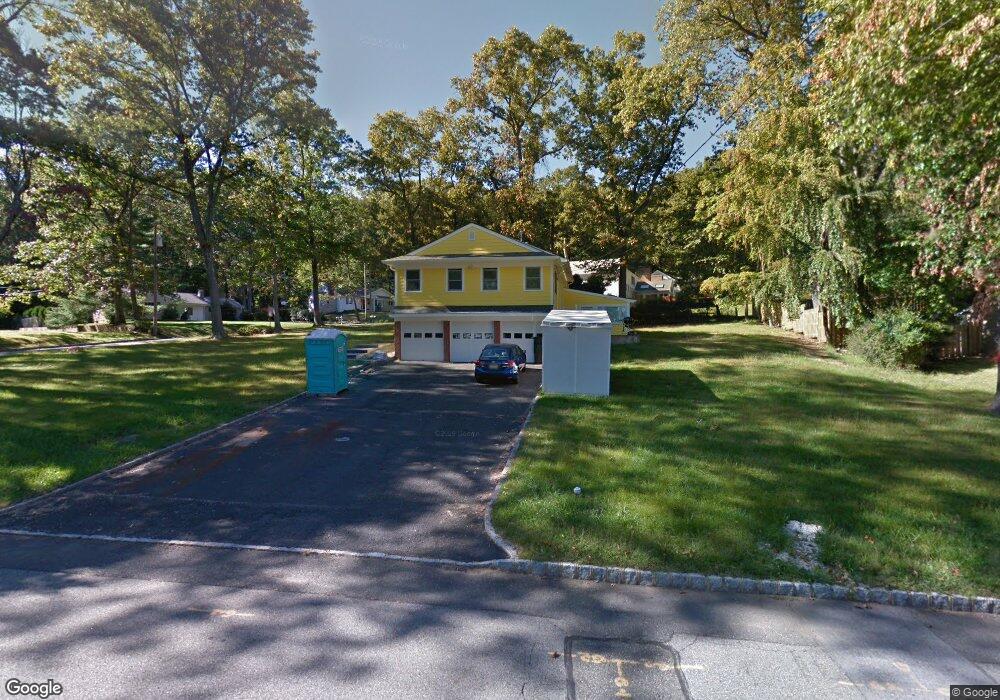
11 N Star Dr Morristown, NJ 07960
Estimated Value: $784,000 - $979,000
3
Beds
3
Baths
2,756
Sq Ft
$331/Sq Ft
Est. Value
About This Home
This home is located at 11 N Star Dr, Morristown, NJ 07960 and is currently estimated at $911,895, approximately $330 per square foot. 11 N Star Dr is a home located in Morris County with nearby schools including Hillcrest School, Thomas Jefferson School, and Sussex Avenue School.
Ownership History
Date
Name
Owned For
Owner Type
Purchase Details
Closed on
Nov 24, 2000
Sold by
Foti Rita M and Foti Frederick J
Bought by
Mosch Steven R and Mosch Linda
Current Estimated Value
Home Financials for this Owner
Home Financials are based on the most recent Mortgage that was taken out on this home.
Original Mortgage
$66,150
Interest Rate
7.43%
Mortgage Type
Stand Alone Second
Purchase Details
Closed on
Apr 22, 1996
Sold by
Cadorin Rita M
Bought by
Foti Rita M
Create a Home Valuation Report for This Property
The Home Valuation Report is an in-depth analysis detailing your home's value as well as a comparison with similar homes in the area
Home Values in the Area
Average Home Value in this Area
Purchase History
| Date | Buyer | Sale Price | Title Company |
|---|---|---|---|
| Mosch Steven R | $367,500 | Fidelity National Title Ins | |
| Foti Rita M | -- | -- |
Source: Public Records
Mortgage History
| Date | Status | Borrower | Loan Amount |
|---|---|---|---|
| Closed | Mosch Steven R | $66,150 | |
| Open | Mosch Steven R | $264,600 |
Source: Public Records
Tax History Compared to Growth
Tax History
| Year | Tax Paid | Tax Assessment Tax Assessment Total Assessment is a certain percentage of the fair market value that is determined by local assessors to be the total taxable value of land and additions on the property. | Land | Improvement |
|---|---|---|---|---|
| 2025 | $10,338 | $516,400 | $226,800 | $289,600 |
| 2024 | $10,354 | $516,400 | $226,800 | $289,600 |
| 2023 | $10,354 | $516,400 | $226,800 | $289,600 |
| 2022 | $9,874 | $516,400 | $226,800 | $289,600 |
| 2021 | $9,874 | $516,400 | $226,800 | $289,600 |
| 2020 | $9,615 | $516,400 | $226,800 | $289,600 |
| 2019 | $9,466 | $516,400 | $226,800 | $289,600 |
| 2018 | $9,362 | $516,400 | $226,800 | $289,600 |
| 2017 | $9,300 | $516,400 | $226,800 | $289,600 |
| 2016 | $9,156 | $516,400 | $226,800 | $289,600 |
| 2015 | $9,350 | $368,700 | $186,600 | $182,100 |
| 2014 | $9,229 | $368,700 | $186,600 | $182,100 |
Source: Public Records
Map
Nearby Homes
- 25 N Star Dr
- 6 Raleigh Ct
- 34 Starlight Dr
- 2 Bickford Dr
- 114 Shady Ln
- 160 W Hanover Ave
- 40 Lord William Penn Dr
- 6 Alpine Dr
- 3 Springhill Rd
- 20 Longhill Rd
- 267 Washington Valley Rd
- 6 Quarry Ct
- 52 Schoolhouse Ln
- 28 Wildflower Ln
- 5 Kensington Ct
- 1 Manor Dr
- 76 Hancock Dr Unit 125
- 13 Holly Dr
- 5 Queens Ct
- 3 Old Orchard Terrace