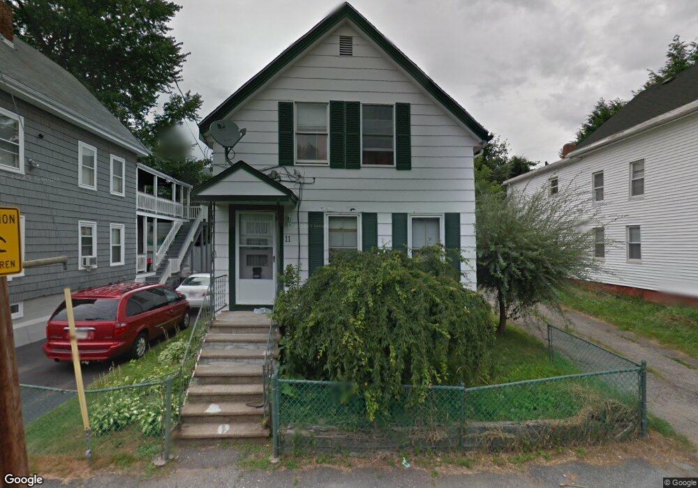
11 New St Haverhill, MA 01830
Lower Acres NeighborhoodEstimated Value: $613,322 - $814,000
7
Beds
3
Baths
2,480
Sq Ft
$290/Sq Ft
Est. Value
About This Home
This home is located at 11 New St, Haverhill, MA 01830 and is currently estimated at $719,581, approximately $290 per square foot. 11 New St is a home located in Essex County with nearby schools including Dr. Paul Nettle Middle School.
Ownership History
Date
Name
Owned For
Owner Type
Purchase Details
Closed on
May 22, 2015
Sold by
Jennings Lloyd
Bought by
Rodriguez Linette and Guzman Christian
Current Estimated Value
Home Financials for this Owner
Home Financials are based on the most recent Mortgage that was taken out on this home.
Original Mortgage
$264,127
Outstanding Balance
$201,160
Interest Rate
3.37%
Mortgage Type
FHA
Estimated Equity
$518,421
Purchase Details
Closed on
Jul 30, 2014
Sold by
Macleod Ronald M and Danis-Mackeod Tamra L
Bought by
Jennings Lloyd
Purchase Details
Closed on
Dec 23, 2009
Sold by
Burroughs Jose G
Bought by
Macleod Ronald M
Home Financials for this Owner
Home Financials are based on the most recent Mortgage that was taken out on this home.
Original Mortgage
$94,400
Interest Rate
4.92%
Mortgage Type
Purchase Money Mortgage
Purchase Details
Closed on
Oct 7, 2004
Sold by
Sulesky Donald J and Sulesky Maureen
Bought by
Burroughs Jose G
Create a Home Valuation Report for This Property
The Home Valuation Report is an in-depth analysis detailing your home's value as well as a comparison with similar homes in the area
Home Values in the Area
Average Home Value in this Area
Purchase History
| Date | Buyer | Sale Price | Title Company |
|---|---|---|---|
| Rodriguez Linette | $269,000 | -- | |
| Jennings Lloyd | $135,000 | -- | |
| Macleod Ronald M | $118,000 | -- | |
| Burroughs Jose G | $194,000 | -- |
Source: Public Records
Mortgage History
| Date | Status | Borrower | Loan Amount |
|---|---|---|---|
| Open | Rodriguez Linette | $264,127 | |
| Previous Owner | Burroughs Jose G | $94,400 | |
| Previous Owner | Burroughs Jose G | $189,600 |
Source: Public Records
Tax History Compared to Growth
Tax History
| Year | Tax Paid | Tax Assessment Tax Assessment Total Assessment is a certain percentage of the fair market value that is determined by local assessors to be the total taxable value of land and additions on the property. | Land | Improvement |
|---|---|---|---|---|
| 2025 | $5,838 | $545,100 | $133,900 | $411,200 |
| 2024 | $5,133 | $482,400 | $125,000 | $357,400 |
| 2023 | $4,955 | $444,400 | $125,000 | $319,400 |
| 2022 | $4,914 | $386,300 | $114,600 | $271,700 |
| 2021 | $4,588 | $341,400 | $98,200 | $243,200 |
| 2020 | $4,453 | $327,400 | $93,700 | $233,700 |
| 2019 | $4,083 | $292,700 | $81,800 | $210,900 |
| 2018 | $3,894 | $273,100 | $77,400 | $195,700 |
| 2017 | $3,719 | $248,100 | $71,400 | $176,700 |
| 2016 | $3,591 | $233,800 | $62,500 | $171,300 |
| 2015 | -- | $169,500 | $62,500 | $107,000 |
Source: Public Records
Map
Nearby Homes
- 8 Dustin St
- 5 Kimball St
- 17 Vine St
- 23 Lewis St
- 11 York St Unit 11
- 9 York St Unit 9
- 48 Portland St
- 151 Franklin St
- 25 Portland St
- 25-27 Dover St
- 192 Franklin St
- 13-15 Arlington St
- 6 Dexter St
- 17 Arlington St
- 23 Arlington St
- 4 Michael Anthony Rd
- 2 Michael Anthony Rd
- 18-22 Essex St Unit 22
- 34 7th Ave
- 19 Washington St Unit 2
- 7 New St
- 13 New St
- 12 New St
- 60 Franklin St
- 64 Franklin St
- 23-25 Charles St
- 23-25 Charles St Unit 1
- 23-25 Charles St Unit 2
- 56 Franklin St
- 1 New St
- 23 Charles St Unit 25
- 15 New St Unit 2
- 15 New St Unit 1
- 15 New St
- 15-17 New St Unit 2
- 15-17 New St
- 21 Charles St
- 72 Franklin St
- 50 Franklin St
- 19 New St