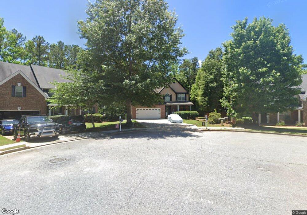
11 New York Ave Sharpsburg, GA 30277
Estimated Value: $469,320 - $498,000
3
Beds
3
Baths
3,166
Sq Ft
$154/Sq Ft
Est. Value
About This Home
This home is located at 11 New York Ave, Sharpsburg, GA 30277 and is currently estimated at $487,830, approximately $154 per square foot. 11 New York Ave is a home located in Coweta County with nearby schools including Poplar Road Elementary School, Lee Middle School, and East Coweta High School.
Ownership History
Date
Name
Owned For
Owner Type
Purchase Details
Closed on
Jul 27, 2015
Sold by
Andrews Bryan D
Bought by
Andrews Bryan D
Current Estimated Value
Home Financials for this Owner
Home Financials are based on the most recent Mortgage that was taken out on this home.
Original Mortgage
$199,502
Outstanding Balance
$151,769
Interest Rate
3.26%
Mortgage Type
VA
Estimated Equity
$336,061
Purchase Details
Closed on
Feb 23, 2006
Sold by
Jonepe Inc
Bought by
Parkside Residential Llc Dba Scenic
Purchase Details
Closed on
Jan 5, 2006
Sold by
Parks Road Investment Llc
Bought by
Jonepe Inc
Purchase Details
Closed on
Apr 21, 2003
Sold by
Parks Road Investment Llc
Bought by
Parks Road Investment Llc
Create a Home Valuation Report for This Property
The Home Valuation Report is an in-depth analysis detailing your home's value as well as a comparison with similar homes in the area
Home Values in the Area
Average Home Value in this Area
Purchase History
| Date | Buyer | Sale Price | Title Company |
|---|---|---|---|
| Andrews Bryan D | -- | -- | |
| Parkside Residential Llc Dba Scenic | $3,690,400 | -- | |
| Jonepe Inc | -- | -- | |
| Parks Road Investment Llc | $4,316,400 | -- |
Source: Public Records
Mortgage History
| Date | Status | Borrower | Loan Amount |
|---|---|---|---|
| Open | Andrews Bryan D | $199,502 |
Source: Public Records
Tax History Compared to Growth
Tax History
| Year | Tax Paid | Tax Assessment Tax Assessment Total Assessment is a certain percentage of the fair market value that is determined by local assessors to be the total taxable value of land and additions on the property. | Land | Improvement |
|---|---|---|---|---|
| 2025 | $1,645 | $193,952 | $36,000 | $157,952 |
| 2024 | $1,535 | $184,183 | $30,000 | $154,183 |
| 2023 | $1,535 | $175,402 | $22,000 | $153,402 |
| 2022 | $3,412 | $143,717 | $22,000 | $121,717 |
| 2021 | $3,408 | $130,369 | $16,000 | $114,369 |
| 2020 | $3,483 | $130,369 | $16,000 | $114,369 |
| 2019 | $3,101 | $106,962 | $12,000 | $94,962 |
| 2018 | $3,119 | $106,962 | $12,000 | $94,962 |
| 2017 | $3,081 | $106,164 | $12,000 | $94,164 |
| 2016 | $2,892 | $99,780 | $12,000 | $87,780 |
| 2015 | $2,585 | $89,406 | $12,000 | $77,406 |
| 2014 | $1,977 | $77,830 | $10,000 | $67,830 |
Source: Public Records
Map
Nearby Homes
- 108 Turnberry Trace
- 105 Turnberry Trace
- 25 Pacific Ave
- 9 Marvin Gardens
- 0 Poplar Rd Unit 10580891
- 24 Marvin Gardens
- 162 Ashton Place
- 2752 Poplar Rd
- Camden Plan at Candleberry Place
- Savannah Plan at Candleberry Place
- Briarwood Plan at Candleberry Place
- Newport Plan at Candleberry Place
- 5 Candleberry Way
- 5 Riverside Dr
- 316 Winchester Dr
- 161 Briandwood Dr
- 53 Fox Ridge Dr
- 37 Fox Ridge Dr
- 28 Fox Ridge Dr
- 45 Riverside Walk
- 15 New York Ave
- 7 New York Ave
- 7 Virginia Ave
- 11 Virginia Ave
- 3 New York Ave
- 14 New York Ave
- 3 Virginia Ave
- 53 Indiana Ave
- 10 New York Ave
- 2 New York Ave
- 49 Indiana Ave
- 6 New York Ave
- 2 Virginia Ave
- 0 Virginia Ave
- 56 Indiana Ave
- 52 Indiana Ave
- 52 Indiana Ave Unit 455
- 65 Indiana Ave
- 20 Turnberry Trc Unit 1
- 20 Turnberry Trc Unit LOT 1