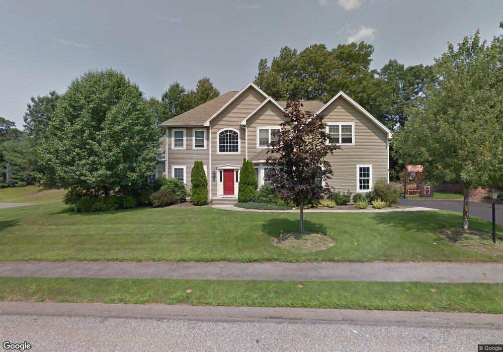
11 Nipmuck Dr Westborough, MA 01581
Estimated Value: $1,088,696 - $1,256,000
4
Beds
4
Baths
3,091
Sq Ft
$383/Sq Ft
Est. Value
About This Home
This home is located at 11 Nipmuck Dr, Westborough, MA 01581 and is currently estimated at $1,184,565, approximately $383 per square foot. 11 Nipmuck Dr is a home located in Worcester County with nearby schools including Westborough High School, Westboro Knowledge Beginnings, and Ebridge Montessori School.
Ownership History
Date
Name
Owned For
Owner Type
Purchase Details
Closed on
Dec 14, 2021
Sold by
Wong Denny and Wong Tammy W
Bought by
Wong Lt
Current Estimated Value
Purchase Details
Closed on
Jun 14, 1999
Sold by
Casa Bldrs & Dev
Bought by
Wong Denny and Wong Tammy W
Home Financials for this Owner
Home Financials are based on the most recent Mortgage that was taken out on this home.
Original Mortgage
$162,000
Interest Rate
6.9%
Mortgage Type
Purchase Money Mortgage
Create a Home Valuation Report for This Property
The Home Valuation Report is an in-depth analysis detailing your home's value as well as a comparison with similar homes in the area
Home Values in the Area
Average Home Value in this Area
Purchase History
| Date | Buyer | Sale Price | Title Company |
|---|---|---|---|
| Wong Lt | -- | None Available | |
| Wong Denny | $399,900 | -- |
Source: Public Records
Mortgage History
| Date | Status | Borrower | Loan Amount |
|---|---|---|---|
| Previous Owner | Wong Denny | $158,000 | |
| Previous Owner | Wong Denny | $50,000 | |
| Previous Owner | Wong Denny | $162,000 |
Source: Public Records
Tax History Compared to Growth
Tax History
| Year | Tax Paid | Tax Assessment Tax Assessment Total Assessment is a certain percentage of the fair market value that is determined by local assessors to be the total taxable value of land and additions on the property. | Land | Improvement |
|---|---|---|---|---|
| 2025 | $16,769 | $1,029,400 | $349,500 | $679,900 |
| 2024 | $15,891 | $968,400 | $326,800 | $641,600 |
| 2023 | $14,703 | $873,100 | $311,100 | $562,000 |
| 2022 | $13,721 | $742,100 | $251,400 | $490,700 |
| 2021 | $13,466 | $726,300 | $235,600 | $490,700 |
| 2020 | $13,326 | $727,400 | $249,400 | $478,000 |
| 2019 | $13,348 | $728,200 | $245,400 | $482,800 |
| 2018 | $1,971 | $680,200 | $245,400 | $434,800 |
| 2017 | $1,326 | $680,200 | $245,400 | $434,800 |
| 2016 | $12,165 | $684,600 | $245,400 | $439,200 |
| 2015 | $11,732 | $631,100 | $219,900 | $411,200 |
Source: Public Records
Map
Nearby Homes
- 59 Indian Meadow Dr
- 8 Stagecoach Cir Unit 8
- 155 Milk St Unit 5
- 9 Shaker Way
- 196 -198 Turnpike Rd
- 1 Hamilton Rd
- 52 Treetop Park Unit 52
- 22 Treetop Park
- 3 Dover Way
- 349 Brigham St
- 9 Treetop Park
- 19 Treetop Park Unit 19
- 11 Hillside Rd
- 223 South St
- 139 Davis St
- 198 South St
- 22 Hitching Post Ln
- 185-187 South St
- 5 Chauncy Cir
- 19 Fisher St
- 15 Nipmuck Dr
- 9 Nipmuck Dr
- 8 Nipmuck Dr
- 30 Powder Hill Way
- 26 Powder Hill Way
- 30 Powder Hill Way Unit 30
- 32 Powder Hill Way
- 20 Powder Hill Way
- 16 Powder Hill Way
- 20 Powder Hill Way Unit 20
- 6 Nipmuck Dr
- 10 Nipmuck Dr
- 12 Nipmuck Dr
- 17 Powder Hill Way
- 11 Powder Hill Way
- 17 Powder Hill Way Unit 17
- 5 Powder Hill Way
- 6 Powder Hill Way
- 2 Powder Hill Way
- 38 Powder Hill Way