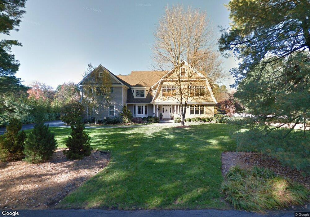
11 Northfield Dr Westport, CT 06880
Coleytown NeighborhoodEstimated Value: $2,588,551 - $3,591,000
5
Beds
7
Baths
6,260
Sq Ft
$506/Sq Ft
Est. Value
About This Home
This home is located at 11 Northfield Dr, Westport, CT 06880 and is currently estimated at $3,170,638, approximately $506 per square foot. 11 Northfield Dr is a home located in Fairfield County with nearby schools including Coleytown Elementary School, Coleytown Middle School, and Staples High School.
Ownership History
Date
Name
Owned For
Owner Type
Purchase Details
Closed on
Jul 11, 2001
Sold by
Cantin Yves and Olshan Regina
Bought by
Piekarski Tr Andrezej
Current Estimated Value
Purchase Details
Closed on
Sep 14, 1994
Sold by
Tobin Bernard and Tobin Rosalind
Bought by
Cantin Yves and Olshan Regina
Home Financials for this Owner
Home Financials are based on the most recent Mortgage that was taken out on this home.
Original Mortgage
$349,000
Interest Rate
8%
Mortgage Type
Unknown
Create a Home Valuation Report for This Property
The Home Valuation Report is an in-depth analysis detailing your home's value as well as a comparison with similar homes in the area
Home Values in the Area
Average Home Value in this Area
Purchase History
| Date | Buyer | Sale Price | Title Company |
|---|---|---|---|
| Piekarski Tr Andrezej | $550,000 | -- | |
| Piekarski Tr Andrezej | $550,000 | -- | |
| Cantin Yves | $367,500 | -- | |
| Cantin Yves | $367,500 | -- |
Source: Public Records
Mortgage History
| Date | Status | Borrower | Loan Amount |
|---|---|---|---|
| Previous Owner | Cantin Yves | $349,000 |
Source: Public Records
Tax History Compared to Growth
Tax History
| Year | Tax Paid | Tax Assessment Tax Assessment Total Assessment is a certain percentage of the fair market value that is determined by local assessors to be the total taxable value of land and additions on the property. | Land | Improvement |
|---|---|---|---|---|
| 2025 | $20,173 | $1,069,600 | $428,700 | $640,900 |
| 2024 | $19,916 | $1,069,600 | $428,700 | $640,900 |
| 2023 | $19,627 | $1,069,600 | $428,700 | $640,900 |
| 2022 | $19,328 | $1,069,600 | $428,700 | $640,900 |
| 2021 | $20,854 | $1,069,600 | $428,700 | $640,900 |
| 2020 | $20,998 | $1,256,600 | $425,700 | $830,900 |
| 2019 | $21,186 | $1,256,600 | $425,700 | $830,900 |
| 2018 | $21,186 | $1,256,600 | $425,700 | $830,900 |
| 2017 | $21,186 | $1,256,600 | $425,700 | $830,900 |
| 2016 | $21,186 | $1,256,600 | $425,700 | $830,900 |
| 2015 | $21,453 | $1,185,900 | $319,200 | $866,700 |
| 2014 | $21,275 | $1,185,900 | $319,200 | $866,700 |
Source: Public Records
Map
Nearby Homes
- 7 Northfield Dr
- 4 Brooklawn Dr
- 7 Brooklawn Dr
- 6 Brooklawn Dr
- 12 Northfield Dr
- 10 Northfield Dr
- 2 Brooklawn Dr
- 5 Northfield Dr
- 8 Brooklawn Dr
- 55 Easton Rd
- 12 Brooklawn Dr
- 14 Brooklawn Dr
- 49 Easton Rd
- 1 Brooklawn Dr
- 7 Meadow View Dr
- 6 Northfield Dr
- 54 Easton Rd
- 4 Northfield Dr
- 10 Brooklawn Dr
- 38 Meadow View Dr