
Seller's Agent in 2025
Julie Lariviere
Bold Real Estate Inc.
(508) 726-3346
2 in this area
19 Total Sales
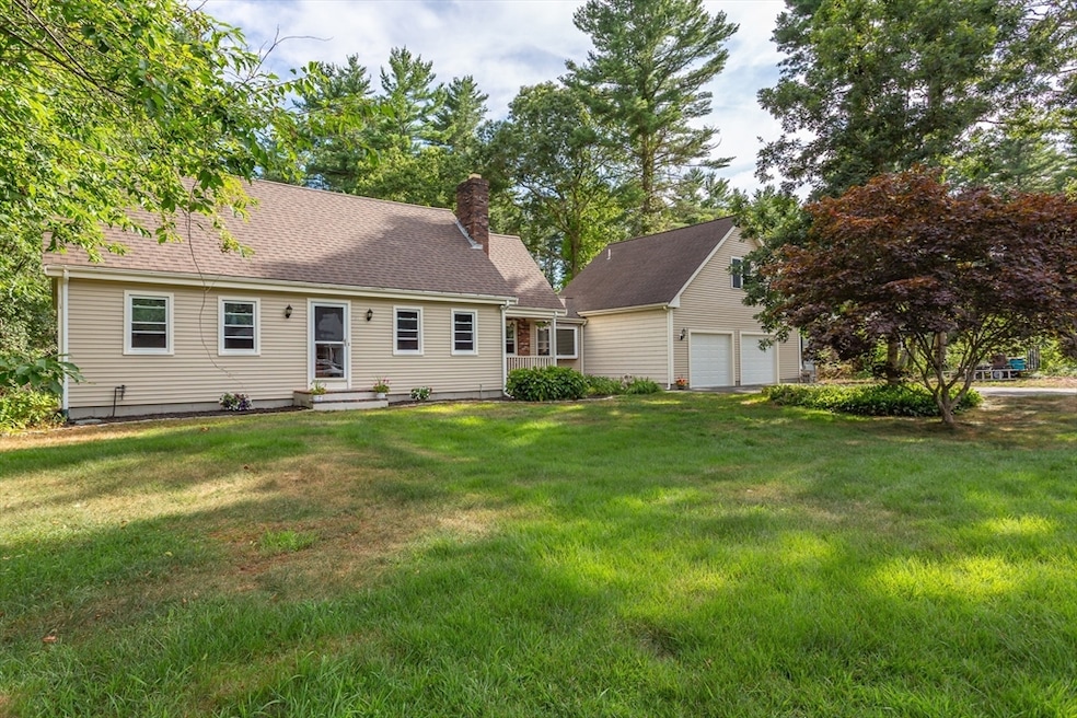
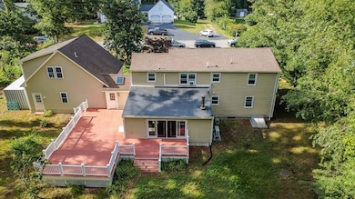
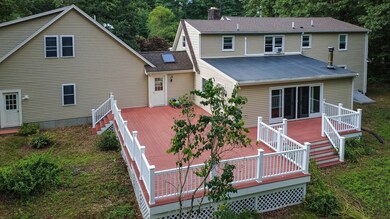
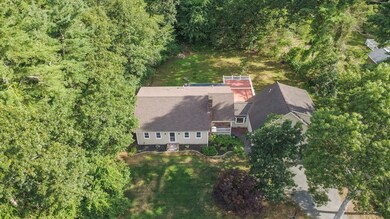
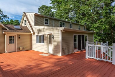
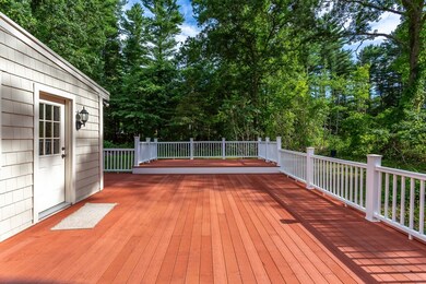
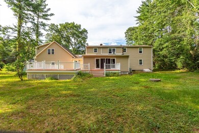
Welcome to this beautiful Cape Cod style home nestled in a desirable residential neighborhood. Offering 3 to 4 bedrooms and 2.5 bathrooms, this home is perfect for families of all sizes. The kitchen boasts a large counter bar, perfect casual dining, or entertaining guests. A pass-through window connects the kitchen to the generously sized family room, making it easy to serve food and stay connected with family or guests while cooking. This oversized Family Room opens onto an extra-large deck — ideal for outdoor gatherings, barbecues, or simply unwind and enjoy the peaceful surroundings Upstairs, you'll find a versatile GREAT ROOM located over the garage, offering plenty of space for a game room, home theater, or additional living area. This great room also includes a convenient 1/2 bath. This home combines classic charm with generous living spaces, creating a warm and welcoming environment inside and out. Oil tank and Roof new - 1 year.
| Date | Type | Sale Price | Title Company |
|---|---|---|---|
| Deed | $679,000 | -- | |
| Deed | $165,000 | -- |
| Date | Status | Loan Amount | Loan Type |
|---|---|---|---|
| Open | $479,000 | New Conventional | |
| Previous Owner | $210,000 | No Value Available | |
| Previous Owner | $80,000 | No Value Available |
| Date | Event | Price | List to Sale | Price per Sq Ft |
|---|---|---|---|---|
| 09/19/2025 09/19/25 | Sold | $679,000 | 0.0% | $231 / Sq Ft |
| 08/10/2025 08/10/25 | Pending | -- | -- | -- |
| 07/25/2025 07/25/25 | For Sale | $679,000 | -- | $231 / Sq Ft |
| Year | Tax Paid | Tax Assessment Tax Assessment Total Assessment is a certain percentage of the fair market value that is determined by local assessors to be the total taxable value of land and additions on the property. | Land | Improvement |
|---|---|---|---|---|
| 2025 | $6,482 | $654,100 | $179,300 | $474,800 |
| 2024 | $6,441 | $617,500 | $169,200 | $448,300 |
| 2023 | $6,357 | $593,600 | $152,400 | $441,200 |
| 2022 | $6,053 | $501,900 | $129,100 | $372,800 |
| 2021 | $5,630 | $443,300 | $117,400 | $325,900 |
| 2020 | $5,668 | $435,300 | $112,900 | $322,400 |
| 2019 | $5,388 | $409,700 | $107,500 | $302,200 |
| 2018 | $5,029 | $377,800 | $107,500 | $270,300 |
| 2017 | $4,907 | $368,400 | $107,500 | $260,900 |
| 2016 | $4,642 | $354,600 | $104,400 | $250,200 |
| 2015 | $4,422 | $342,800 | $104,400 | $238,400 |
| 2014 | $4,234 | $335,800 | $102,200 | $233,600 |
Seller's Agent in 2025
Julie Lariviere
Bold Real Estate Inc.
(508) 726-3346
2 in this area
19 Total Sales
Buyer's Agent in 2025
Morgan Doherty
RE/MAX
(774) 501-7131
1 in this area
21 Total Sales
Source: MLS Property Information Network (MLS PIN)
MLS Number: 73409647
APN: FREE-000228-000000-000050
Disclaimer: Certain information contained herein is derived from information provided by parties other than Homes.com. All information provided is deemed reliable, but is not guaranteed to be accurate and should be independently verified.
![]() The property listing data and information, or the Images, set forth herein were provided to MLS Property Information Network, Inc. from third party sources, including sellers, lessors and public records, and were compiled by MLS Property Information Network, Inc. The property listing data and information, and the Images, are for the personal, non-commercial use of consumers having a good faith interest in purchasing or leasing listed properties of the type displayed to them and may not be used for any purpose other than to identify prospective properties which such consumers may have a good faith interest in purchasing or leasing. MLS Property Information Network, Inc. and its subscribers disclaim any and all representations and warranties as to the accuracy of the property listing data and information, or as to the accuracy of any of the Images, set forth herein.
The property listing data and information, or the Images, set forth herein were provided to MLS Property Information Network, Inc. from third party sources, including sellers, lessors and public records, and were compiled by MLS Property Information Network, Inc. The property listing data and information, and the Images, are for the personal, non-commercial use of consumers having a good faith interest in purchasing or leasing listed properties of the type displayed to them and may not be used for any purpose other than to identify prospective properties which such consumers may have a good faith interest in purchasing or leasing. MLS Property Information Network, Inc. and its subscribers disclaim any and all representations and warranties as to the accuracy of the property listing data and information, or as to the accuracy of any of the Images, set forth herein.