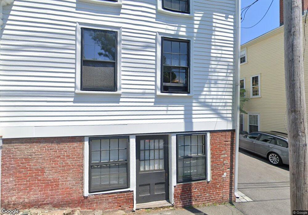
11 Pearl St Marblehead, MA 01945
Estimated Value: $939,421 - $1,134,000
3
Beds
3
Baths
2,400
Sq Ft
$433/Sq Ft
Est. Value
About This Home
This home is located at 11 Pearl St, Marblehead, MA 01945 and is currently estimated at $1,039,605, approximately $433 per square foot. 11 Pearl St is a home located in Essex County with nearby schools including Marblehead High School, Marblehead Community Charter Public School, and Devereux School.
Ownership History
Date
Name
Owned For
Owner Type
Purchase Details
Closed on
Jun 26, 2007
Sold by
Scrimshaw T and Crawford Peter S
Bought by
Cook Glenn J
Current Estimated Value
Purchase Details
Closed on
Apr 22, 2003
Sold by
Crawford Peter S
Bought by
Scrimshaw T
Purchase Details
Closed on
May 19, 1999
Sold by
Crawford Peter S
Bought by
Scrimshaw T and Crawford Peter S
Create a Home Valuation Report for This Property
The Home Valuation Report is an in-depth analysis detailing your home's value as well as a comparison with similar homes in the area
Home Values in the Area
Average Home Value in this Area
Purchase History
| Date | Buyer | Sale Price | Title Company |
|---|---|---|---|
| Cook Glenn J | $573,000 | -- | |
| Cook Glenn J | $573,000 | -- | |
| Scrimshaw T | -- | -- | |
| Crawfo4rd Peter S | -- | -- | |
| Scrimshaw T | -- | -- | |
| Scrimshaw T | $100,000 | -- | |
| Scrimshaw T T | $100,000 | -- |
Source: Public Records
Mortgage History
| Date | Status | Borrower | Loan Amount |
|---|---|---|---|
| Open | Scrimshaw T T | $282,000 |
Source: Public Records
Tax History
| Year | Tax Paid | Tax Assessment Tax Assessment Total Assessment is a certain percentage of the fair market value that is determined by local assessors to be the total taxable value of land and additions on the property. | Land | Improvement |
|---|---|---|---|---|
| 2025 | $7,370 | $814,400 | $499,200 | $315,200 |
| 2024 | $7,092 | $791,500 | $499,200 | $292,300 |
| 2023 | $6,615 | $661,500 | $430,100 | $231,400 |
| 2022 | $6,635 | $630,700 | $384,000 | $246,700 |
| 2021 | $6,492 | $623,000 | $376,300 | $246,700 |
| 2020 | $5,926 | $570,400 | $368,600 | $201,800 |
| 2019 | $5,879 | $547,400 | $345,600 | $201,800 |
| 2018 | $5,609 | $509,000 | $307,200 | $201,800 |
| 2017 | $5,309 | $482,200 | $291,800 | $190,400 |
| 2016 | $5,012 | $451,500 | $261,100 | $190,400 |
| 2015 | $4,709 | $425,000 | $245,800 | $179,200 |
| 2014 | $4,662 | $420,400 | $245,800 | $174,600 |
Source: Public Records
Map
Nearby Homes
- 7 Mechanic Ct
- 3 Frost Ln Unit 1
- 9 Darling St
- 45 Pleasant St
- 26 Summer St Unit 1
- 7 Lee St Unit 1
- 132 Elm St
- 132 Elm St Unit 132
- 66 Pleasant St Unit 1
- 66 Pleasant St Unit 2
- 9 Lincoln Park
- 55 Brackett Place Unit B
- 55 Roosevelt Ave
- 290 Washington St Unit A
- 6 Mount Vernon St
- 41 Atlantic Ave Unit 1
- 157 Green St Unit 3
- 7 Cottage St
- 4 Ballast Ln
- 349 Ocean Ave
- 13 Pearl St
- 9 Pearl St
- 7 High St
- 7 Pearl St Unit 3rd
- 7 Pearl St Unit 2
- 7 Pearl St
- 7 Pearl St Unit 1st front
- 7 Pearl St Unit 3
- 7 Pearl St Unit 27th Floor
- 11 High St
- 1 Mechanic St
- 1 Mechanic St Unit 1
- 18 Pearl St
- 4 High St
- 2 High St
- 20 Pearl St
- 13 High St
- 7 Mechanic St
- 7 Mechanic St Unit 1
- 43 Washington St
Your Personal Tour Guide
Ask me questions while you tour the home.