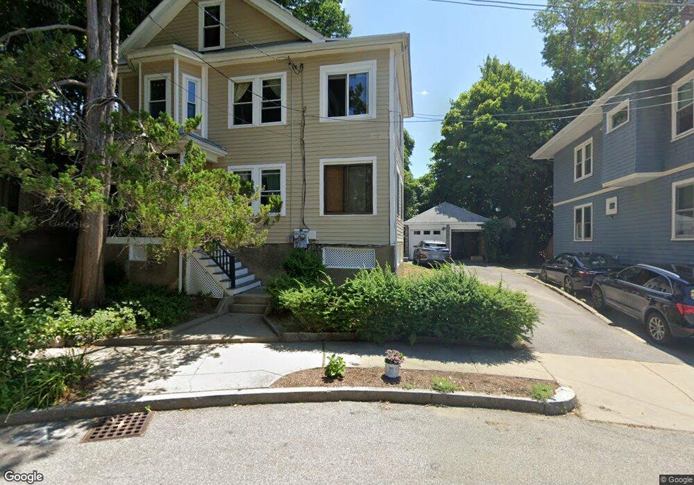
11 Playstead Rd Newton, MA 02458
Brighton NeighborhoodEstimated Value: $920,549 - $1,274,000
4
Beds
2
Baths
2,342
Sq Ft
$495/Sq Ft
Est. Value
About This Home
This home is located at 11 Playstead Rd, Newton, MA 02458 and is currently estimated at $1,158,387, approximately $494 per square foot. 11 Playstead Rd is a home located in Middlesex County with nearby schools including St Columbkille Partnership School and Shaloh House Jewish Day School.
Ownership History
Date
Name
Owned For
Owner Type
Purchase Details
Closed on
Feb 4, 2011
Sold by
Traer Mary C
Bought by
Alberts Jaime E
Current Estimated Value
Home Financials for this Owner
Home Financials are based on the most recent Mortgage that was taken out on this home.
Original Mortgage
$300,000
Outstanding Balance
$205,672
Interest Rate
4.82%
Mortgage Type
Purchase Money Mortgage
Estimated Equity
$952,715
Purchase Details
Closed on
Jul 26, 2000
Sold by
Jacqueline Earle Int
Bought by
Traer Mary
Home Financials for this Owner
Home Financials are based on the most recent Mortgage that was taken out on this home.
Original Mortgage
$323,400
Interest Rate
8.18%
Mortgage Type
Purchase Money Mortgage
Create a Home Valuation Report for This Property
The Home Valuation Report is an in-depth analysis detailing your home's value as well as a comparison with similar homes in the area
Home Values in the Area
Average Home Value in this Area
Purchase History
| Date | Buyer | Sale Price | Title Company |
|---|---|---|---|
| Alberts Jaime E | $575,000 | -- | |
| Alberts Jamie E | -- | -- | |
| Traer Mary | $413,000 | -- |
Source: Public Records
Mortgage History
| Date | Status | Borrower | Loan Amount |
|---|---|---|---|
| Open | Alberts Jamie E | $300,000 | |
| Closed | Alberts Jaime E | $300,000 | |
| Previous Owner | Traer Mary | $300,000 | |
| Previous Owner | Traer Mary | $323,400 | |
| Previous Owner | Traer Mary | $323,400 | |
| Closed | Traer Mary | $47,600 |
Source: Public Records
Tax History Compared to Growth
Tax History
| Year | Tax Paid | Tax Assessment Tax Assessment Total Assessment is a certain percentage of the fair market value that is determined by local assessors to be the total taxable value of land and additions on the property. | Land | Improvement |
|---|---|---|---|---|
| 2025 | $5,630 | $574,500 | $379,000 | $195,500 |
| 2024 | $5,444 | $557,800 | $368,000 | $189,800 |
| 2023 | $5,197 | $510,500 | $289,100 | $221,400 |
| 2022 | $4,973 | $472,700 | $267,700 | $205,000 |
| 2021 | $4,667 | $433,700 | $245,600 | $188,100 |
| 2020 | $4,528 | $433,700 | $245,600 | $188,100 |
| 2019 | $4,235 | $405,300 | $229,500 | $175,800 |
| 2018 | $4,045 | $373,800 | $216,600 | $157,200 |
| 2017 | $3,813 | $342,900 | $198,700 | $144,200 |
| 2016 | $3,584 | $314,900 | $182,300 | $132,600 |
| 2015 | $3,417 | $294,300 | $170,400 | $123,900 |
Source: Public Records
Map
Nearby Homes
- 121 Tremont St Unit B1
- 99 Tremont St Unit 105
- 99 Tremont St Unit 413
- 70 Washington St Unit 70
- 70 Washington St
- 8 Tremont Place
- 21 Glenley Terrace
- 69 Presentation Rd
- 106 Farlow Rd
- 39 Champney St
- 427-435 Faneuil St Unit R4
- 18 Breck Ave Unit 18
- 180 Hunnewell Ave Unit 180
- 206 Franklin St
- 159 Washington St Unit 4
- 68 Vernon St
- 65-67 Saint James Cir
- 4 Remick Terrace
- 4 Remick Terrace Unit 4
- 21 Upcrest Rd
- 11 Playstead Rd Unit 2
- 11 Playstead Rd Unit 1
- 7 Playstead Rd Unit 2
- 7 Playstead Rd Unit 1
- 15 Playstead Rd Unit 17
- 10 Playstead Rd
- 10 Playstead Rd Unit 1
- 151 Tremont St
- 151 Tremont St Unit 1
- 151 Tremont St
- 151 Tremont St Unit 2
- 147 Tremont St
- 121 Tremont St
- 159 Tremont St
- 143 Tremont St
- 143 Tremont St Unit 416
- 143 Tremont St Unit 501
- 143 Tremont St
- 143 Tremont St Unit 1
- 26 Playstead Rd