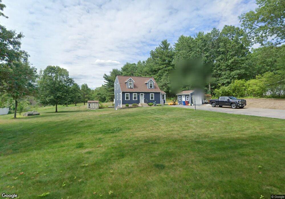
11 Red Gate Rd Tyngsboro, MA 01879
Estimated Value: $699,000 - $732,000
3
Beds
2
Baths
2,112
Sq Ft
$338/Sq Ft
Est. Value
About This Home
This home is located at 11 Red Gate Rd, Tyngsboro, MA 01879 and is currently estimated at $714,408, approximately $338 per square foot. 11 Red Gate Rd is a home located in Middlesex County with nearby schools including Tyngsborough Elementary School, Tyngsborough Middle School, and Innovation Academy Charter School.
Ownership History
Date
Name
Owned For
Owner Type
Purchase Details
Closed on
Apr 10, 2025
Sold by
Antonino Losurdo 2012 Ret and Losurdo
Bought by
Losurdo Int and Losurdo L
Current Estimated Value
Purchase Details
Closed on
Mar 20, 2014
Sold by
Losurdo Antonino and Losurdo Kathleen M
Bought by
Antonino Losurdo Ret and Losurdo
Purchase Details
Closed on
Oct 1, 1996
Sold by
Applewood Construction
Bought by
Losurdo Antonio and Losurdo Kathleen
Home Financials for this Owner
Home Financials are based on the most recent Mortgage that was taken out on this home.
Original Mortgage
$141,600
Interest Rate
7.83%
Mortgage Type
Purchase Money Mortgage
Create a Home Valuation Report for This Property
The Home Valuation Report is an in-depth analysis detailing your home's value as well as a comparison with similar homes in the area
Home Values in the Area
Average Home Value in this Area
Purchase History
| Date | Buyer | Sale Price | Title Company |
|---|---|---|---|
| Losurdo Int | -- | None Available | |
| Losurdo Int | -- | None Available | |
| Antonino Losurdo Ret | -- | -- | |
| Antonino Losurdo Ret | -- | -- | |
| Losurdo Antonio | $157,375 | -- | |
| Losurdo Antonio | $157,375 | -- |
Source: Public Records
Mortgage History
| Date | Status | Borrower | Loan Amount |
|---|---|---|---|
| Previous Owner | Losurdo Antonio | $28,000 | |
| Previous Owner | Losurdo Antonio | $141,600 |
Source: Public Records
Tax History Compared to Growth
Tax History
| Year | Tax Paid | Tax Assessment Tax Assessment Total Assessment is a certain percentage of the fair market value that is determined by local assessors to be the total taxable value of land and additions on the property. | Land | Improvement |
|---|---|---|---|---|
| 2025 | $7,635 | $618,700 | $271,900 | $346,800 |
| 2024 | $7,487 | $588,600 | $265,000 | $323,600 |
| 2023 | $7,224 | $510,900 | $221,400 | $289,500 |
| 2022 | $6,901 | $461,900 | $193,100 | $268,800 |
| 2021 | $6,650 | $413,800 | $175,700 | $238,100 |
| 2020 | $6,531 | $401,900 | $167,000 | $234,900 |
| 2019 | $6,383 | $377,000 | $158,300 | $218,700 |
| 2018 | $6,096 | $356,300 | $158,300 | $198,000 |
| 2017 | $5,972 | $348,000 | $158,300 | $189,700 |
| 2016 | $5,921 | $337,200 | $158,300 | $178,900 |
| 2015 | $5,644 | $332,800 | $153,900 | $178,900 |
Source: Public Records
Map
Nearby Homes
- 454 Dunstable Rd
- 7 Axletree Rd
- 45 Red Gate Rd
- 160 Westford Rd
- 0 Dunstable Rd
- 0 Lowell St
- 10 Dickens Ln
- 19 Sandstone Rd
- 14 Centercrest Dr Unit 14
- 15 Stone Ridge Rd
- 20 Highland Rd
- 76 Russells Way
- 22 Highland Rd
- 23 Morrison Ln
- 11 Old Hickory Rd
- 24 Old Tyng Rd
- 46 Pawtucket Blvd Unit 37
- 446 Westford St
- 20 Merrimac Way Unit 20E
- 45 Riley Rd Unit 45
- 5 Red Gate Rd
- 15 Red Gate Rd
- 14 Red Gate Rd
- 46 Red Gate Rd
- 472 Dunstable Rd
- 10 Red Gate Rd
- 0 Redgate Road Lot 1 Unit 50345368
- 22 Red Gate Rd
- 468 Dunstable Rd
- 462 Dunstable Rd
- 474 Dunstable Rd
- 458 Dunstable Rd
- 24 Red Gate Rd
- 27 Red Gate Rd
- 456 Dunstable Rd
- 465 Dunstable Rd
- 8 Brookview Cir
- 478 Dunstable Rd
- 4 Brookview Cir
- 452 Dunstable Rd