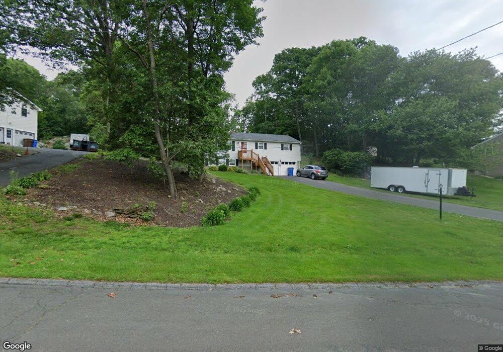
11 Regent Dr Shelton, CT 06484
Estimated Value: $441,000 - $524,000
3
Beds
1
Bath
1,104
Sq Ft
$438/Sq Ft
Est. Value
About This Home
This home is located at 11 Regent Dr, Shelton, CT 06484 and is currently estimated at $483,205, approximately $437 per square foot. 11 Regent Dr is a home located in Fairfield County with nearby schools including Perry Hill School, Shelton Intermediate School, and Shelton High School.
Ownership History
Date
Name
Owned For
Owner Type
Purchase Details
Closed on
Sep 16, 2005
Sold by
Date Ravi and Date Kimberly
Bought by
Masiello William and Masiello Kathleen
Current Estimated Value
Purchase Details
Closed on
Sep 11, 2001
Sold by
Hayden Lewis B and Hayden Helen E
Bought by
Dale Rani R and Gabor Kimberly A
Home Financials for this Owner
Home Financials are based on the most recent Mortgage that was taken out on this home.
Original Mortgage
$183,900
Interest Rate
7.05%
Create a Home Valuation Report for This Property
The Home Valuation Report is an in-depth analysis detailing your home's value as well as a comparison with similar homes in the area
Home Values in the Area
Average Home Value in this Area
Purchase History
| Date | Buyer | Sale Price | Title Company |
|---|---|---|---|
| Masiello William | $334,500 | -- | |
| Masiello William | $334,500 | -- | |
| Dale Rani R | $229,900 | -- | |
| Dale Rani R | $229,900 | -- |
Source: Public Records
Mortgage History
| Date | Status | Borrower | Loan Amount |
|---|---|---|---|
| Open | Dale Rani R | $200,000 | |
| Previous Owner | Dale Rani R | $176,250 | |
| Previous Owner | Dale Rani R | $183,900 |
Source: Public Records
Tax History Compared to Growth
Tax History
| Year | Tax Paid | Tax Assessment Tax Assessment Total Assessment is a certain percentage of the fair market value that is determined by local assessors to be the total taxable value of land and additions on the property. | Land | Improvement |
|---|---|---|---|---|
| 2025 | $4,168 | $221,480 | $99,260 | $122,220 |
| 2024 | $4,248 | $221,480 | $99,260 | $122,220 |
| 2023 | $3,869 | $221,480 | $99,260 | $122,220 |
| 2022 | $3,869 | $221,480 | $99,260 | $122,220 |
| 2021 | $3,448 | $156,520 | $48,580 | $107,940 |
| 2020 | $3,509 | $156,520 | $48,580 | $107,940 |
| 2019 | $3,509 | $156,520 | $48,580 | $107,940 |
| 2017 | $3,476 | $156,520 | $48,580 | $107,940 |
| 2015 | $3,789 | $169,820 | $55,720 | $114,100 |
| 2014 | $3,789 | $169,820 | $55,720 | $114,100 |
Source: Public Records
Map
Nearby Homes
- 39 L Hermitage Dr Unit 39
- 141 Spring Glen Unit 141
- 113 Spring Glen
- 45 Greystone
- 358 Long Hill Ave
- 27 Country Walk
- 356 Long Hill Ave
- 2 Congress Ave
- 16 Willoughby Rd
- 5 Independence Dr
- 93 Shelton Ave
- 3 Maler Ave
- 277 Eagles Landing Unit 277
- 16 Naugatuck Ave
- 125 Oak Ave
- 112 Woodland Park
- 20 Woodland Park
- 26 King St
- 0 Wells Ave
- 42 Wells Ave