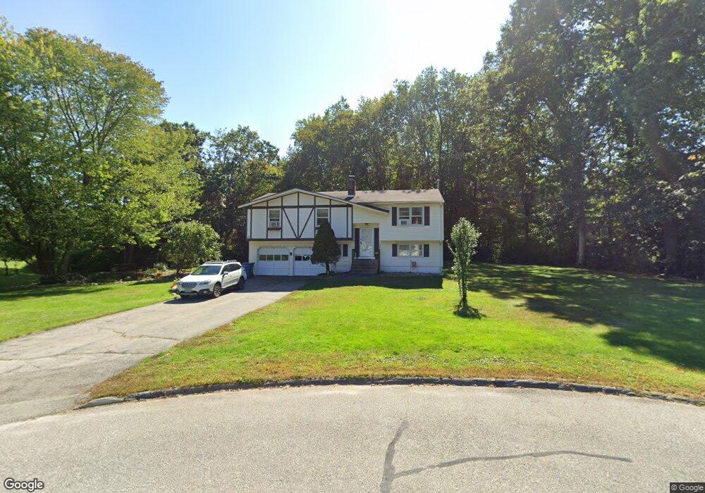
11 Reuven Dr Ledyard, CT 06339
Estimated Value: $366,000 - $505,000
3
Beds
2
Baths
1,276
Sq Ft
$336/Sq Ft
Est. Value
About This Home
This home is located at 11 Reuven Dr, Ledyard, CT 06339 and is currently estimated at $428,292, approximately $335 per square foot. 11 Reuven Dr is a home located in New London County with nearby schools including Ledyard Middle School and Ledyard High School.
Ownership History
Date
Name
Owned For
Owner Type
Purchase Details
Closed on
Dec 1, 1998
Sold by
Attanasio Anthony
Bought by
Adcock Frederick P and Bloeser Crystal A
Current Estimated Value
Home Financials for this Owner
Home Financials are based on the most recent Mortgage that was taken out on this home.
Original Mortgage
$120,600
Interest Rate
6.83%
Purchase Details
Closed on
Jun 19, 1987
Sold by
Darrigo John
Bought by
Attanasio Anthony
Create a Home Valuation Report for This Property
The Home Valuation Report is an in-depth analysis detailing your home's value as well as a comparison with similar homes in the area
Home Values in the Area
Average Home Value in this Area
Purchase History
| Date | Buyer | Sale Price | Title Company |
|---|---|---|---|
| Adcock Frederick P | $127,000 | -- | |
| Attanasio Anthony | $139,900 | -- |
Source: Public Records
Mortgage History
| Date | Status | Borrower | Loan Amount |
|---|---|---|---|
| Closed | Attanasio Anthony | $25,000 | |
| Open | Attanasio Anthony | $115,000 | |
| Closed | Attanasio Anthony | $117,500 | |
| Closed | Attanasio Anthony | $120,600 |
Source: Public Records
Tax History Compared to Growth
Tax History
| Year | Tax Paid | Tax Assessment Tax Assessment Total Assessment is a certain percentage of the fair market value that is determined by local assessors to be the total taxable value of land and additions on the property. | Land | Improvement |
|---|---|---|---|---|
| 2025 | $5,314 | $143,080 | $51,030 | $92,050 |
| 2024 | $5,038 | $143,080 | $51,030 | $92,050 |
| 2023 | $4,945 | $143,080 | $51,030 | $92,050 |
| 2022 | $4,839 | $143,080 | $51,030 | $92,050 |
| 2021 | $4,807 | $143,080 | $51,030 | $92,050 |
| 2020 | $4,614 | $131,950 | $48,510 | $83,440 |
| 2019 | $4,626 | $131,950 | $48,510 | $83,440 |
| 2018 | $4,525 | $131,950 | $48,510 | $83,440 |
| 2017 | $4,294 | $131,950 | $48,510 | $83,440 |
| 2016 | $4,209 | $131,950 | $48,510 | $83,440 |
| 2015 | $4,011 | $131,950 | $48,510 | $83,440 |
| 2014 | $4,088 | $136,710 | $51,030 | $85,680 |
Source: Public Records
Map
Nearby Homes
- 105 Spicer Hill Rd
- 675 Colonel Ledyard Hwy
- 31 Seabury Ave
- 7 Chidley Way
- 134 Iron St
- 19 Center Dr
- 155 Iron St
- 11 Wicklow Turn
- 97 Thomas Rd
- 5 Sachem Ln
- 25 Old Colony Ln
- 16 Abbey Rd
- 14 Abbey Rd
- 528 Colonel Ledyard Hwy
- 20 Lakeside Dr Unit P
- 7 Captain Amos Stanton Dr
- 4 Lakeside Dr Unit L
- 6 Lakeside Dr Unit P
- 39 Ash Dr Unit 9
- 148 Gallup Hill Rd