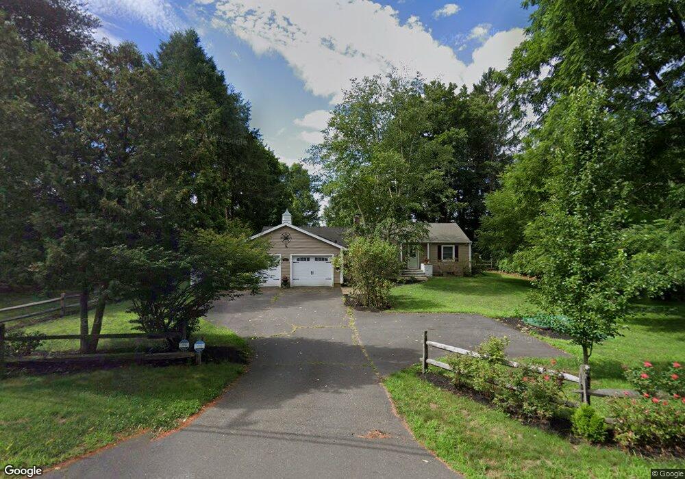
11 Riverside Rd Simsbury, CT 06070
Estimated Value: $457,958 - $497,000
2
Beds
2
Baths
1,965
Sq Ft
$246/Sq Ft
Est. Value
About This Home
This home is located at 11 Riverside Rd, Simsbury, CT 06070 and is currently estimated at $482,490, approximately $245 per square foot. 11 Riverside Rd is a home located in Hartford County with nearby schools including Tariffville School, Henry James Memorial School, and Simsbury High School.
Ownership History
Date
Name
Owned For
Owner Type
Purchase Details
Closed on
Aug 24, 2007
Sold by
Brooks Stacey
Bought by
Krupinski Paul G and Krupinski Wendy M
Current Estimated Value
Home Financials for this Owner
Home Financials are based on the most recent Mortgage that was taken out on this home.
Original Mortgage
$337,000
Outstanding Balance
$214,677
Interest Rate
6.78%
Estimated Equity
$267,813
Purchase Details
Closed on
Apr 12, 2001
Sold by
Marsh James J and Marsh Sherry L
Bought by
Brooks Stacey and Jarrell Lisa
Purchase Details
Closed on
Nov 27, 1991
Sold by
Winsted Sb
Bought by
Marsh James and Marsh Sherry
Create a Home Valuation Report for This Property
The Home Valuation Report is an in-depth analysis detailing your home's value as well as a comparison with similar homes in the area
Home Values in the Area
Average Home Value in this Area
Purchase History
| Date | Buyer | Sale Price | Title Company |
|---|---|---|---|
| Krupinski Paul G | $337,000 | -- | |
| Brooks Stacey | $164,000 | -- | |
| Marsh James | $128,000 | -- |
Source: Public Records
Mortgage History
| Date | Status | Borrower | Loan Amount |
|---|---|---|---|
| Open | Marsh James | $179,000 | |
| Open | Marsh James | $337,000 | |
| Previous Owner | Marsh James | $150,000 |
Source: Public Records
Tax History
| Year | Tax Paid | Tax Assessment Tax Assessment Total Assessment is a certain percentage of the fair market value that is determined by local assessors to be the total taxable value of land and additions on the property. | Land | Improvement |
|---|---|---|---|---|
| 2025 | $7,752 | $226,940 | $78,890 | $148,050 |
| 2024 | $7,559 | $226,940 | $78,890 | $148,050 |
| 2023 | $7,221 | $226,940 | $78,890 | $148,050 |
| 2022 | $6,596 | $170,750 | $85,750 | $85,000 |
| 2021 | $6,596 | $170,750 | $85,750 | $85,000 |
| 2020 | $6,333 | $170,750 | $85,750 | $85,000 |
| 2019 | $6,372 | $170,750 | $85,750 | $85,000 |
| 2018 | $6,418 | $170,750 | $85,750 | $85,000 |
| 2017 | $6,295 | $162,400 | $83,550 | $78,850 |
| 2016 | $6,028 | $162,400 | $83,550 | $78,850 |
| 2015 | $6,028 | $162,400 | $83,550 | $78,850 |
| 2014 | $6,032 | $162,400 | $83,550 | $78,850 |
Source: Public Records
Map
Nearby Homes
- 8 Gargan Place
- 10 Woods Ln
- 2 Gillette Ct Unit D
- 1 West St Unit 219
- 3 Cobtail Way
- 15 Sand Hill Rd
- 9 Carriage Dr Unit 9
- 30 Southbridge Ct Unit 30
- 6 Heritage Ln
- 63 Duncaster Rd
- 24 Hunting Ridge Dr
- 545 Simsbury Rd
- 31 Oxford Ct
- 28 Great Pond Rd
- 9 Barry Ln
- 90 Seminary Rd
- 60 Barry Ln
- 11 Saddle Ridge Unit 11
- 5 Shady Ln
- 126 Hopmeadow St Unit 3H
- 9 Riverside Rd
- 15 Riverside Rd
- 7 Riverside Rd
- 10 Riverside Rd
- 8 Riverside Rd
- 12 Riverside Rd
- 19 Riverside Rd
- 5 Riverside Rd
- 14 Riverside Rd
- 85 E Weatogue St
- 89 E Weatogue St
- 16 Riverside Rd
- 8 Bradley Rd
- 91 E Weatogue St
- 4 Bradley Rd
- 93 E Weatogue St
- 23 Riverside Rd
- 10 Bradley Rd
- 21 Riverside Rd
- 73 E Weatogue St
Your Personal Tour Guide
Ask me questions while you tour the home.