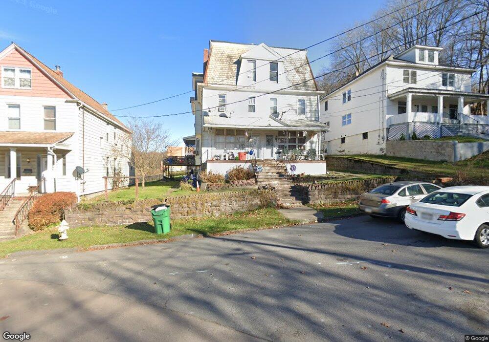
11 Robert St Nanticoke, PA 18634
Estimated Value: $174,000 - $190,000
--
Bed
--
Bath
2,994
Sq Ft
$61/Sq Ft
Est. Value
About This Home
This home is located at 11 Robert St, Nanticoke, PA 18634 and is currently estimated at $181,333, approximately $60 per square foot. 11 Robert St is a home located in Luzerne County with nearby schools including Kennedy Early Childhood Center, Nanticoke Area Elementary Center Center, and Greater Nanticoke Area Senior High School.
Ownership History
Date
Name
Owned For
Owner Type
Purchase Details
Closed on
Oct 14, 2024
Sold by
Sullivan Charles and Sullivan Maria
Bought by
Arsenault Connor Wendall
Current Estimated Value
Home Financials for this Owner
Home Financials are based on the most recent Mortgage that was taken out on this home.
Original Mortgage
$244,625
Outstanding Balance
$242,039
Interest Rate
6.32%
Mortgage Type
New Conventional
Estimated Equity
-$60,706
Purchase Details
Closed on
Apr 2, 2024
Sold by
Walsh Richard
Bought by
Sullivan Charles
Purchase Details
Closed on
Feb 6, 2024
Sold by
Morris Kenneth W and Morris Jill L
Bought by
Walsh Richard
Purchase Details
Closed on
Sep 27, 2018
Sold by
Higgins Susan and Estate Of Melanie Ruth Motisko
Bought by
Morris Kenneth W and Morris Jill L
Purchase Details
Closed on
Mar 20, 1990
Bought by
Motisko Henry M
Create a Home Valuation Report for This Property
The Home Valuation Report is an in-depth analysis detailing your home's value as well as a comparison with similar homes in the area
Home Values in the Area
Average Home Value in this Area
Purchase History
| Date | Buyer | Sale Price | Title Company |
|---|---|---|---|
| Arsenault Connor Wendall | $257,500 | None Listed On Document | |
| Sullivan Charles | $150,000 | Covenant Abstract | |
| Walsh Richard | $100,500 | None Listed On Document | |
| Morris Kenneth W | $24,000 | Bilbow Abstract Llc | |
| Motisko Henry M | $15,000 | -- |
Source: Public Records
Mortgage History
| Date | Status | Borrower | Loan Amount |
|---|---|---|---|
| Open | Arsenault Connor Wendall | $244,625 |
Source: Public Records
Tax History Compared to Growth
Tax History
| Year | Tax Paid | Tax Assessment Tax Assessment Total Assessment is a certain percentage of the fair market value that is determined by local assessors to be the total taxable value of land and additions on the property. | Land | Improvement |
|---|---|---|---|---|
| 2025 | $828 | $35,000 | $16,100 | $18,900 |
| 2024 | $828 | $35,000 | $16,100 | $18,900 |
| 2023 | $803 | $35,000 | $16,100 | $18,900 |
| 2022 | $797 | $35,000 | $16,100 | $18,900 |
| 2021 | $769 | $35,000 | $16,100 | $18,900 |
| 2020 | $764 | $35,000 | $16,100 | $18,900 |
| 2019 | $1,718 | $80,700 | $17,800 | $62,900 |
| 2018 | $1,659 | $80,700 | $17,800 | $62,900 |
| 2017 | $1,565 | $80,700 | $17,800 | $62,900 |
| 2016 | -- | $80,700 | $17,800 | $62,900 |
| 2015 | $1,183 | $80,700 | $17,800 | $62,900 |
| 2014 | $1,183 | $80,700 | $17,800 | $62,900 |
Source: Public Records
Map
Nearby Homes
- 151 Robert St
- 46 W Kirmar Ave
- 1116 Chestnut St
- 9 Thomas St
- 0 Fine and Hemlock St
- Hemlock St Hemlock St
- 0 Enterprise St
- 1218 New Grant St
- 711 S Hanover St
- 250 W Church St
- 1235 S Prospect St
- 314 W Main St
- 0 Middle Rd
- 135 W Broad St
- 255 W Main St
- 246 E Washington St
- 133 W Main St
- 138 Espy St
- 257 E Ridge St
- 55 Hill St
- 15 Robert St
- 5 Robert St
- 25 Robert St
- 25 Robert St
- 21 E Kirmar Ave
- 41 E Kirmar Ave
- 37 E Kirmar Ave
- 39 E Kirmar Ave
- 31 E Kirmar Ave
- 29 E Kirmar Ave
- 0 E Kirmar Ave
- 45 E Kirmar Ave
- 25 E Kirmar Ave
- 59 E Kirmar Ave
- 49 E Kirmar Ave
- 19 E Kirmar Ave
- 61 Robert St
- 17 E Kirmar Ave
- 65 E Kirmar Ave
- 63 E Kirmar Ave