Estimated Value: $475,000 - $505,000
About This Home
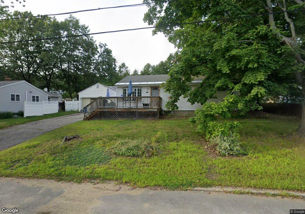
This home is located at 11 Robinwood Ave, Dover, NH 03820 and is currently estimated at $486,092, approximately $413 per square foot. 11 Robinwood Ave is a home located in Strafford County with nearby schools including Garrison School, Dover Middle School, and Dover Senior High School.
Ownership History
We collect this data history from publicly available records. To have your information removed, we recommend requesting removal directly through your county’s website.
Purchase Details
Home Financials for this Owner
Home Financials are based on the most recent Mortgage that was taken out on this home.Home Values in the Area
Average Home Value in this Area
Purchase History
We collect this data history from publicly available records. To have your information removed, we recommend requesting removal directly through your county’s website.
| Date | Buyer | Sale Price | Title Company |
|---|---|---|---|
| $157,400 | -- |
Mortgage History
We collect this data history from publicly available records. To have your information removed, we recommend requesting removal directly through your county’s website.
| Date | Status | Borrower | Loan Amount |
|---|---|---|---|
| Open | $154,979 |
Tax History
We collect this data history from publicly available records. To have your information removed, we recommend requesting removal directly through your county’s website.
| Year | Tax Paid | Tax Assessment Tax Assessment Total Assessment is a certain percentage of the fair market value that is determined by local assessors to be the total taxable value of land and additions on the property. | Land | Improvement |
|---|---|---|---|---|
| 2025 | $8,445 | $429,100 | $159,000 | $270,100 |
| 2024 | $7,797 | $429,100 | $159,000 | $270,100 |
| 2023 | $7,201 | $385,100 | $159,000 | $226,100 |
| 2022 | $6,881 | $346,800 | $143,100 | $203,700 |
| 2021 | $6,773 | $312,100 | $135,200 | $176,900 |
| 2020 | $6,550 | $263,600 | $119,300 | $144,300 |
| 2019 | $6,469 | $256,800 | $115,300 | $141,500 |
| 2018 | $6,058 | $243,100 | $107,300 | $135,800 |
| 2017 | $5,774 | $223,200 | $91,400 | $131,800 |
| 2016 | $5,460 | $207,700 | $87,800 | $119,900 |
| 2015 | $5,117 | $192,300 | $75,200 | $117,100 |
| 2014 | $4,895 | $188,200 | $71,100 | $117,100 |
| 2011 | $4,906 | $195,300 | $81,200 | $114,100 |
Map
- 18 Piscataqua Rd
- 2 Juniper Dr
- 4 Fords Landing Dr
- 29 Hemlock Forest
- 15 Hemlock Forest
- 4 Hemlock Forest
- 56 Durham Rd Unit 51
- 50 Piscataqua Rd
- 7 Harvest Dr
- 1 Middlebrook Rd
- 16 Polly Ann Park
- 93 Stark Ave
- 65 Polly Ann Trailer Park
- 1 Nute Rd
- 81 Stark Ave
- 25 Nute Rd
- 12 Zeland Dr
- 16 Porch Light Dr Unit 2
- 55 Pointe Place Unit 108
- 13 Stark Ave
- 9 Robinwood Ave
- 13 Robinwood Ave
- 141-A Back River Rd
- 8 Robinwood Ave
- 6 Robinwood Ave
- 4 Robinwood Ave
- 15 Robinwood Ave
- 141 Back River Rd
- 6 Tetreau Dr
- 7 Robinwood Ave
- 50 Spruce Ln
- 2 Robinwood Ave
- 5 Robinwood Ave
- 46 Spruce Ln
- 4 Tetreau Dr
- 139 Back River Rd
- 139 Back River Rd
- 139 Back River Rd Unit A
- 3 Robinwood Ave
- 52 Spruce Ln
Ask me questions while you tour the home.