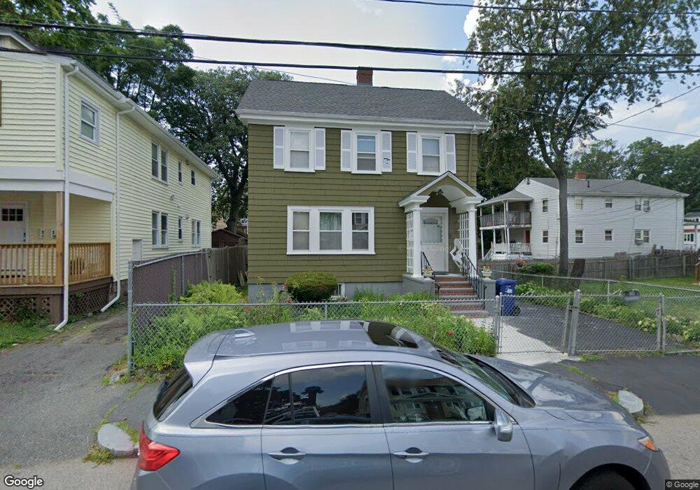
11 Rockingham Rd Mattapan, MA 02126
Southern Mattapan NeighborhoodEstimated Value: $534,000 - $618,000
3
Beds
1
Bath
1,248
Sq Ft
$467/Sq Ft
Est. Value
About This Home
This home is located at 11 Rockingham Rd, Mattapan, MA 02126 and is currently estimated at $582,599, approximately $466 per square foot. 11 Rockingham Rd is a home located in Suffolk County with nearby schools including KIPP Academy Boston Charter School, Boston Preparatory Charter Public School, and Berea Seventh-day Adventist Academy.
Ownership History
Date
Name
Owned For
Owner Type
Purchase Details
Closed on
May 22, 2023
Sold by
Hutchinson Normajoy E
Bought by
Normajoy E Hutchinson Ret
Current Estimated Value
Create a Home Valuation Report for This Property
The Home Valuation Report is an in-depth analysis detailing your home's value as well as a comparison with similar homes in the area
Home Values in the Area
Average Home Value in this Area
Purchase History
| Date | Buyer | Sale Price | Title Company |
|---|---|---|---|
| Normajoy E Hutchinson Ret | -- | None Available |
Source: Public Records
Tax History Compared to Growth
Tax History
| Year | Tax Paid | Tax Assessment Tax Assessment Total Assessment is a certain percentage of the fair market value that is determined by local assessors to be the total taxable value of land and additions on the property. | Land | Improvement |
|---|---|---|---|---|
| 2025 | $5,749 | $496,500 | $154,900 | $341,600 |
| 2024 | $5,016 | $460,200 | $152,800 | $307,400 |
| 2023 | $4,705 | $438,100 | $145,500 | $292,600 |
| 2022 | $4,414 | $405,700 | $134,700 | $271,000 |
| 2021 | $3,947 | $369,900 | $128,300 | $241,600 |
| 2020 | $3,598 | $340,700 | $132,200 | $208,500 |
| 2019 | $3,440 | $326,400 | $100,300 | $226,100 |
| 2018 | $3,196 | $305,000 | $100,300 | $204,700 |
| 2017 | $2,954 | $278,900 | $100,300 | $178,600 |
| 2016 | $2,789 | $253,500 | $100,300 | $153,200 |
| 2015 | $2,627 | $216,900 | $86,800 | $130,100 |
| 2014 | $2,502 | $198,900 | $86,800 | $112,100 |
Source: Public Records
Map
Nearby Homes
- 839-843 Cummins Hwy
- 770 Cummins Hwy Unit 1
- 770 Cummins Hwy Unit 22
- 231 Itasca St
- 34 Ridlon Rd
- 10 Brockton St
- 90 Hollingsworth St
- 95 Woodhaven St
- 179 Hebron St
- 23 Caton St
- 265 Hebron St
- 48-50 Rockdale St
- 72 Livermore St
- 25 Alpine St Unit 7
- 7 Winborough St
- 100 Itasca St
- 645 River St
- 0 Tina Ave
- 20 Monterey Ave
- 60 and 64 Monterey Ave
- 15 Rockingham Rd Unit 17
- 17 Rockingham Rd Unit 1
- 17 Rockingham Rd Unit B
- 699 Cummins Hwy
- 699 Cummins Hwy
- 699 Cummins Hwy Unit 10
- 7 Rockingham Rd
- 19 Rockingham Rd
- 10 Rugby Rd Unit 12
- 6 Rugby Rd
- 16 Rugby Rd
- 10 Rockingham Rd
- 23 Rockingham Rd
- 6 Rockingham Rd
- 18 Rugby Rd
- 687 Cummins Hwy
- 711 Cummins Hwy
- 14 Rockingham Rd
- 1-3 Corman Rd
- 22 Rockingham Rd