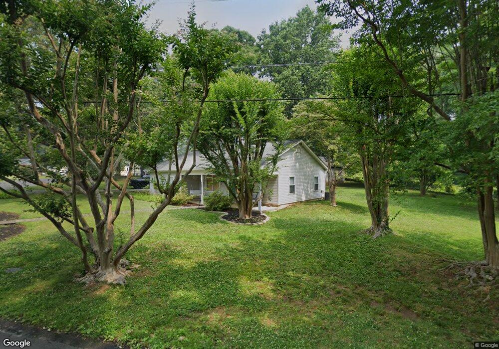
11 Roosevelt Dr Annapolis, MD 21401
Parole NeighborhoodEstimated Value: $447,000 - $525,000
3
Beds
2
Baths
1,054
Sq Ft
$458/Sq Ft
Est. Value
About This Home
This home is located at 11 Roosevelt Dr, Annapolis, MD 21401 and is currently estimated at $482,549, approximately $457 per square foot. 11 Roosevelt Dr is a home located in Anne Arundel County with nearby schools including West Annapolis Elementary School, Wiley H. Bates Middle School, and Annapolis High School.
Ownership History
Date
Name
Owned For
Owner Type
Purchase Details
Closed on
Aug 11, 2021
Sold by
Jessica Foreman
Bought by
Foreman Jessica and Foreman Wesley
Current Estimated Value
Home Financials for this Owner
Home Financials are based on the most recent Mortgage that was taken out on this home.
Original Mortgage
$265,500
Interest Rate
2.8%
Mortgage Type
New Conventional
Purchase Details
Closed on
Dec 13, 2003
Sold by
George Rew E
Bought by
Fox Jessica M
Purchase Details
Closed on
Sep 5, 1991
Sold by
Johnson William H
Bought by
George Andrew E
Home Financials for this Owner
Home Financials are based on the most recent Mortgage that was taken out on this home.
Original Mortgage
$85,150
Interest Rate
9.15%
Create a Home Valuation Report for This Property
The Home Valuation Report is an in-depth analysis detailing your home's value as well as a comparison with similar homes in the area
Home Values in the Area
Average Home Value in this Area
Purchase History
| Date | Buyer | Sale Price | Title Company |
|---|---|---|---|
| Foreman Jessica | -- | Closing Usa Llc | |
| Fox Jessica M | $226,250 | -- | |
| George Andrew E | $63,500 | -- |
Source: Public Records
Mortgage History
| Date | Status | Borrower | Loan Amount |
|---|---|---|---|
| Previous Owner | Foreman Jessica | $265,500 | |
| Previous Owner | George Andrew E | $85,150 | |
| Closed | Fox Jessica M | -- |
Source: Public Records
Tax History
| Year | Tax Paid | Tax Assessment Tax Assessment Total Assessment is a certain percentage of the fair market value that is determined by local assessors to be the total taxable value of land and additions on the property. | Land | Improvement |
|---|---|---|---|---|
| 2025 | $4,363 | $392,200 | $295,800 | $96,400 |
| 2024 | $4,363 | $352,533 | $0 | $0 |
| 2023 | $3,890 | $312,867 | $0 | $0 |
| 2022 | $3,285 | $273,200 | $209,400 | $63,800 |
| 2021 | $916 | $259,767 | $0 | $0 |
| 2020 | $916 | $246,333 | $0 | $0 |
| 2019 | $916 | $232,900 | $162,900 | $70,000 |
| 2018 | $916 | $232,900 | $162,900 | $70,000 |
| 2017 | $2,877 | $232,900 | $0 | $0 |
| 2016 | $916 | $242,800 | $0 | $0 |
| 2015 | $916 | $242,800 | $0 | $0 |
| 2014 | -- | $242,800 | $0 | $0 |
Source: Public Records
Map
Nearby Homes
- 2001 Warners Terrace N Unit 102
- 20 Washington Dr
- 2002 Phillips Terrace Unit 6
- 668 N Bestgate Rd
- 2013 Warners Terrace S Unit 138
- 2013 Warners Terrace S Unit 242
- 2150 Hideaway Ct Unit 28
- 2058 Quaker Way Unit 12
- 68 Harbour Heights Dr
- 12 Harbour Heights Dr
- 2052 Quaker Way Unit 7
- 603 Burtons Cove Way Unit 3
- 605 Admiral Dr
- 2161 Scotts Crossing Ct Unit 30
- 629 Admiral Dr Unit U206
- 2159 Scotts Crossing Ct Unit 201
- 623 Admiral Dr Unit 304
- 775 Howards Loop Unit 167
- 2015 Gov Thomas Bladen Way Unit 204
- 2006 Peggy Stewart Way Unit 204
- 12 Lincoln Pkwy
- 10 Roosevelt Dr
- 3 Lincoln Pkwy
- 35 Lincoln Pkwy
- 9 Roosevelt Dr
- 14 Washington Dr
- 36 Lincoln Pkwy
- 13 Lincoln Pkwy
- 34 Lincoln Pkwy
- 37 Lincoln Pkwy
- 5 Roosevelt Dr
- 15 Washington Dr
- 8 Roosevelt Dr
- 33 Lincoln Pkwy
- 2 Lincoln Pkwy
- 38 Lincoln Pkwy
- 16 Washington Dr
- 24 Lincoln Pkwy
- 32 Lincoln Pkwy
- 23 Washington Dr
Your Personal Tour Guide
Ask me questions while you tour the home.