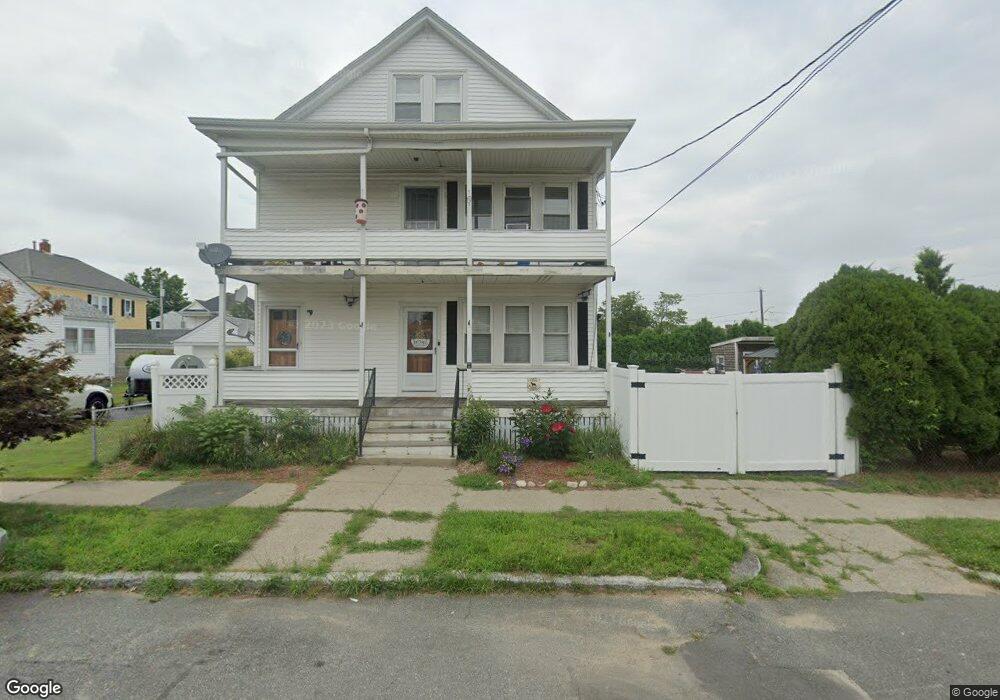
11 Rutland St Unit 13 New Bedford, MA 02745
Acushnet Station NeighborhoodEstimated Value: $479,787 - $525,000
5
Beds
2
Baths
2,214
Sq Ft
$231/Sq Ft
Est. Value
About This Home
This home is located at 11 Rutland St Unit 13, New Bedford, MA 02745 and is currently estimated at $512,447, approximately $231 per square foot. 11 Rutland St Unit 13 is a home located in Bristol County with nearby schools including Jireh Swift School, Normandin Middle School, and New Bedford High School.
Ownership History
Date
Name
Owned For
Owner Type
Purchase Details
Closed on
Nov 13, 2009
Sold by
Dorius T Masse Ret
Bought by
Correia Paul J and Raposo Elizabeth
Current Estimated Value
Home Financials for this Owner
Home Financials are based on the most recent Mortgage that was taken out on this home.
Original Mortgage
$223,870
Outstanding Balance
$146,029
Interest Rate
4.98%
Mortgage Type
Purchase Money Mortgage
Estimated Equity
$366,418
Purchase Details
Closed on
Sep 21, 2006
Sold by
Masse Dorius T
Bought by
Dorius T Masse Ret
Purchase Details
Closed on
Jun 12, 2006
Sold by
Masse Dorius T
Bought by
Dorius T Masse Ret
Create a Home Valuation Report for This Property
The Home Valuation Report is an in-depth analysis detailing your home's value as well as a comparison with similar homes in the area
Home Values in the Area
Average Home Value in this Area
Purchase History
| Date | Buyer | Sale Price | Title Company |
|---|---|---|---|
| Correia Paul J | $228,000 | -- | |
| Correia Paul J | $228,000 | -- | |
| Dorius T Masse Ret | -- | -- | |
| Dorius T Masse Ret | -- | -- | |
| Dorius T Masse Ret | -- | -- | |
| Dorius T Masse Ret | -- | -- |
Source: Public Records
Mortgage History
| Date | Status | Borrower | Loan Amount |
|---|---|---|---|
| Open | Dorius T Masse Ret | $223,870 | |
| Closed | Dorius T Masse Ret | $223,870 | |
| Previous Owner | Dorius T Masse Ret | $15,000 |
Source: Public Records
Tax History Compared to Growth
Tax History
| Year | Tax Paid | Tax Assessment Tax Assessment Total Assessment is a certain percentage of the fair market value that is determined by local assessors to be the total taxable value of land and additions on the property. | Land | Improvement |
|---|---|---|---|---|
| 2025 | $4,946 | $437,300 | $122,500 | $314,800 |
| 2024 | $4,416 | $368,000 | $122,500 | $245,500 |
| 2023 | $4,116 | $288,000 | $98,400 | $189,600 |
| 2022 | $3,781 | $243,300 | $93,700 | $149,600 |
| 2021 | $3,793 | $243,300 | $93,700 | $149,600 |
| 2020 | $3,832 | $237,100 | $93,700 | $143,400 |
| 2019 | $3,770 | $228,900 | $93,700 | $135,200 |
| 2018 | $3,625 | $218,000 | $93,700 | $124,300 |
| 2017 | $3,296 | $197,500 | $90,100 | $107,400 |
| 2016 | $3,128 | $189,700 | $86,500 | $103,200 |
| 2015 | $2,932 | $186,400 | $86,500 | $99,900 |
| 2014 | $2,779 | $183,300 | $82,900 | $100,400 |
Source: Public Records
Map
Nearby Homes
- 349 Conduit St Unit 351
- 22 Holden St
- 19 Rutland St
- 4 Holden St
- 14 Rutland St
- 339 Conduit St
- 30 Holden St Unit 32
- 20 Rutland St
- 25 Rutland St
- 32 Holden St Unit 2 floor
- 354 Conduit St
- 227 Dawson St Unit 229
- 225 Dawson St
- 344 Conduit St
- 15 Holden St
- 26 Rutland St Unit 28
- 9 Holden St
- 42 Holden St
- 25 Holden St
- 237 Dawson St Unit 239