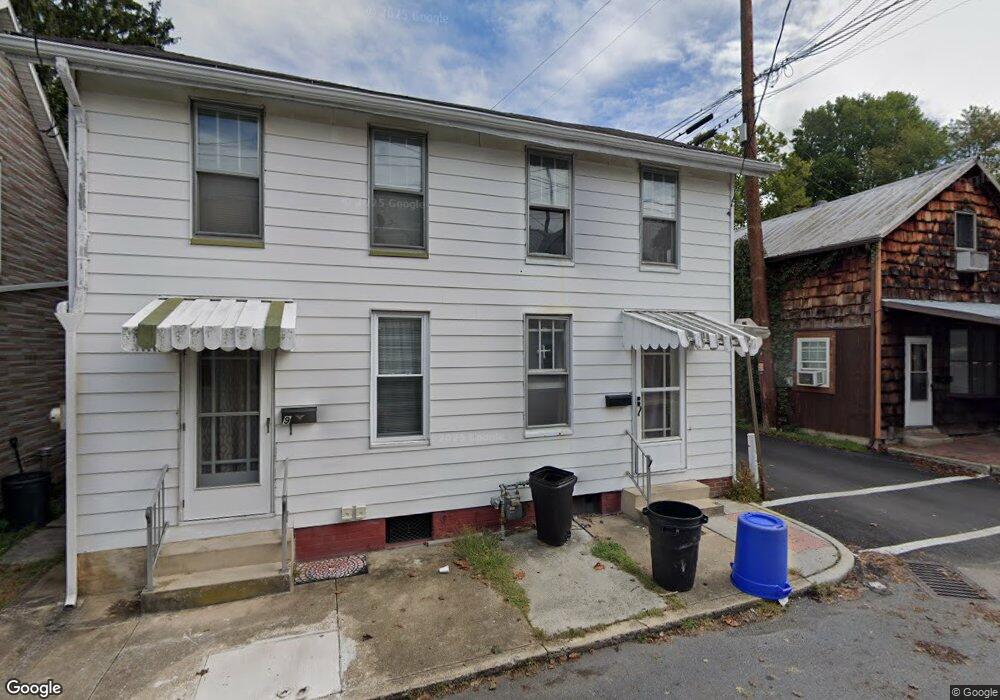
11 S High St Mechanicsburg, PA 17055
Estimated Value: $117,000 - $203,000
2
Beds
1
Bath
1,092
Sq Ft
$138/Sq Ft
Est. Value
About This Home
This home is located at 11 S High St, Mechanicsburg, PA 17055 and is currently estimated at $150,725, approximately $138 per square foot. 11 S High St is a home located in Cumberland County with nearby schools including Elmwood Academy, Mechanicsburg Middle School, and Mechanicsburg Area Senior High School.
Ownership History
Date
Name
Owned For
Owner Type
Purchase Details
Closed on
Jun 21, 2011
Sold by
Hsbc Mortgage Services Inc
Bought by
Elm Cove Properties Llc
Current Estimated Value
Purchase Details
Closed on
Mar 2, 2011
Sold by
Anderson Sheriff Ronny R and Crockett Donna
Bought by
Hsbc Mortgage Services Inc
Purchase Details
Closed on
Feb 28, 2006
Sold by
Beam Richard
Bought by
Crockett Donna
Home Financials for this Owner
Home Financials are based on the most recent Mortgage that was taken out on this home.
Original Mortgage
$62,600
Interest Rate
6.15%
Mortgage Type
New Conventional
Create a Home Valuation Report for This Property
The Home Valuation Report is an in-depth analysis detailing your home's value as well as a comparison with similar homes in the area
Home Values in the Area
Average Home Value in this Area
Purchase History
| Date | Buyer | Sale Price | Title Company |
|---|---|---|---|
| Elm Cove Properties Llc | $44,000 | -- | |
| Hsbc Mortgage Services Inc | -- | -- | |
| Crockett Donna | $78,300 | -- |
Source: Public Records
Mortgage History
| Date | Status | Borrower | Loan Amount |
|---|---|---|---|
| Previous Owner | Crockett Donna | $62,600 |
Source: Public Records
Tax History Compared to Growth
Tax History
| Year | Tax Paid | Tax Assessment Tax Assessment Total Assessment is a certain percentage of the fair market value that is determined by local assessors to be the total taxable value of land and additions on the property. | Land | Improvement |
|---|---|---|---|---|
| 2025 | $1,458 | $62,000 | $19,900 | $42,100 |
| 2024 | $1,409 | $62,000 | $19,900 | $42,100 |
| 2023 | $1,116 | $62,000 | $19,900 | $42,100 |
| 2022 | $1,309 | $62,000 | $19,900 | $42,100 |
| 2021 | $1,262 | $62,000 | $19,900 | $42,100 |
| 2020 | $1,235 | $62,000 | $19,900 | $42,100 |
| 2019 | $1,213 | $62,000 | $19,900 | $42,100 |
| 2018 | $1,193 | $62,000 | $19,900 | $42,100 |
| 2017 | $1,146 | $62,000 | $19,900 | $42,100 |
| 2016 | -- | $62,000 | $19,900 | $42,100 |
| 2015 | -- | $62,000 | $19,900 | $42,100 |
| 2014 | -- | $62,000 | $19,900 | $42,100 |
Source: Public Records
Map
Nearby Homes
- 133 W Locust St Unit 107
- 219 W Main St
- 212 W Allen St
- 27 W Simpson St
- 218 S Market St
- 13 E Allen St
- 112 S Washington St
- 419 W Simpson St
- 424 W Main St
- 128 W Portland St Unit 11
- 18 E Keller St
- 121 E Locust St
- 136 E Locust St
- 7 E Woodland Dr
- 517 W Main St
- 205 W Maplewood Ave
- 313 E Main St
- 117 E Maplewood Ave
- 114 E Maplewood Ave
- 303 Brandy Ln
- 9 S High St
- 7 S High St
- 5 S High St
- 15 & 17 S High St
- 12 S High St
- 14 S High St
- 16 S High St
- 10 S High St
- 200 W Locust St
- 143 W Main St
- 201 W Main St
- 203 W Main St Unit 2
- 203 W Main St Unit 1
- 203 W Main St Unit 1
- 203 W Main St Unit 2
- 100 S High St
- 207 W Main St
- 133 UNIT 216 W Locust St Unit 216
- 133 W Locust St Unit 114114
- 133 W Locust St Unit NOC-14