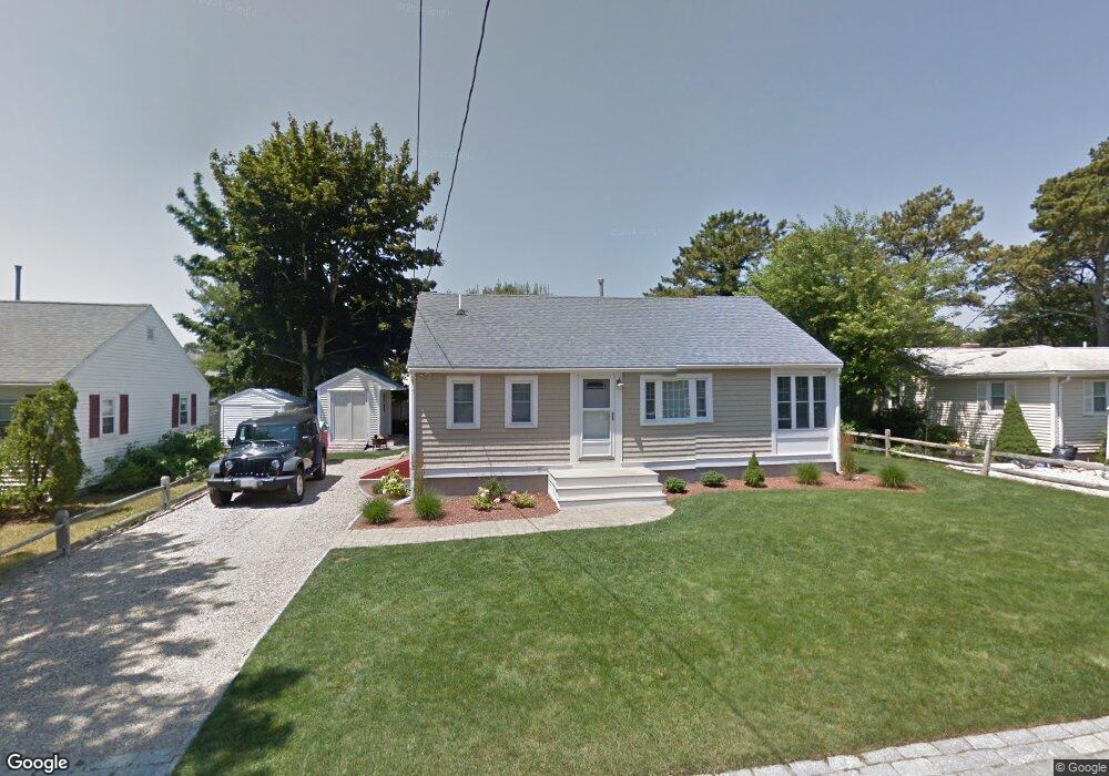
11 Uncle Rolf Rd Dennis Port, MA 02639
Dennis Port NeighborhoodEstimated Value: $563,000 - $776,000
3
Beds
2
Baths
936
Sq Ft
$759/Sq Ft
Est. Value
About This Home
This home is located at 11 Uncle Rolf Rd, Dennis Port, MA 02639 and is currently estimated at $710,599, approximately $759 per square foot. 11 Uncle Rolf Rd is a home located in Barnstable County with nearby schools including Dennis-Yarmouth Regional High School and St. Pius X. School.
Ownership History
Date
Name
Owned For
Owner Type
Purchase Details
Closed on
Nov 20, 2024
Sold by
Gottwald Kevin and Gottwald Jacquelyn
Bought by
Gottwald Ft and Gottwald
Current Estimated Value
Purchase Details
Closed on
Jan 9, 2004
Sold by
Flanagan 3Rd W James
Bought by
Gottwald Kevin and Gottwald Jacquelyn
Purchase Details
Closed on
Sep 23, 1999
Sold by
Hurley Leo F and Hurley Rosemarie A
Bought by
Flanagan W James
Home Financials for this Owner
Home Financials are based on the most recent Mortgage that was taken out on this home.
Original Mortgage
$95,000
Interest Rate
8.1%
Mortgage Type
Purchase Money Mortgage
Purchase Details
Closed on
Nov 1, 1991
Sold by
West Peter and West Bette A
Bought by
Hurley Leo F and Hurley Rosemarie A
Home Financials for this Owner
Home Financials are based on the most recent Mortgage that was taken out on this home.
Original Mortgage
$60,000
Interest Rate
8.9%
Mortgage Type
Purchase Money Mortgage
Create a Home Valuation Report for This Property
The Home Valuation Report is an in-depth analysis detailing your home's value as well as a comparison with similar homes in the area
Home Values in the Area
Average Home Value in this Area
Purchase History
| Date | Buyer | Sale Price | Title Company |
|---|---|---|---|
| Gottwald Ft | -- | None Available | |
| Gottwald Ft | -- | None Available | |
| Gottwald Kevin | $267,500 | -- | |
| Flanagan W James | $130,000 | -- | |
| Hurley Leo F | $114,000 | -- | |
| Gottwald Kevin | $267,500 | -- | |
| Flanagan W James | $130,000 | -- | |
| Hurley Leo F | $114,000 | -- |
Source: Public Records
Mortgage History
| Date | Status | Borrower | Loan Amount |
|---|---|---|---|
| Previous Owner | Flanagan W James | $95,000 | |
| Previous Owner | Hurley Leo F | $60,000 |
Source: Public Records
Tax History Compared to Growth
Tax History
| Year | Tax Paid | Tax Assessment Tax Assessment Total Assessment is a certain percentage of the fair market value that is determined by local assessors to be the total taxable value of land and additions on the property. | Land | Improvement |
|---|---|---|---|---|
| 2025 | $3,128 | $722,500 | $276,500 | $446,000 |
| 2024 | $2,962 | $674,800 | $265,900 | $408,900 |
| 2023 | $2,865 | $613,500 | $241,700 | $371,800 |
| 2022 | $2,600 | $464,200 | $190,500 | $273,700 |
| 2021 | $2,607 | $432,400 | $186,800 | $245,600 |
| 2020 | $2,499 | $409,700 | $186,800 | $222,900 |
| 2019 | $2,293 | $371,700 | $198,800 | $172,900 |
| 2018 | $2,208 | $348,200 | $189,300 | $158,900 |
| 2017 | $2,018 | $328,200 | $174,300 | $153,900 |
| 2016 | $1,931 | $295,700 | $164,400 | $131,300 |
| 2015 | $1,892 | $295,700 | $164,400 | $131,300 |
| 2014 | $1,814 | $285,700 | $154,400 | $131,300 |
Source: Public Records
Map
Nearby Homes
- 64 Beaten Rd
- 37 Ocean Dr Unit 2
- 154 Old Wharf Rd Unit 26
- 154 Old Wharf Rd Unit 14
- 112 Old Wharf Rd Unit E4
- 112 Old Wharf Rd Unit E1
- 120 Old Wharf Rd Unit 11
- 217 Old Wharf Rd Unit 64
- 31 Easy St
- 241 Old Wharf Rd Unit 82
- 241 Old Wharf Rd Unit 127
- 241 Old Wharf Rd Unit 90
- 80 Michaels Ave
- 262 Old Wharf Rd Unit 67
- 262 Old Wharf Rd Unit 5
- 262 Old Wharf Rd Unit 5
- 262 Old Wharf Rd Unit 20
- 262 Old Wharf Rd Unit 87
- 37 Beach Hills Rd
- 37-A Beach Hills Rd
- 9 Uncle Rolf Rd
- 15 Uncle Rolf Rd
- 10 Bain Rd
- 16 Uncle Rolf Rd
- 16 Uncle Rolf Rd Unit 16
- 19 Uncle Rolf Rd
- 10 Uncle Rolf Rd
- 5 Uncle Rolf Rd
- 14 Bain Rd
- 20 Uncle Rolf Rd
- 125 Captain Chase Rd
- 129 Captain Chase Rd
- 123 Captain Chase Rd
- 4 Bain Rd
- 6 Uncle Rolf Rd
- 23 Uncle Rolf Rd
- 9 Bain Rd
- 133 Captain Chase Rd
- 24 Uncle Rolf Rd
- 13 Bain Rd