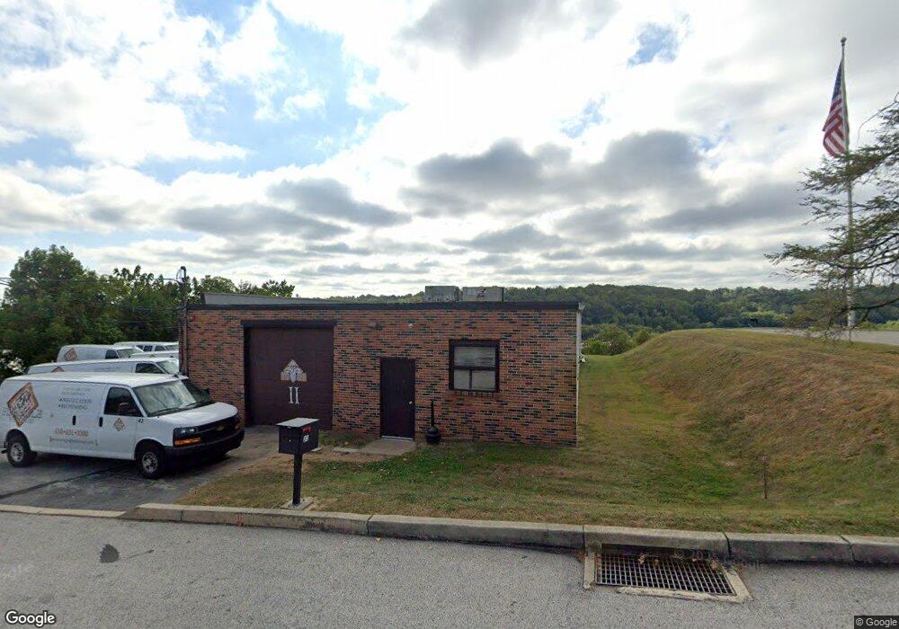
11 Union Hill Rd Conshohocken, PA 19428
Estimated Value: $823,507
--
Bed
--
Bath
3,376
Sq Ft
$244/Sq Ft
Est. Value
About This Home
This home is located at 11 Union Hill Rd, Conshohocken, PA 19428 and is currently estimated at $823,507, approximately $243 per square foot. 11 Union Hill Rd is a home located in Montgomery County with nearby schools including Bridgeport Elementary School, Upper Merion Middle School, and Upper Merion High School.
Ownership History
Date
Name
Owned For
Owner Type
Purchase Details
Closed on
Oct 16, 2009
Sold by
Spadafora Family Limited Partnership
Bought by
Emk Partnership
Current Estimated Value
Home Financials for this Owner
Home Financials are based on the most recent Mortgage that was taken out on this home.
Original Mortgage
$364,000
Outstanding Balance
$236,470
Interest Rate
4.98%
Mortgage Type
Commercial
Estimated Equity
$587,037
Purchase Details
Closed on
Feb 7, 1997
Sold by
Spadafora Anthony and Spadafora Johaan
Bought by
Spadafora Family Ltd Partnership
Create a Home Valuation Report for This Property
The Home Valuation Report is an in-depth analysis detailing your home's value as well as a comparison with similar homes in the area
Home Values in the Area
Average Home Value in this Area
Purchase History
| Date | Buyer | Sale Price | Title Company |
|---|---|---|---|
| Emk Partnership | $455,000 | None Available | |
| Spadafora Family Ltd Partnership | -- | -- |
Source: Public Records
Mortgage History
| Date | Status | Borrower | Loan Amount |
|---|---|---|---|
| Open | Emk Partnership | $364,000 |
Source: Public Records
Tax History Compared to Growth
Tax History
| Year | Tax Paid | Tax Assessment Tax Assessment Total Assessment is a certain percentage of the fair market value that is determined by local assessors to be the total taxable value of land and additions on the property. | Land | Improvement |
|---|---|---|---|---|
| 2025 | $5,010 | $176,660 | $55,820 | $120,840 |
| 2024 | $5,010 | $176,660 | $55,820 | $120,840 |
| 2023 | $4,817 | $176,660 | $55,820 | $120,840 |
| 2022 | $4,638 | $176,660 | $55,820 | $120,840 |
| 2021 | $4,586 | $176,660 | $55,820 | $120,840 |
| 2020 | $4,482 | $176,660 | $55,820 | $120,840 |
| 2019 | $4,402 | $176,660 | $55,820 | $120,840 |
| 2018 | $4,383 | $176,660 | $55,820 | $120,840 |
| 2017 | $4,299 | $176,660 | $55,820 | $120,840 |
| 2016 | $4,230 | $176,660 | $55,820 | $120,840 |
| 2015 | $4,070 | $176,660 | $55,820 | $120,840 |
| 2014 | $4,070 | $176,660 | $55,820 | $120,840 |
Source: Public Records
Map
Nearby Homes
- 628 Ford St
- 627 Ford St
- 607 Apple St
- 258 Tennessee Ave
- 537 Apple St Unit 302
- 211 Josephine Ave
- 139 Moir Ave
- 1196 Rebel Hill Rd
- 218 Bullock St
- 107 Cedar Ave
- 116 Cedar Ave
- 223 Rebel Hill Rd
- 17 Merion Ave
- 272 Militia Dr Unit 11A
- 1408 Rene Rd
- 1626 Mount Pleasant Rd
- 235 Valley Forge Lookout Place
- 300 W Elm St Unit 2412
- 1345 Valley Rd
- 463 New Elm St
- 15 Union Hill Rd
- 3 Union Hill Rd
- 7 Union Hill Rd
- 1000 New Dehaven St
- 8 Union Hill Rd
- 1075 New Dehaven St
- 1087 New Dehaven St
- 1093 New Dehaven St
- 1099 New Dehaven St
- 1101 Dehaven St
- 1103 Dehaven St
- 1099 Dehaven St
- 948 Matsonford Rd
- 946 Matsonford Rd
- 42 Dehaven Ave
- 902 Matsonford Rd
- 32 Dehaven Ave
- 1098 New Dehaven St
- 828 Matsonford Rd Unit B
- 30 Dehaven Ave