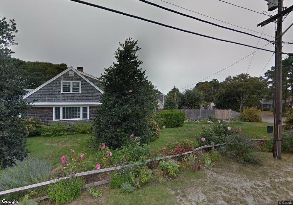
11 Union Park Rd Dennis Port, MA 02639
Dennis Port NeighborhoodEstimated Value: $780,000 - $1,023,617
--
Bed
2
Baths
--
Sq Ft
7,841
Sq Ft Lot
About This Home
This home is located at 11 Union Park Rd, Dennis Port, MA 02639 and is currently estimated at $883,404. 11 Union Park Rd is a home located in Barnstable County with nearby schools including Dennis-Yarmouth Regional High School and St. Pius X. School.
Ownership History
Date
Name
Owned For
Owner Type
Purchase Details
Closed on
Dec 29, 1977
Bought by
Franklin Russell W and Franklin Marsha R
Current Estimated Value
Create a Home Valuation Report for This Property
The Home Valuation Report is an in-depth analysis detailing your home's value as well as a comparison with similar homes in the area
Home Values in the Area
Average Home Value in this Area
Purchase History
| Date | Buyer | Sale Price | Title Company |
|---|---|---|---|
| Franklin Russell W | -- | -- |
Source: Public Records
Mortgage History
| Date | Status | Borrower | Loan Amount |
|---|---|---|---|
| Open | Franklin Russell W | $98,000 | |
| Closed | Franklin Russell W | $35,000 | |
| Closed | Franklin Russell W | $30,000 |
Source: Public Records
Tax History Compared to Growth
Tax History
| Year | Tax Paid | Tax Assessment Tax Assessment Total Assessment is a certain percentage of the fair market value that is determined by local assessors to be the total taxable value of land and additions on the property. | Land | Improvement |
|---|---|---|---|---|
| 2025 | $3,369 | $778,100 | $291,400 | $486,700 |
| 2024 | $3,241 | $738,300 | $280,200 | $458,100 |
| 2023 | $3,135 | $671,200 | $254,700 | $416,500 |
| 2022 | $2,867 | $512,000 | $200,800 | $311,200 |
| 2021 | $2,673 | $443,300 | $196,800 | $246,500 |
| 2020 | $2,618 | $429,200 | $196,800 | $232,400 |
| 2019 | $2,586 | $419,100 | $209,500 | $209,600 |
| 2018 | $2,535 | $399,900 | $199,500 | $200,400 |
| 2017 | $2,362 | $384,100 | $183,700 | $200,400 |
| 2016 | $2,223 | $340,400 | $173,200 | $167,200 |
| 2015 | $2,179 | $340,400 | $173,200 | $167,200 |
| 2014 | $2,062 | $324,700 | $162,700 | $162,000 |
Source: Public Records
Map
Nearby Homes
- 402 Old Wharf Rd
- 402 Old Wharf Rd
- 405 Old Wharf Rd Unit B204
- 405 Old Wharf Rd Unit B204
- 102 Sea St
- 9 Chase Ave Unit 6
- 11 Ocean Park W
- 22 Ferncliff Rd
- 37-A Beach Hills Rd
- 37 Beach Hills Rd
- 262 Old Wharf Rd Unit 67
- 262 Old Wharf Rd Unit 5
- 262 Old Wharf Rd Unit 5
- 262 Old Wharf Rd Unit 20
- 262 Old Wharf Rd Unit 87
- 241 Old Wharf Rd Unit 82
- 241 Old Wharf Rd Unit 127
- 241 Old Wharf Rd Unit 90
- 26 Manning Rd
- 1 E Belmont Unit 630
- 9 Union Park Rd
- 374 Old Wharf Rd
- 12 Union Park Rd
- 380 Old Wharf Rd
- 7 Union Park Rd
- 8 Highbank Cartway
- 10 Union Park Rd
- 12 Highbank Cartway
- 15 Highbank Cartway
- 370 Old Wharf Rd
- 1 Hamilton Rd
- 379 Old Wharf Rd
- 5 Union Park Rd
- 8 Pilgrim Terrace
- 368 Old Wharf Rd
- 5 Hamilton Rd
- 29 Highbank Cir
- 16 Highbank Cartway
- 9 Hamilton Rd
- 6 Pilgrim Terrace