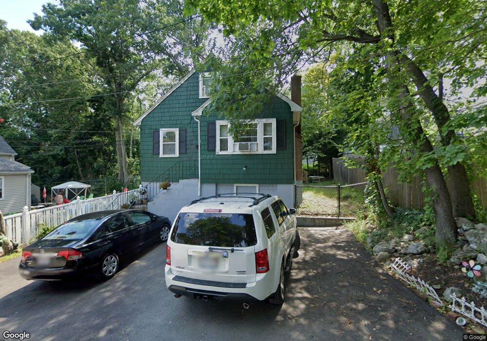
11 Vanderbilt Ave Mattapan, MA 02126
Hyde Park NeighborhoodEstimated Value: $467,000 - $551,000
3
Beds
1
Bath
941
Sq Ft
$554/Sq Ft
Est. Value
About This Home
This home is located at 11 Vanderbilt Ave, Mattapan, MA 02126 and is currently estimated at $521,706, approximately $554 per square foot. 11 Vanderbilt Ave is a home located in Suffolk County with nearby schools including Boston Preparatory Charter Public School.
Ownership History
Date
Name
Owned For
Owner Type
Purchase Details
Closed on
Jan 28, 2010
Sold by
Us Bk
Bought by
Lewis Gwynn M
Current Estimated Value
Purchase Details
Closed on
Aug 6, 2008
Sold by
Brooks Pamela and Wells Fargo Bk
Bought by
Us Bk
Purchase Details
Closed on
May 26, 2006
Sold by
Johnson Marguerite and Warner Marguerite
Bought by
Brooks Pamela
Home Financials for this Owner
Home Financials are based on the most recent Mortgage that was taken out on this home.
Original Mortgage
$229,600
Interest Rate
9.08%
Mortgage Type
Adjustable Rate Mortgage/ARM
Purchase Details
Closed on
Feb 21, 1990
Sold by
Dubrow Sheldon H
Bought by
Warner Marguerite
Purchase Details
Closed on
Nov 20, 1989
Sold by
Mtge Corp New Engl
Bought by
Dubrow Michelle D
Purchase Details
Closed on
Aug 9, 1989
Sold by
Bennett Joanne
Bought by
Mtg Corp New England
Create a Home Valuation Report for This Property
The Home Valuation Report is an in-depth analysis detailing your home's value as well as a comparison with similar homes in the area
Home Values in the Area
Average Home Value in this Area
Purchase History
| Date | Buyer | Sale Price | Title Company |
|---|---|---|---|
| Lewis Gwynn M | $120,000 | -- | |
| Us Bk | $181,000 | -- | |
| Brooks Pamela | $287,000 | -- | |
| Warner Marguerite | $133,000 | -- | |
| Dubrow Michelle D | $80,000 | -- | |
| Mtg Corp New England | $95,000 | -- |
Source: Public Records
Mortgage History
| Date | Status | Borrower | Loan Amount |
|---|---|---|---|
| Previous Owner | Brooks Pamela | $229,600 | |
| Previous Owner | Mtg Corp New England | $203,000 | |
| Previous Owner | Mtg Corp New England | $37,300 |
Source: Public Records
Tax History Compared to Growth
Tax History
| Year | Tax Paid | Tax Assessment Tax Assessment Total Assessment is a certain percentage of the fair market value that is determined by local assessors to be the total taxable value of land and additions on the property. | Land | Improvement |
|---|---|---|---|---|
| 2025 | $4,684 | $404,500 | $138,700 | $265,800 |
| 2024 | $4,537 | $416,200 | $115,400 | $300,800 |
| 2023 | $4,139 | $385,400 | $106,800 | $278,600 |
| 2022 | $3,918 | $360,100 | $99,800 | $260,300 |
| 2021 | $3,578 | $335,300 | $96,000 | $239,300 |
| 2020 | $2,699 | $255,600 | $78,800 | $176,800 |
| 2019 | $2,451 | $232,500 | $59,100 | $173,400 |
| 2018 | $2,319 | $221,300 | $59,100 | $162,200 |
| 2017 | $2,151 | $203,100 | $59,100 | $144,000 |
| 2016 | $2,108 | $191,600 | $59,100 | $132,500 |
| 2015 | $2,560 | $211,400 | $76,400 | $135,000 |
| 2014 | $2,458 | $195,400 | $76,400 | $119,000 |
Source: Public Records
Map
Nearby Homes
- 46 Oakwood St
- 0 Tina Ave
- 7 Winborough St
- 130 Greenfield Rd
- 24 Melba Way
- 25 Alpine St Unit 7
- 23 Caton St
- 839-843 Cummins Hwy
- 24 Belnel Rd
- 90 Hollingsworth St
- 645 River St
- 179 Hebron St
- 20 Massasoit St
- 42 Osceola St
- 39 Wachusett St
- 231 Itasca St
- 30 Massasoit St
- 770 Cummins Hwy Unit 1
- 770 Cummins Hwy Unit 22
- 10 Brockton St